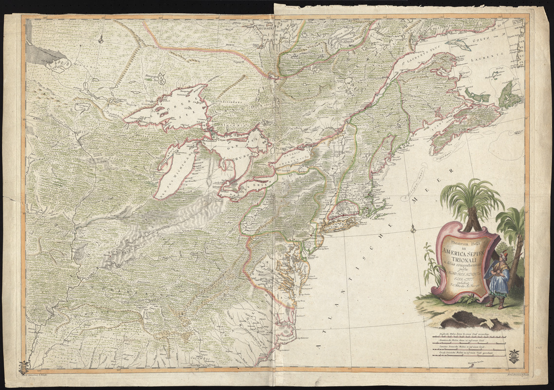
Theatrum belli in America Septentrionali
This map is also available in American Revolutionary Geographies Online (ARGO), a collections portal especially built for material relating to the American Revolutionary War Era. Visit ARGO to learn more about this item and explore the historical geography of North America in the late eighteenth century.
Item Information
- Title:
- Theatrum belli in America Septentrionali
- Description:
-
Shows the east coast from the Gulf of the St. Lawrence to the Carolinas, and the interior as far west as the Mississippi Valley. Displayed here is the first state of the map, lacking the inset of Fort Frederick.
- Creator:
- Rhode, Johann Christoph, 1713-1786
- Contributor:
- Berger, Friedrich Gottlieb, b. 1713
- Name on Item:
-
II. foliis comprehensum jussu Acad[emiis] Reg[iis] Scient[iarum] et Eleg[antium] exhibet ; I.C. Rhode Ac[ademiae?] Geogr[aphus?] ; Berger, sculpsit Berol[ini].
- Date:
-
[1755]
- Format:
-
Maps/Atlases
- Location:
- George Washington's Mount Vernon
- Collection (local):
-
Richard H. Brown Revolutionary War Map Collection at Mount Vernon
- Subjects:
-
North America--Maps
- Places:
-
North America (area)
- Extent:
- 1 map : hand col. ; 55 x 78 cm.
- Terms of Use:
-
No known copyright restrictions.
This work is licensed for use under a Creative Commons Attribution Non-Commercial Share Alike License (CC BY-NC-SA).

- Publisher:
-
Berlin :
Academia Regia Scientiarum et Elegantium Litterarum
- Scale:
-
Scale [ca. 1:4,000,000]
- Language:
-
German
Latin
- Catalog Record:
-
MVLA record
- Notes:
-
Date of publication from Tooley, R.V. Tooley's Dict. of mapmakers. 1979.
Prime meridian: [Ferro].
Relief shown pictorially.
Lower left: Nord America I. Blatt ; Lower right: Nord America II. Blatt.
Map in German. Title in Latin.
- Notes (date):
-
This date is inferred.
- Identifier:
-
06_01_009621


