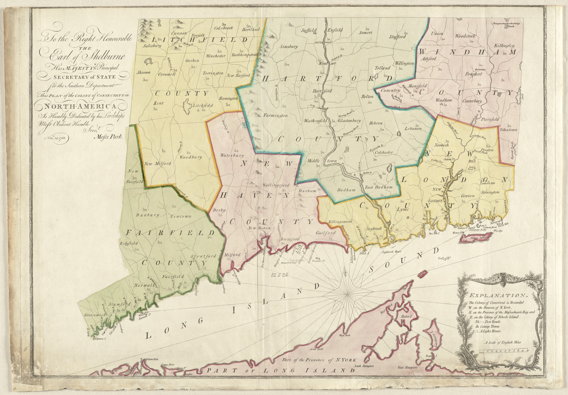
To the right honourable, the Earl of Shelbourne, His Majesty's principal Secretary of State for the Southern Department : this plan of the colony of Connecticut in North-America is humbly dedicated
This map is also available in American Revolutionary Geographies Online (ARGO), a collections portal especially built for material relating to the American Revolutionary War Era. Visit ARGO to learn more about this item and explore the historical geography of North America in the late eighteenth century.
Item Information
- Title:
- To the right honourable, the Earl of Shelbourne, His Majesty's principal Secretary of State for the Southern Department : this plan of the colony of Connecticut in North-America is humbly dedicated
- Title (alt.):
-
Plan of the colony of Connecticut in North America
- Description:
-
Moses Park, a surveyor from Preston, Connecticut, executed this map in 1766 with the assistance of Asa Spaulding of Norwalk and Samuel Mott of Preston. Displayed here is the second state of the map, which differs from the first state in the collection of the Clements Library at the University of Michigan. In this state, an "e" has been added to the name of Shelburne, and "Connecticut R." is seen on the bend of the river above Hadham. Other locational changes have been made in this state as well.
- Creator:
- Park, Moses
- Name on Item:
-
by his lordship's most obedient humble servt. Moses Park. Novr. 24, 1766.
- Date:
-
1766
- Format:
-
Maps/Atlases
- Location:
- George Washington's Mount Vernon
- Collection (local):
-
Richard H. Brown Revolutionary War Map Collection at Mount Vernon
- Subjects:
-
Connecticut--Maps--Early works to 1800
Connecticut--Administrative and political divisions--Maps--Early works to 1800
Lansdowne, William Petty, Marquis of, 1737-1805
- Places:
-
Connecticut
- Extent:
- 1 map : hand col. ; 52 x 73 cm.
- Terms of Use:
-
No known copyright restrictions.
This work is licensed for use under a Creative Commons Attribution Non-Commercial Share Alike License (CC BY-NC-SA).

- Publisher:
-
[S.l.] :
[s.n.]
- Scale:
-
Scale [ca. 1:275,000]
- Language:
-
English
- Catalog Record:
-
MVLA record
- Notes:
-
Relief shown pictorially.
Shows counties, towns, rivers, and post roads.
State 2.
- Identifier:
-
06_01_009524
- LCCN:
-
73691553


