Toggle navigation
LMEC Home
Exhibitions
Georeferencing
Tools for Teachers
Collections
My Favorites
Sign Up / Log In
Search
Search the map portal
Map Collection
Map Collection
Map Sets
Search
Search
Search for
Search In
All Fields
Creator
Title
Subject
Place
Search All Digital Collections
Advanced Search
214 Results
My Search
Start Over
More Like
commonwealth:z603vp26c
Remove constraint More Like: commonwealth:z603vp26c
Filter your Search
Place
North and Central America
143
North America
107
Saint Lawrence River
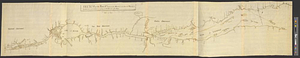
64
Canada
53
United States
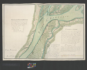
49
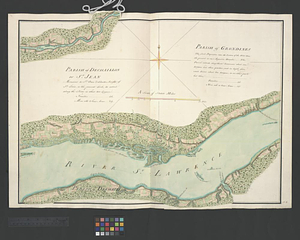
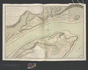
Quebec
42
Longue-Pointe-de-Mingan
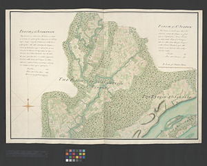
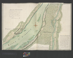
12
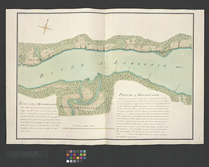
Mingan Îles de
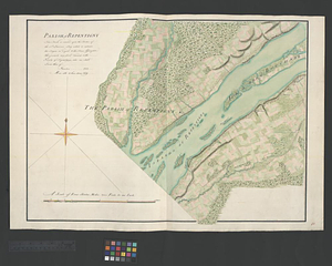
12
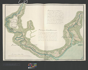
more
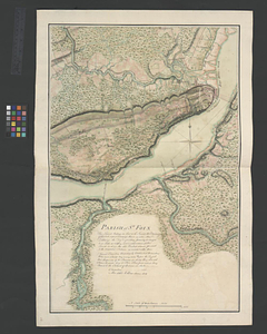
Place
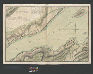
»
Topic
North America--Maps
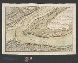
80
Saint Lawrence River--Maps
65
North America--Maps--Early works to 1800
27
United States--History--French and Indian War, 1754-1763--Maps
24
United States--Maps--Early works to 1800
14
United States--Maps
13
Longue-Pointe (Québec)--Maps
12
Mingan Islands (Québec)--Maps
12
more
Topic
»
Date
Date range begin
–
Date range end
Current results range from
1744
to
1945
View distribution
Creator
Jefferys, Thomas, -1771
17
Robert Sayer and John Bennett (Firm)
15
Cook, James, 1728-1779
13
Desjardins, pilot of Québec
12
Saunders, Charles, Sir, 1713?-1775
12
Anville, Jean Baptiste Bourguignon d', 1697-1782
8
Kitchin, Thomas, 1718-1784
8
Holland, Samuel, 1728-1801
7
more
Creator
»
Format
Maps/Atlases
214
Manuscripts
1
Georeferenced
Yes
20
No
194
Collection
American Revolutionary War-Era Maps
169
New York Public Library Collection
79
William L. Clements Library Collection
55
Norman B. Leventhal Map & Education Center Collection
45
American Antiquarian Society Collection
19
Library and Archives Canada Collection
14
MacLean Collection Map Library
1
Richard H. Brown Revolutionary War Map Collection at Mount Vernon
1
Available to use
Creative Commons license
81
No known restrictions
45
Search Constraints
Sort by date (asc)
relevance
title
date (asc)
date (desc)
Number of results to display per page
100 per page
10
per page
20
per page
50
per page
100
per page
View results as:
grid view
map view
Search Results
1.
Nova orbis sive America Septentrionalis per sua regna provinc. et insul. cura et opera
2.
Amérique Septentrionale
3.
Amérique Septentrionale publiée sous les auspices de Monseigneur le Duc d'Orleans prémier prince du sang
4.
A chart of Canada River : from ye island of Anticosty as far up as Quebeck, ye islands, locks, shoals, & soundings as they...
5.
Nova tabula geographica complectens borealiorem Americae partem : in qua exacte delineatae sunt Canada sive Nova Francia, Nova...
6.
Specimen trigesimae sextae partis ex globo terrestri trium pedum Parisin cujus nec non globi Coelestis constructio addito...
7.
North America. : Performed under the patronage of Louis Duke of Orleans, first prince of the blood
8.
Cours du fleuve St. Laurent : deuxieme feuille : depuis Quebec jusqu'au havre des Papinachouas
9.
Cours du fleuve St. Laurent : premiere feuille : contenant depuis le Lac Ontario jusqu'a Quebec
10.
Cours du fleuve St. Laurent : troisieme feuille : depuis le mont Camille jusqu'a l'isle d'Anticosti
11.
Copie de la carte de Monsieur Klam ou l'on voit les sources e la riviere d'Orange suivant de nouvelles observation
12.
A map of Philadelphia and parts adjacent
13.
Mappa geographica Americae Septentrionalis : ad emendatiora exemplaria adhuc edita jussu Acad. reg. scient. et eleg. litt....
14.
Canada, Louisiane et terres angloises
15.
Canada, Louisiane et terres angloises
16.
Carte de l'Amerique Septentrionale depuis le 28 degré de latitude jusqu'au 72
17.
Carte générale de l'Amérique séptentrionale : avec les posséssions Angloises dans cette partie du nouveau monde
18.
A Map of the British and French settlements in North America : (part the second) containing part of New York, Pensilvania, New...
19.
A Map of the British and French settlements in North America
20.
A Map of the British and French settlements in North America
21.
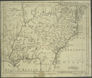
A map of Virginia, North and South Carolina, Georgia, Maryland : with part of New Jersey &c
22.
Plan of the river St. Lawrence from the Island of Anticosta to Quebec ... from a manuscript found on board of the Alcide taken...
23.
Theatrum belli in America Septentrionali
24.
A general map of the middle British colonies in America : Viz. Virginia, Maryland, Delaware, Pensilvania, New-Jersey, New-York,...
25.
A new and accurate map of the English empire in North America : representing their rightful claim as confirm'd by charters, and...
26.
Carte du gouvernement de Montréal
27.
A plan of the River St. Laurence from Green Island to Cape Carrouge
28.
Plan of the town of Quebec the capital of Canada in North America : with the bason and a part of the adjacent country shewing...
29.
Plan of the town of Quebec the capital of Canada in North America : with the bason and a part of the adjacent country shewing...
30.
An accurate map of North America
31.
Draught of the river St. Lawrence from Lake Ontario to Montreal
32.
Sketch of the river St Lawrence from Montreal to the island of St Barnaby on the south side, and the islands of Jeremy on the...
33.
Sketch of the river St Lawrence from Montreal to the island of St Barnaby on the south side, and the islands of Jeremy on the...
34.
Sketch of the river St. Lawrence from Montreal to the island St. Barnaby on the south side, and the islands of Jeremy on the...
35.
Sketch of the river St. Lawrence from Montreal to the island St. Barnaby on the south side and the islands of Jeremy on the...
36.
Sketch of the river St: Lawrence from Montreal to the island St: Barnaby on the south side, and the islands of Jeremy on the...
37.
Sketch of the seven dangerous rappids with their true channel : also the appearance the river makes at those places between...
38.
An accurate map of Canada, with the adjacent countries : exhibiting the late seat of war between the English & French in those...
39.
Continuation of the Grande Riviere with the village of Fariole lying near Cape Torment on the north shore
40.
Parish of Batiscant. Parish of St. Pierre Becquet. Parish of Champlain. Parish of Gentilly
41.
Parish of Dechaillon or St. Jean. Parish of Grondines
42.
Parish of Dechambeaux. Parish of Cape Sante. Parish of Lotbinière. Parish of St. Croix
43.
Parish of La Norray & Dautray. Parish of Sorrel
44.
Parish of L'Assomption. Parish of St. Sulpice
45.
Parish of Lavalterie. Parish of Contrecoeur
46.
Parish of Magdelaine. Parish of Becancour
47.
Parish of Repentigny
48.
Parish of St. Ann's. Parish of the River Batiscant
49.
Parish of St. Foix
50.
Parish of St. Joachim. Parish of St. Famille. Parish of St. Anne. Parish of St. François
51.
Parish of St. Lawrence. Parish of Beaumont. Parish of St. Peter
52.
Parish of St. Michelle. Parish of St. John Baptist. Parish of St. Vertier
53.
Parish of St. Nicholas. The Parish of St. Augustin
54.
Parish of the Ecureuils. Parish of Point aux Trembles. Parish of St. Antoine. Parish of St. Croix
55.
Parish of Vercheres. Parish of St. Antoine
56.
Plan of Canada or the province of Quebec from the uppermost settlements to the island of Coudre as surveyed by order of his...
57.
Plan of that part of Canada and the River St. Lawrence which lies between Point du Lac and Repentigny on the north shore &...
58.
The St. Lawrence River between Trois Rivières and Grondines Parish
59.
The St. Lawrence River from the Rapids of Richelieu to Cape Torment
60.
Town of Three Rivers
61.
An accurate map of the British, French & Spanish settlements in Nth. America and the West Indies : as stipulated by the...
62.
Carta della Nuova Inghilterra, Nuova Yorc, e Pensilvania
63.
[Map of Spanish Louisiana and the American colonies]
64.
[Map of Spanish Louisiana and the American colonies]
65.
A New & accurate map of North America : including the British acquisitions gained by the late war, 1763
66.
A new and accurate map of North America laid down according to the latest and most approved observations, and discoveries
67.
Amerique Septentrionale
68.
North America
69.
North America
70.
A plan of part of the province of Quebec from the Lake de Deux Montagne to River Batiscant made agreeable to the orders &...
71.
A plan of part of the province of Quebec from the river St. Anne to the island of Coudre made agreeable to the orders and...
72.
A plan of the settled part of Canada reduced from the large survey made in the years 1760 & 1761 by order of General Murray...
73.
A new and accurate map of North America
74.
North America
75.
An exact map of North America : from the best authorities
76.
North America
77.
Carte des parties nord et ouest de l'Amérique dressée d'apres les relations les plus authentique par M... en 1764 : nouvelle...
78.
Mapa de America sujecto à las observaciones astronomicas
79.
North America, : as divided amongst the European powers
80.
North America, agreeable to the most approved maps and charts
81.
North America, as divided amongst the European powers
82.
An accurate map of North America : Describing and distinguishing the British and Spanish dominions of this great continent;...
83.
A map of the British colonies in North America : with the roads, distances, limits, and extent of the settlements, humbly...
84.
A map of the most inhabited part of Virginia containing the whole province of Maryland : with part of Pensilvania, New Jersey...
85.
Part of North America : comprehending the course of Ohio, New England, New York, New Jersey, Pennsylvania, Maryland, Virginia,...
86.
Channels around the Island of Orleans
87.
Gaspee Bay
88.
Hare Island; Pointe aux Allouettes of Larks Point; English Bank
89.
Manicouagan Shoals; Havre St. Nicholas; Bay of the Seven Islands
90.
Part of the Anticosti Island; Mingan Island; Mignan Harbor
91.
Region of Gaspee Bay
92.
Region of Hare Island
93.
The River St. Lawrence from Mal Bay to the Basin of Quebec
94.
The River St. Lawrence from the Basin of Quebec to the Falls of Richeu
95.
The Seven Islands and the Bay
96.
The Shoals of Beauport; The River St. Lawrence from the Basin of Quebec to the Falls of Richeu
97.
St. Paul's Bay; Isle de Coudres; Great Cove; Pt. de Mille Vaches
98.
An Accurate map of the present seat of war between Great-Britain and her colonies in North America
99.
Acurate charte von Nord-America : aus dem besten quellen
100.
L'Amérique Septentrionale
‹ Prev
Next ›
1
2
3


![[Map of Spanish Louisiana and the American colonies]](https://bpldcassets.blob.core.windows.net/derivatives/images/commonwealth:z603vq85r/image_thumbnail_300.jpg)
![[Map of Spanish Louisiana and the American colonies]](https://bpldcassets.blob.core.windows.net/derivatives/images/commonwealth:z603vp210/image_thumbnail_300.jpg)