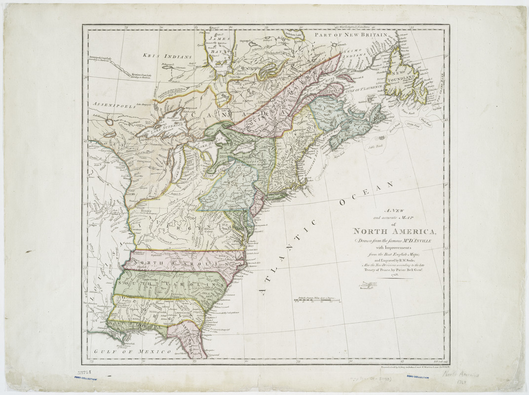
A new and accurate map of North America
This map is also available in American Revolutionary Geographies Online (ARGO), a collections portal especially built for material relating to the American Revolutionary War Era. Visit ARGO to learn more about this item and explore the historical geography of North America in the late eighteenth century.
Item Information
- Title:
- A new and accurate map of North America
- Creator:
- Bell, Peter, (Geographer)
- Contributor:
- Anville, Jean Baptiste Bourguignon d', 1697-1782
- Contributor:
- Seale, Richard William
- Contributor:
- Dury, Andrew
- Name on Item:
-
drawn from the famous Mr. d'Anville with improvements from the best English maps ; and engraved by R.W. Seale ; also the new divisions according to the late treaty of peace, by Peter Bell, geor. ; R.W. Seale sculp.
- Date:
-
1768
- Format:
-
Maps/Atlases
- Location:
- New York Public Library
- Collection (local):
-
Maps of North America
- Subjects:
-
North America--Maps--Early works to 1800
- Places:
-
North America (area)
- Extent:
- 1 map : hand color ; 46 x 50 cm.
- Terms of Use:
-
No known copyright restrictions.
This work is licensed for use under a Creative Commons Attribution Non-Commercial Share Alike License (CC BY-NC-SA).

- Publisher:
-
London :
Printed & sold by A. Dury in Dukes Court, St. Martins Lane
- Scale:
-
Scale [ca. 1:6,336,000]
- Language:
-
English
- Catalog Record:
-
https://digitalcollections.nypl.org/items/510d47df-fd2e-a3d9-e040-e00a18064a99
- Notes:
-
Relief shown pictorially.
Covers the eastern half of North America from James Bay to Cape Canaveral.
Prime meridian: Ferro.


