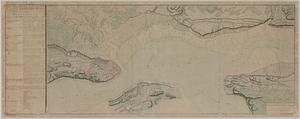
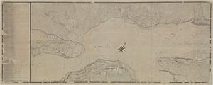
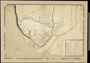
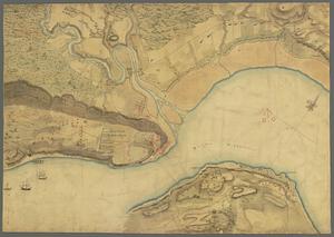
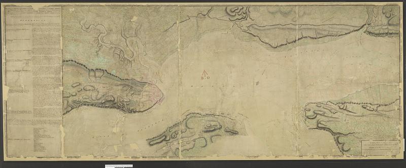
Plan of the town of Quebec the capital of Canada in North America : with the bason and a part of the adjacent country shewing the principal encampments and works of the British army commanded by Maj. Gen. Wolfe and those of the French army commanded by the Lieut. Gen. the Marquis of Montcalm during the siege of that place in 1759
This map is also available in American Revolutionary Geographies Online (ARGO), a collections portal especially built for material relating to the American Revolutionary War Era. Visit ARGO to learn more about this item and explore the historical geography of North America in the late eighteenth century.
Item Information
- Title:
- Plan of the town of Quebec the capital of Canada in North America : with the bason and a part of the adjacent country shewing the principal encampments and works of the British army commanded by Maj. Gen. Wolfe and those of the French army commanded by the Lieut. Gen. the Marquis of Montcalm during the siege of that place in 1759
- Cartographer:
- Mackellar, Patrick, 1717-1778
- Name on Item:
-
Patrick Mackellar
- Date:
-
1759
- Format:
-
Maps/Atlases
- Genre:
-
Manuscript maps
- Location:
- Library and Archives Canada
- Collection (local):
-
Library and Archives Canada Collection
- Subjects:
-
Seven Years' War, 1756-1763--Campaigns--Canada--Maps
Québec (Québec)--Maps
Fortification--Québec (Province)
Saint Lawrence River--Maps
New France--Maps
- Places:
-
CanadaQuébec
Saint Lawrence River
New France
- Extent:
- 1 manuscript map : hand color ; 70 x 180 cm
- Terms of Use:
-
Copyright expired. Contact host institution to download image.
Contact host institution for more information.
- Place of origin:
-
Québec
- Language:
-
English
- Catalog Record:
-
Catalog record
- Notes:
-
Board of Ordnance Stamp.
- Identifier:
-
e010746211
- Barcode:
-
4170850