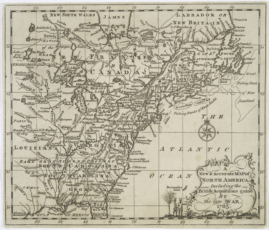
A New & accurate map of North America : including the British acquisitions gained by the late war, 1763
This map is also available in American Revolutionary Geographies Online (ARGO), a collections portal especially built for material relating to the American Revolutionary War Era. Visit ARGO to learn more about this item and explore the historical geography of North America in the late eighteenth century.
Item Information
- Title:
- A New & accurate map of North America : including the British acquisitions gained by the late war, 1763
- Creator:
- Millan, John, -1782
- Contributor:
- Dilly, Charles, 1739-1807
- Contributor:
- Dilly, E. (Edward), 1732-1779
- Date:
-
1763
- Format:
-
Maps/Atlases
- Location:
- New York Public Library
- Collection (local):
-
Maps of North America
- Subjects:
-
North America--History--Colonial period, ca. 1600-1775--Maps--Early works to 1800
Great Britain--Colonies--America--Maps--Early works to 1800
- Places:
-
North America (area)
- Extent:
- 1 map ; 19 x 22 cm.
- Terms of Use:
-
No known copyright restrictions.
This work is licensed for use under a Creative Commons Attribution Non-Commercial Share Alike License (CC BY-NC-SA).

- Publisher:
-
[S.l.] :
[s.n.]
- Scale:
-
Scale not given
- Language:
-
English
- Catalog Record:
-
https://digitalcollections.nypl.org/items/510d47db-b007-a3d9-e040-e00a18064a99
- Notes:
-
Relief shown pictorially.
From John Entick's General history of the late war. v. 1.
Eastern North America from Labrador to the Gulf of Mexico and west to the Lake of the Woods.


