A chart of Canada River : from ye island of Anticosty as far up as Quebeck, ye islands, locks, shoals, & soundings as they appear at low water
Item Information
- Title:
- A chart of Canada River : from ye island of Anticosty as far up as Quebeck, ye islands, locks, shoals, & soundings as they appear at low water
- Description:
-
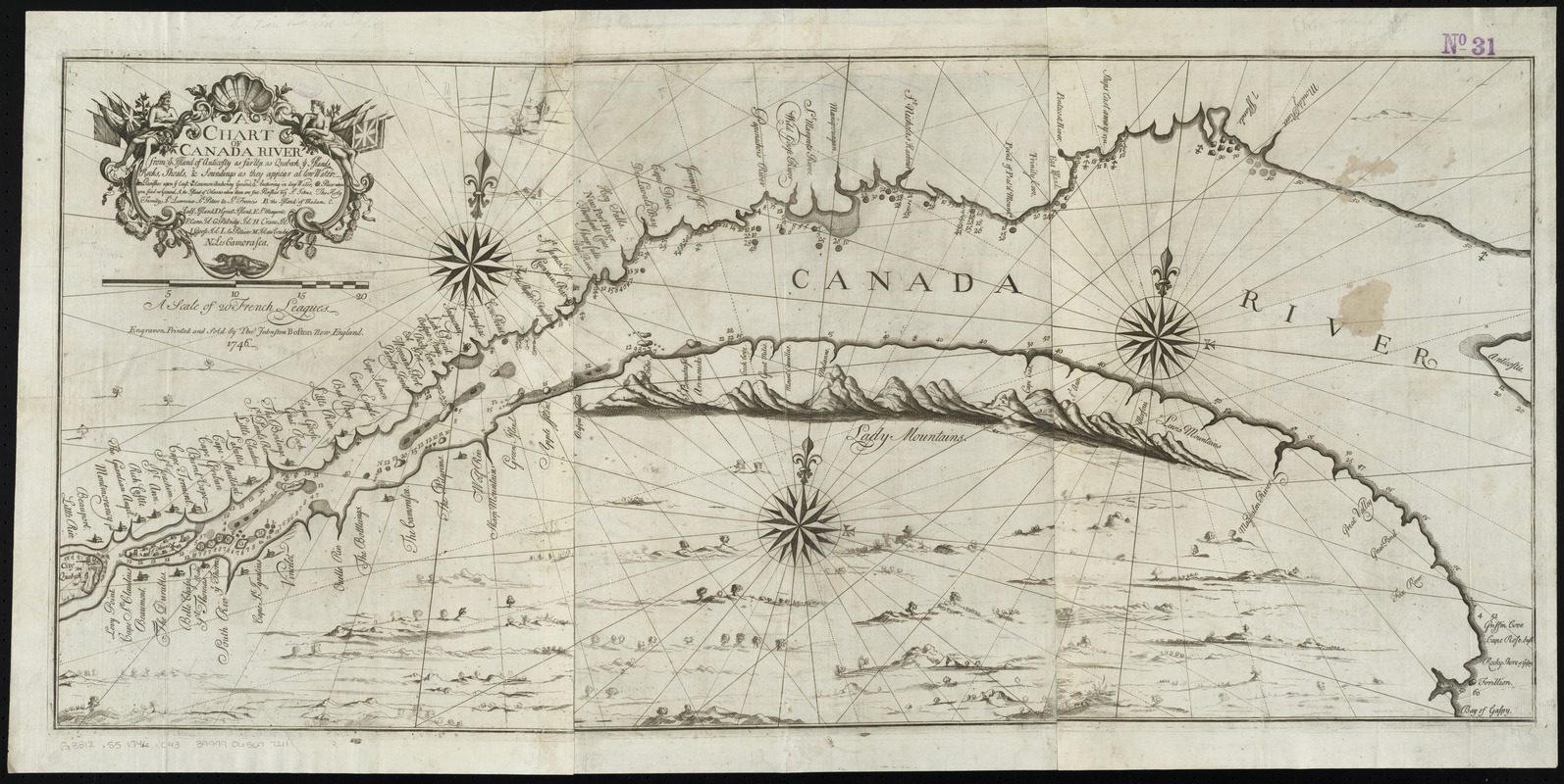
After the conquest of Louisburg, Governor Shirley began organizing an attack on Quebec. During the preparations, this chart of the St. Lawrence River was engraved by Johnston, a "Boston house painter, japanner, engraver, painter of coats of arms, church singer, publisher of singing-books and pioneer New England builder of organs." The chart notes French settlements and provides some hydrographic data, all based on an unidentified "French draft." Given how little was known about the area, it was fortunate that the expedition was cancelled, perhaps due to British concerns that another military success might encourage the colonies to pursue a more independent course.
- Printer of plates:
- Johnston, Thomas, 1708-1767
- Engraver:
- Johnston, Thomas, 1708-1767
- Date:
-
1746
- Format:
-
Maps/Atlases
- Location:
-
Boston Public Library
Norman B. Leventhal Map & Education Center - Collection (local):
-
Norman B. Leventhal Map & Education Center Collection
- Subjects:
-
Saint Lawrence River--Maps
Québec (Province)--Maps
- Places:
-
CanadaQuebec (province)
Saint Lawrence River
- Extent:
- 1 map on 3 sheets : engraving ; 44 x 98 cm., on sheets 51 x 39 cm. and smaller.
- Terms of Use:
-
No known copyright restrictions.
No known restrictions on use.
- Publisher:
-
Boston :
Engraven, printed and sold by Thos. Johnston
- Scale:
-
Scale [ca. 1:600,000]
- Language:
-
English
- Notes:
-
Boston Public Library copy joined into one sheet.
Relief shown pictorially. Depths shown by soundings.
Includes references and legend in the title cartouche below the title.
Includes illustrated profiles of the Lady Mountains and the Lewis Mountains.
- Notes (exhibitions):
-
Exhibited: "Made in Boston" organized by the Norman B. Leventhal Map Center at the Boston Public Library, 2013-2014.
- Identifier:
-
06_01_010764
- Call #:
-
G3312.S5 1746 .C43
- Barcode:
-
39999065677211


