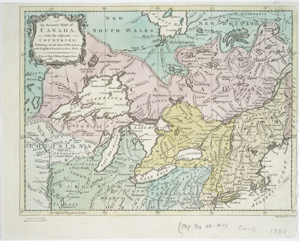
An accurate map of Canada, with the adjacent countries : exhibiting the late seat of war between the English & French in those parts
This map is also available in American Revolutionary Geographies Online (ARGO), a collections portal especially built for material relating to the American Revolutionary War Era. Visit ARGO to learn more about this item and explore the historical geography of North America in the late eighteenth century.
Item Information
- Title:
- An accurate map of Canada, with the adjacent countries : exhibiting the late seat of war between the English & French in those parts
- Creator:
- Seale, Richard William
- Contributor:
- Hinton, John, -1781
- Name on Item:
-
R.W. Seale, del. et sculp.
- Date:
-
[1761]
- Format:
-
Maps/Atlases
- Location:
- New York Public Library
- Collection (local):
-
Maps of North America
- Subjects:
-
Canada--Maps--Early works to 1800
- Places:
-
Canada
- Extent:
- 1 map : hand col. ; 25 x 33 cm.
- Terms of Use:
-
No known copyright restrictions.
This work is licensed for use under a Creative Commons Attribution Non-Commercial Share Alike License (CC BY-NC-SA).

- Publisher:
-
[London] :
Univers. Mag., J. Hinton
- Scale:
-
Scale ca. 1:5,600,000
- Language:
-
English
- Catalog Record:
-
https://digitalcollections.nypl.org/items/510d47db-b017-a3d9-e040-e00a18064a99
- Notes:
-
From Universal magazine of knowledge and pleasure, v. 28, Feb. 1761.
Relief shown pictorially.
- Notes (date):
-
This date is inferred.


