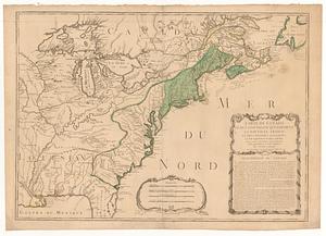
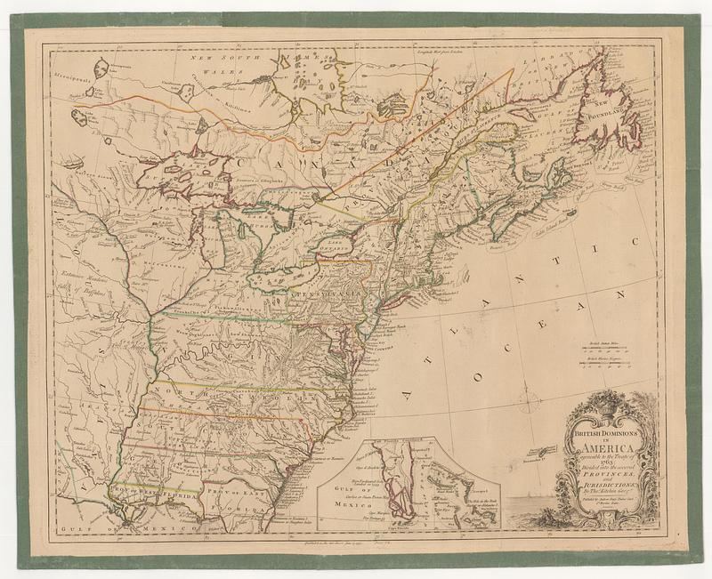
British dominions in America agreeable to the treaty of 1763 : divided into the several provinces, and jurisdictions
This map is also available in American Revolutionary Geographies Online (ARGO), a collections portal especially built for material relating to the American Revolutionary War Era. Visit ARGO to learn more about this item and explore the historical geography of North America in the late eighteenth century.
Item Information
- Title:
- British dominions in America agreeable to the treaty of 1763 : divided into the several provinces, and jurisdictions
- Cartographer:
- Kitchin, Thomas, 1719-1784
- Publisher:
- Dury, Andrew
- Name on Item:
-
by Tho.s Kitchin geog.r
- Date:
-
June 17, 1777
- Format:
-
Maps/Atlases
- Location:
- MacLean Collection Map Library
- Collection (local):
-
MacLean Collection Map Library
- Subjects:
-
United States--Maps--Early works to 1800
Canada--Maps--Early works to 1800
- Places:
-
United States
Canada
- Extent:
- 1 map ; 437 x 538 mm
- Terms of Use:
-
Public Domain/No known restrictions on use. Contact host institution to download image.
Contact host institution for more information.
- Publisher:
-
London :
Published by Andrew Dury, Dukes Court S.t Martins Lane
- Language:
-
English
- Identifier:
-
MC_20100
- Call #:
-
20100