Toggle navigation
LMEC Home
Exhibitions
Georeferencing
Tools for Teachers
Collections
My Favorites
Sign Up / Log In
Search
Search the map portal
Map Collection
Map Collection
Map Sets
Search
Search
Search for
Search In
All Fields
Creator
Title
Subject
Place
Search All Digital Collections
Advanced Search
8563 Results
My Search
Start Over
More Like
commonwealth:kk91fq60v
Remove constraint More Like: commonwealth:kk91fq60v
Date facet yearly ssim
1500
to
1549
Remove constraint Date facet yearly ssim: <span class='from'>1500</span> to <span class='to'>1549</span>
Filter your Search
Place
North and Central America
5,856
United States
4,776
Massachusetts
2,052
Europe
1,359
Suffolk (county)
1,034
Boston
1,007
Canada
450
Asia
422
more
Place
»
Topic
Boston (Mass.)--Maps
577
United States--Maps
273
Real property--Massachusetts--Boston--Maps
174
Massachusetts--Maps
160
Landowners--Massachusetts--Boston--Maps
132
North America--Maps--Early works to 1800
103
New England--Maps
99
Europe--Maps
78
more
Topic
»
Date
Date range begin
–
Date range end
Current results range from
1482
to
2023
View distribution
Creator
United States. Hydrographic Office
594
O.H. Bailey & Co
148
Des Barres, Joseph F. W. (Joseph Frederick Wallet), 1722-1824
124
United States. Post Office Dept
120
Ptolemy, 2nd cent
100
Walling, Henry Francis, 1825-1888
94
Geological Survey (U.S.)
86
Jefferys, Thomas, -1771
86
more
Creator
»
Format
Maps/Atlases
8,504
Manuscripts
215
Prints
56
Books
36
Objects/Artifacts
10
Drawings/Illustrations
8
Posters
4
Georeferenced
Yes
869
No
7,694
Collection
Norman B. Leventhal Map & Education Center Collection
8,555
Boston and New England Maps
2,205
Urban Maps
1,936
Maritime Charts and Atlases
1,085
American Revolutionary War-Era Maps
624
Boston Redevelopment Authority Collection
87
Mapping Boston Collection
6
Richard H. Brown Revolutionary War Map Collection at Mount Vernon
5
more
Collection
»
Available to use
No known restrictions
8,408
Creative Commons license
58
Search Constraints
Sort by relevance
relevance
title
date (asc)
date (desc)
Number of results to display per page
100 per page
10
per page
20
per page
50
per page
100
per page
View results as:
grid view
map view
Search Results
1.
Pascaerte vande Vlaemsche, Soute, en Caribesche Eylanden, als mede Terra Nova, en de custen van Nova Francia, Nova Anglia, Nieu...
2.
A chart of the sea coast of New Found Land, New Scotland, New England, New York, New Jersey, with Virginia and Maryland
3.
The coast of Nova Scotia, New England, New-York, Jersey, the Gulph and River of St. Lawrence : the islands of Newfoundland,...
4.
A chart of the West Indies from Cape Cod to the River Oronoque
5.
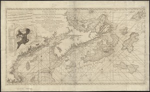
A new chart of the coast of New England, Nova Scotia, and the islands of St. Iohn, Cape Breton, Sable, the banks of St. Peters,...
6.
Pascaerte vande Vlaemsche, Soute, en Caribesche Eylanden, als mede Terra Nova, en de custen van Nova Francia, Nova Anglia, Nieu...
7.
Pascaerte van Brazil en Nieu Nederlandt, van Corvo en Flores tot de Barbados
8.
An actual survey of the sea coast from New York to the I. Cape Brition : with tables of the direct and thwart courses &...
9.
A chart of the sea coast of New Foundland, New Scotland, New York, New Jersey, with Virginia and Maryland and New England
10.
De Noordelyckste Zee Kusten van America van Groenland door de Straet Davis ende Straet Hudson tot Terra Neuf =...
11.
Paskaert van de Noordelijckste kuste van America van Groenland door de Straet Davis en de Straet Hudson tot Terra Neuf
12.
The American Pilot [title page]
13.
Pascaerte van Terra Nova Nova Francia Nievw Engeland En de Groote Revier van Canada
14.
Archipelagus Atlanticus cum suis insulis Canariis, Hesperidibus et Azoribus
15.
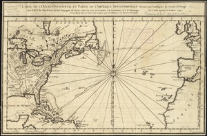
Carte de l'ocean occidental et partie de l'Amerique septentrionale : dressée pour l'intelligence du Journal du voyage que le...
16.
Chart comprizing Greenland with the countries and islands about Baffin's and Hudson's Bays
17.
Chart shewing the tracks across the North Atlantic Ocean of Don Christopher Columbus
18.
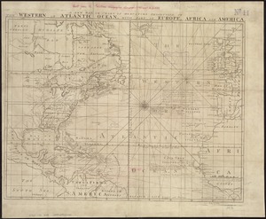
Hydrographical map of the Atlantic Ocean, extending from the southermost part of North America to Europe : Shewing the differt....
19.
Mar del nort
20.
A new chart of the Atlantic or Western Ocean
21.
A new map or chart in Mercators projection, of the Western or Atlantic Ocean, with part of Europe, Africa and America
22.
A new map or chart of the Western or Atlantic Ocean, with part of Europe Africa & America : showing the course of galleons,...
23.
Pascaarte vande Noorder Zee custen van America, vande West-hoeck van Ysland doorde Straet Davis en Hudson, tot aen Terra Neuf
24.
Terra nova, ac maris tractus circa Novam Franciam, Angliam, Belgium, Venezuelam Novam, Andalusiam, Guianan, et Brasiliam =...
25.
Carta particolare della nuoua Belgia è parte della nuoua Anglia
26.
A chart of the coast of New England from the South Shoal to Cape Sable including Georges Bay from Holland & actual surveys
27.
A chart of the coast of New England from the South Shoal to Cape Sable including Georges Bay from Holland & actual surveys
28.
The coast of New England
29.
[Coast of New England from Chatham Harbor to Naragansett Bay]
30.
[Coast of New England from Chatham Harbor to Naragansett Bay]
31.
A correct map of the coast of New England
32.
Pas caerte van Nieu Nederlandt en de Engelsche Virginies van Cabo Cod tot Cabo Canrick
33.
A chart of New York Harbour with the soundings views of land marks and nautical directions : for the use of pilotage
34.
A new and correct chart of the coast of New England and New York with the adjacent parts of Nova Scotia and New Brunswick from...
35.
A map of the coast of New England, from Staten Island to the island of Breton
36.
Carte nouvelle des posséssions angloises en Amérique : dressée pour l'intelligence de la guerre présente et divisée...
37.
Chart comprizing Greenland with the countries and islands about Baffin's and Hudson's Bays
38.
A chart of the Atlantic Ocean : its islands and the adjacent continents: In which the British Dominions in Europe and America,...
39.
A new chart of the vast Atlantic Ocean
40.
Chart of the coast of New England
41.
The coast of a part of New England, New York, New Jersey, Pensilvania, Maryland, Virginia, and part of North Carolina &c. with...
42.
The coast of New England
43.
Costes et rivieres de Virginie, de Mariland, et de Nouvelle Angletere
44.
A new chart of the coast of New England, Nova Scotia, and the islands of St. John, Cape Breton, Sable, the banks of St. Peters,...
45.
The 100th anniversary map of Abraham Lincoln's visit to Massachusetts, September 11-23, 1848
46.
1630 shoreline
47.
1879. Progress map of the U.S. Geographical Surveys west of the 100th Meridian : prepared under the direction of 1st Lieut....
48.
1903 Map of Salem and surrounding places
49.
19th annual convention of the National Association of Real Estate Boards : at Tulsa, June 7 to June 11 in 1926
50.
2005 significant U.S. hurricane strikes
51.
The 2100 project : an atlas for the Green New Deal
52.
227 Harzgerode
53.
305 Glatz
54.
38,000,000 escaped -- 10,000,000 died
55.
4 Kinten
56.
660 Wakulah St., Roxbury
57.
[A chart of Boston Bay and vicinity]
58.
[A chart of New York Island & North River : East River, passage through Hell Gate, Flushing Bay, Hampstead Bay, Oyster,...
59.
The A.A.A. key road map of continental Europe
60.
Aaron Bohrod's America, its history
61.
ABC pathfinder railway guide map : eastern division
62.
Abolition of Slavery, 1863
63.
Aboriginal map of North America, denoting the boundaries and the locations of various Indian tribes
64.
Acapulco, México
65.
Accurata delineatio Castrorum Suecicorum, ut et Haffniae, Regni Daniae Metropolis
66.
Accurata delineatio oppugnatae a faederatis, Caesareis, Polonicis, Danicis, et Brandeburgicis copijs sub-ductu Seren: Electoris...
67.
Accurata delineatio regionis circa Nieburgum Fioniæ cum prælio ibi commisso inter Danorum et fæderatorum exercitum ab una et...
68.
Accurata Scaniae, Blekingiae et Hallandiae descriptio
69.
An accurate map of Cuba, and the adjacent islands
70.
An accurate map of Dorset Shire divided into hundreds
71.
An accurate map of Dorset Shire, divided into its hundreds
72.
An accurate map of England and Wales with the principal roads from the best authorities
73.
An accurate map of England and Wales with the principal roads from the best authorities
74.
An accurate map of Europe from the best authorities
75.
An accurate map of Hindostan or India, from the best authorities
76.
An accurate map of His Majesty's province of New-Hampshire in New England : taken from actual surveys of all the inhabited...
77.
An Accurate map of New Hampshire in New England, from a late survey
78.
An Accurate map of New York in North America, from a late survey
79.
An accurate map of North America : describing and distinguishing the British, Spanish and French dominions on this great...
80.
An accurate map of North America : describing and distinguishing the British and Spanish dominions on this great continent :...
81.
An accurate map of North America : describing and distinguishing the British and Spanish dominions of this great continent;...
82.
An accurate map of North and South Carolina with their Indian frontiers, shewing in a distinct manner all the mountains,...
83.
An accurate map of Rhode Island, part of Connecticut and Massachusets, shewing Admiral Arbuthnot's station in blocking up...
84.
An accurate map of the coast of Cape de Verde
85.
An accurate map of the Commonwealth of Massachusetts exclusive of the district of Maine : compiled pursuant to an Act of the...
86.
An accurate map of the country round Boston in New England from the best authorities
87.
An accurate map of the county of Essex, divided into its hundreds
88.
An accurate map of the district of Maine being part of the Commonwealth of Massachusetts : compiled pursuant to an act of the...
89.
An accurate map of the United States of America, with part of the surrounding provinces agreeable to the Treaty of Peace of 1783
90.
Accuratissima Brasiliae tabula
91.
Accuratissima Circuli Saxoniae tabula quae est pars septentrionalis Germaniae
92.
Accuratissima Dominii Veneti in Italia, Ducatus Parmae, Placentiae, Modenae Regii Et Mantuae, Episcopatus Tridentini Tabula...
93.
Accuratissima et maxima totius Turcici Imperii tabula cum omnibus suis regionibus novissima delineatio
94.
Accuratissima principatus Cataloniae, et comitatuum Ruscinonis, et Cerretaniae descriptio
95.
Adams, Mass : 1882
96.
Adriatic
97.
The adventures of Mark Twain
98.
Aegyptus Antiqua
99.
Aerial photograph of South Boston
100.
Aerial photograph of South Boston
‹ Prev
Next ›
1
2
3
4
5
…
85
86


![The American Pilot [title page]](https://bpldcassets.blob.core.windows.net/derivatives/images/commonwealth:3f462z36r/image_thumbnail_300.jpg)


![[Coast of New England from Chatham Harbor to Naragansett Bay]](https://bpldcassets.blob.core.windows.net/derivatives/images/commonwealth:7h149x27g/image_thumbnail_300.jpg)
![[Coast of New England from Chatham Harbor to Naragansett Bay]](https://bpldcassets.blob.core.windows.net/derivatives/images/commonwealth:7h149z37x/image_thumbnail_300.jpg)


![[A chart of Boston Bay and vicinity]](https://bpldcassets.blob.core.windows.net/derivatives/images/commonwealth:cj82m2976/image_thumbnail_300.jpg)


