Toggle navigation
LMEC Home
Exhibitions
Georeferencing
Tools for Teachers
Collections
My Favorites
Sign Up / Log In
Search
Search the map portal
Map Collection
Map Collection
Map Sets
Search
Search
Search for
Search In
All Fields
Creator
Title
Subject
Place
Search All Digital Collections
Advanced Search
210 Results
My Search
Start Over
More Like
commonwealth:hq37vv363
Remove constraint More Like: commonwealth:hq37vv363
Filter your Search
Place
North and Central America
167
United States
155
New England
139
Massachusetts
34
New York
29
Rhode Island
17
Connecticut
15
Canada
14
more
Place
»
Topic
New England--Maps
120
Railroads--New England--Maps
55
Massachusetts--Maps
19
New York (State)--Maps
19
New England--Maps--Early works to 1800
15
Railroads--New York (State)--Maps
13
World maps--Early works to 1800
13
Rhode Island--Maps
10
more
Topic
»
Date
Date range begin
–
Date range end
Current results range from
1482
to
2015
View distribution
Creator
Ortelius, Abraham, 1527-1598
5
Walling, Henry Francis, 1825-1888
5
Bew, John, -1793
4
Lodge, John, -1796
4
United States. Post Office Dept
4
Bellin, Jacques Nicolas, 1703-1772
3
Bordon, Benedetto, 1450-1530
3
Farwell, John Whittemore, 1843-1929
3
more
Creator
»
Format
Maps/Atlases
210
Books
1
Manuscripts
1
Georeferenced
Yes
27
No
183
Collection
Norman B. Leventhal Map Center Collection
108
Sidney R. Knafel Map Collection at Phillips Academy
87
Boston and New England Maps
80
American Revolutionary War-Era Maps
39
American Antiquarian Society Collection
9
David Judkins Weaver Papers
3
William L. Clements Library Collection
3
British Library Collection
2
more
Collection
»
Available to use
No known restrictions
108
Creative Commons license
3
Search Constraints
Sort by date (asc)
relevance
title
date (asc)
date (desc)
Number of results to display per page
100 per page
10
per page
20
per page
50
per page
100
per page
View results as:
grid view
map view
Search Results
101.
Massachusetts, Rhode-Island and Connecticut
102.
Map of the eastern and middle states
103.
New England and New York in 1697
104.
Map of Massachusetts, Connecticut and Rhode Island constructed from the latest authorities
105.
Map of the states of Maine, New Hampshire, Vermont, Massachusetts, Connecticut & Rhode Island
106.
Geological map of Massachusetts
107.
A map of the yearly meeting of Friends for New England A.D. 1833
108.
A map of the New England states : Maine, New Hampshire, Vermont, Massachusetts, Rhode Island & Connecticut, with the adjacent...
109.
Massachusetts
110.
Map of Massachusetts, Rhode-Island & Connecticut : compiled from the latest authorities
111.
New-England
112.
Sketch of the states of Massachusetts, Connecticut, and Rhode Island, and parts of New Hampshire & New York exhibiting the...
113.
Map of Maine, New Hampshire, Vermont, Massachusetts, Rhode Island, and Connecticut : exhibiting the post offices, post roads,...
114.
Massachusetts
115.
Railroad map of New England, with adjacent portions of New York & Canada
116.
Map of Maine, New Hampshire and Vermont, from the most authentic sources
117.
Map showing the proposed rail roads from Boston to Burlington, from Hale's map of New England
118.
Map of the country copied from Hale's map of N. E. with railroad route from Boston to Lake Champlain : through Keene, N. H
119.
Diagram of rail roads diverging from Boston : showing the depots and distances
120.
Sketch of the states of Massachusetts, Connecticut, and Rhode Island, and parts of New Hampshire & New York exhibiting the...
121.
The harbor of Holmes' Hole
122.
Map of New England
123.
Map exhibiting the rail road routes leading from Boston, to Ogdensburg and Buffalo, N.Y
124.
Map of the Troy & Greenfield Rail Road and its connections
125.
Map exhibiting the rail road, canal, lake and river routes from New York and Boston to the west, via Ogdensburgh, Buffalo and...
126.
Map of New England exhibiting the rail road & telegraphic lines now in operation
127.
Map of the Boston & Maine Railroad, showing its relative position & connection with other railroads
128.
Rail road map of New England & eastern New York
129.
Rail road map of New England & eastern New York
130.
Railroad map of New England & eastern New York complied from the most authentic sources
131.
[Map of New England, 31st]
132.
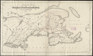
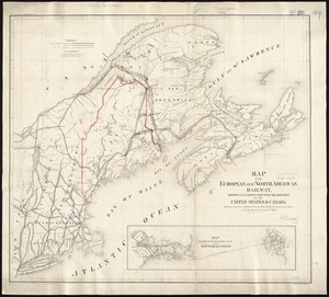
Map of the European and North American Railway, showing its connection with the railways of the United States & Canada; made by...
133.
Map of the rail road from Boston to Stanstead
134.
A map of the Yearly Meeting of Friends for New England : 1850
135.
Map showing the relative distances of Porsmouth [i.e. Portsmouth] and Boston from Concord & Manchester, N.H
136.
Map of the New York & Boston Railway, with its connections with other railways
137.
Sherman & Smith's rail road, steam boat & stage route map of New England, New-York, and Canada
138.
Williams' telegraph and rail road map of the New England states, eastern portion of New York state and Canada
139.
Williams' telegraph and rail road map of the New England states, eastern protion of New York state and Canada : compiled from...
140.
Map of New England exhibiting the rail road and telegraphic lines now in operation
141.
Preliminary sketch showing the positions of Davis' Shoal and other dangers recently discovered by the Coast Survey and the...
142.
Sketch A No. 5 showing proposed site for a light house on Sow and Pigs Reef
143.
Telegraph and rail road map of the New England states
144.
Massachusetts and Rhode Island
145.
New England : reduced from Jeffrey's [sic] map, London, 1774
146.
Ensign, Bridgman & Fanning's rail road map of the United States, showing the depots & stations
147.
E.P. Dutton & Co.'s railroad, steam boat & stage route map of New England, New-York and Canada
148.
Lloyd's railroad, telegraph & express map of the Eastern States to accompany Lloyd's railroad, telegraph & express map of the...
149.
G. Woolworth Colton's railroad, township & distance map of New England with adjacent portions of New York, Canada & New Brunswick
150.
Post route map of the states of New Hampshire, Vermont, Massachusetts, Rhode Island, Connecticut, and parts of New York and Maine
151.
Post route map of the states of New Hampshire, Vermont, Massachusetts, Rhode Island, Connecticut, and parts of New York and Maine
152.
Boston Clinton Fitchburg and Mansfield Framingham Lowell Railroads, and connections
153.
Map of New England with adjacent portions of New York & Canada
154.
Map showing the lines of canals & rail roads owned, leased & operated by the Delaware and Hudson Canal and Rail Road Co. with...
155.
Railway map of the New England states, engraved expressly for the Pathfinder railway guide
156.
Barnstable County, Dukes County and Nantucket Island, Massachusetts
157.
Commercial map of New England
158.
Map of the European & North American Railway and its connections
159.
Map of New England : with adjacent portions of New York & Canada
160.
Map of New England with adjacent portions of New York & Canada
161.
Old Colony Railroad and connections
162.
Post route map of the states of New Hampshire, Vermont, Massachusetts, Rhode Island, Connecticut, and parts of New York and Maine
163.
Map of New England with adjacent portions of New York & Canada
164.
Map of the South Mountain and Boston Railroad & connections showing territory passed through, rail-roads and canals crossed or...
165.
Map of the Boston and Northwestern, Massachusetts Central, and Boston and Poughkeepsie Railroads and their connections
166.
G. Woolworth Colton's railroad, township & distance map of New England : with adjacent portions of New York, Canada & New...
167.
ABC pathfinder railway guide map : eastern division
168.
Map of the Eastern Railroad and principal connections
169.
A new chart of ye coast of New Found Land, New Scotland and New England &c.
170.
The New England states and part of Canada
171.
To the honourable Walter Younge, barronet, one of the commissioners for his majestie's collonis : this description of New...
172.
Sketch A showing the progress of the survey in section no. 1 from 1844 to 1881
173.
Vereinigte Staaten von Nord-Amerika in 6 blattern, bl. 3
174.
Map of the Boston, Concord, Montreal & White Mountains Railroad and its principal connections
175.
Map of the Eastern Railroad and principal connections
176.
Map showing the comparative merits, and benefits to Massachusetts, of the proposed extension of the New York and Massachusetts...
177.
Post route map of the states of New Hampshire, Vermont, Massachusetts, Rhode Island, Connecticut and parts of New York and...
178.
Post route map of the states of New Hampshire, Vermont, Massachusetts, Rhode Island, Connecticut and parts of New York and...
179.
The New York, New Haven & Hartford Railroad and connections
180.
Relief practice map
181.
Post route map of the states of New Hampshire, Vermont, Massachusetts, Rhode Island, Connecticut and parts of New York and...
182.
C.H. Guild & Co.'s newspaper map of New England
183.
Map of the Hudson River & Berkshire R. R. and its connections
184.
Post route map of the states of New Hampshire, Vermont, Massachusetts, Rhode Island, Connecticut showing post offices with the...
185.
New post office, township, county and railroad map of New England : with distances
186.
A small map of the sea coast of New England together with the outlines of several of the provinces lying thereon, 1738
187.
The National Publishing Company's railroad, post office, township and county map of Massachusetts, Rhode Island and Connecticut...
188.
Trolley pathfinder birds eye map of interurban trolley lines in New England
189.
Map of the New England and Middle Atlantic States
190.
The New England commercial and route survey : showing all postoffices, railroads, electric roads in operation and proposed,...
191.
Map first division railway mail service
192.
The heart of New England
193.
Summer resorts of the coast, lake, and mountain regions along the Boston & Maine Railroad and connections
194.
The New England commercial and route survey
195.
Fishing grounds out of Boston : NLSECO marine diesel oil engines ; built by New London Ship & Engine Co., Groton, Conn
196.
Hodgman's new map showing location and classification golf and country clubs of New England with automobile roads and distances
197.
National map of New England states Vermont, New Hampshire, Massachusetts, Connecticut, Rhode Island and Maine showing counties...
198.
Industrial map of New England
199.
Rand McNally official 1920 auto trails map : District number 6 : New England, eastern New York
200.
Travel-map of New England
‹ Prev
Next ›
1
2
3


![[Map of New England, 31st]](https://bpldcassets.blob.core.windows.net/derivatives/images/commonwealth:wd3763094/image_thumbnail_300.jpg)


![Map showing the relative distances of Porsmouth [i.e. Portsmouth] and Boston from Concord & Manchester, N.H](https://bpldcassets.blob.core.windows.net/derivatives/images/commonwealth:7h14b104z/image_thumbnail_300.jpg)