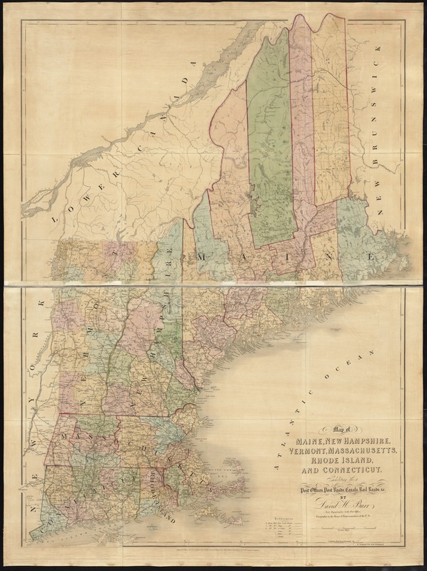
Map of Maine, New Hampshire, Vermont, Massachusetts, Rhode Island, and Connecticut : exhibiting the post offices, post roads, canals, rail roads, &c
Item Information
- Title:
- Map of Maine, New Hampshire, Vermont, Massachusetts, Rhode Island, and Connecticut : exhibiting the post offices, post roads, canals, rail roads, &c
- Description:
-
Detailed map showing drainage, township and county boundaries, cities and towns, canals, road, and railroads.
- Creator:
- Burr, David H., 1803-1875
- Name on Item:
-
by David H. Burr (late topographer to the Post Office,) Geographer to the House of Representatives of the U.S.
- Date:
-
[1839]
- Format:
-
Maps/Atlases
- Location:
-
Boston Public Library
Norman B. Leventhal Map & Education Center - Collection (local):
-
Norman B. Leventhal Map & Education Center Collection
- Subjects:
-
New England--Maps
- Places:
-
New England (area)
- Extent:
- 1 map : hand col. ; 124 x 91 cm.
- Terms of Use:
-
No known copyright restrictions.
No known restrictions on use.
- Publisher:
-
London :
J. Arrowsmith
- Scale:
-
Scale [ca. 1:642,000]
- Language:
-
English
- Notes:
-
From his The American Atlas (London, J. Arrowsmith, 1839).
Relief shown by hachures.
- Notes (date):
-
This date is inferred.
- Identifier:
-
06_01_008651
- Call #:
-
G3720 1839 .B87
- Barcode:
-
39999065657007
- LCCN:
-
98688373


