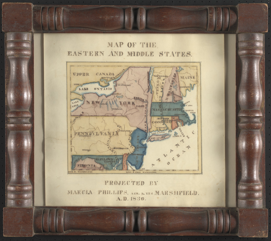
Map of the eastern and middle states
Item Information
- Title:
- Map of the eastern and middle states
- Cartographer:
- Phillips, Marcia
- Name on Item:
-
projected by Marcia Phillips, age 9. yrs
- Date:
-
1830
- Format:
-
Maps/Atlases
Manuscripts
- Location:
-
Boston Public Library
Norman B. Leventhal Map & Education Center - Collection (local):
-
Norman B. Leventhal Map & Education Center Collection
- Subjects:
-
New England--Maps
Middle Atlantic States--Maps
Manuscript maps
- Places:
-
New England (area)
Middle Atlantic (area)
- Extent:
- 1 manuscript map : hand color ; 18 x 22 cm, on sheet 31 x 31 cm
- Terms of Use:
-
No known copyright restrictions.
No known restrictions on use.
- Place of origin:
-
Marshfield
- Scale:
-
Scale approximately 1:3,500,000
- Language:
-
English
- Notes:
-
Manuscript map in ink and watercolor, by a schoolgirl.
Prime meridian: Washington.
Framed.
- Identifier:
-
06_01_016729
- Call #:
-
G3715 1830 .P78
- Barcode:
-
39999085951299


