Toggle navigation
LMEC Home
Exhibitions
Georeferencing
Tools for Teachers
Collections
My Favorites
Sign Up / Log In
Search
Search the map portal
Map Collection
Map Collection
Map Sets
Search
Search
Search for
Search In
All Fields
Creator
Title
Subject
Place
Search All Digital Collections
Advanced Search
8186 Results
My Search
Start Over
More Like
commonwealth:cj82m423t
Remove constraint More Like: commonwealth:cj82m423t
Filter your Search
Place
North and Central America
4,935
United States
3,616
Suffolk (county)
1,026
Boston
999
Europe
963
Canada
427
France
269
Massachusetts
249
more
Place
»
Topic
Boston (Mass.)--Maps
574
United States--Maps
270
Real property--Massachusetts--Boston--Maps
174
Massachusetts--Maps
160
Landowners--Massachusetts--Boston--Maps
132
North America--Maps--Early works to 1800
103
New England--Maps
99
Europe--Maps
78
more
Topic
»
Date
Date range begin
–
Date range end
Current results range from
1482
to
2023
View distribution
Creator
United States. Hydrographic Office
357
O.H. Bailey & Co
148
Des Barres, Joseph F. W. (Joseph Frederick Wallet), 1722-1824
123
United States. Post Office Dept
120
Ptolemy, 2nd cent
100
Walling, Henry Francis, 1825-1888
94
Jefferys, Thomas, -1771
85
Geological Survey (U.S.)
82
more
Creator
»
Format
Maps/Atlases
8,127
Manuscripts
221
Prints
51
Books
36
Objects/Artifacts
10
Drawings/Illustrations
8
Posters
4
Georeferenced
Yes
869
No
7,317
Collection
Norman B. Leventhal Map Center Collection
8,162
Boston and New England Maps
2,184
Urban Maps
1,926
Maritime Charts and Atlases
750
American Revolutionary War-Era Maps
640
Boston Redevelopment Authority Collection
86
New York Public Library Collection
9
Richard H. Brown Revolutionary War Map Collection at Mount Vernon
8
more
Collection
»
Available to use
No known restrictions
8,021
Creative Commons license
69
Search Constraints
Sort by relevance
relevance
title
date (asc)
date (desc)
Number of results to display per page
100 per page
10
per page
20
per page
50
per page
100
per page
View results as:
grid view
map view
Search Results
1.
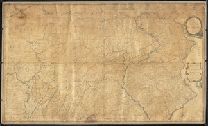
A map of the state of Pennsylvania
2.
A map of Pennsylvania exhibiting not only the improved parts of that Province, but also its extensive frontiers : laid down...
3.
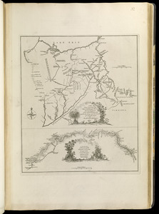
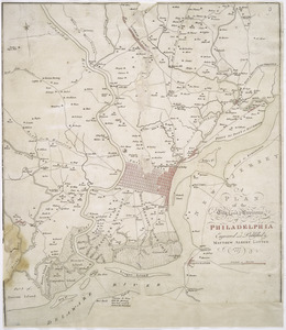
[Environs of Philadelphia]
4.
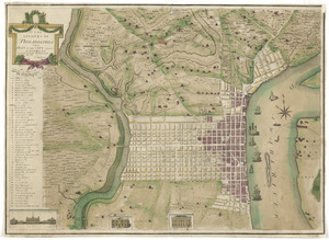
A plan of the city and environs of Philadelphia
5.
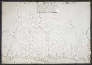
A MAPP OF PENSYLVANIA IN AMERICA
6.
Grundriss von Philadelphia der hauptstadt in Pensylvanien und umliegenden Gegend
7.
A plan of the city of Philadelphia, the capital of Pennsylvania, from an actual survey
8.
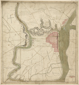
This plan of the city of Philadelphia and it's [sic] environs, (shewing the improved parts,) is dedicated to the mayor,...
9.
Carte de la Pensylvanie et du Nouveau Jersey
10.
Karte von Neu England, Neu Yorck und Pensilvanien : sur Allgemeinen historie der reisen
11.
A map exhibiting a general view of the roads and inland navigation of Pennsylvania, and part of the adjacent states :...
12.
A map of the country between Will's Creek & Monongahela River shewing the rout and encampments of the English army in 1755
13.
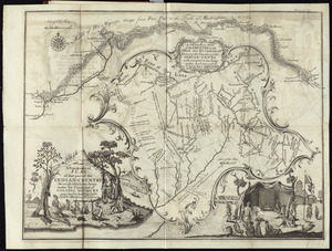
A map of the country on the Ohio and Muskingum Rivers : shewing the situation of the Indian towns with respect to the army...
14.
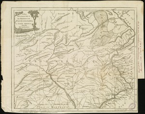
A new and accurate map of the province of Pennsylvania in North America, from the best authorities
15.
New Engelland, New York, New Yersey und Pensilvania
16.
A new map of Virginia, Mary-land and the improved parts of Penn-sylvania & New Jersey
17.
Pensylvania Nova Jersey et Nova York cum Regionibus ad Fluvium Delaware in America sitis
18.
The State of Pennsylvania
19.
To the Honourable Thomas Penn and Richard Penn, Esqrs., true & absolute proprietaries & Governours of the Province of...
20.
A plan of the city and environs of Philadelphia
21.
A map of Philadelphia and parts adjacent
22.
Philadelphia and neighborhood
23.
Philadelphia and vicinity. Military
24.
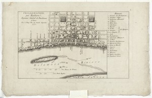
Philadelphie, par Easburn, arpenteur general de Pensilvanie
25.
A plan of the city and environs of Philadelphia
26.
Plan of the city of Philadelphia
27.
A plan of the city of Philadelphia
28.
Plan of the city of Philadelphia and its environs shewing its defences during the years 1777 & 1778 : together with the siege...
29.
A plan of the city of Philadelphia, the capital of Pennsylvania, from an actual survey
30.
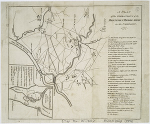
A plan of the operations of the British & Rebel army in the Campaign, 1777
31.
To the citizens of Philadelphia this plan of the city and its environs : is respectfully dedicated by the editors
32.
[A map of part of Pennsylvania & Maryland intended to shew, at one view, the several places proposed for opening a...
33.
Carte des environs du Fort Pitt et de la nouvelle province Indiana : dediée a M. Franklin
34.
An exact map of New Jersey, Pensylvania [sic], New York, Maryland & Virginia, from the latest surveys
35.
A map of the country between Will's Creek & Monongahela River shewing the rout and encampments of the English army in 1755
36.
A New and accurate map of Virginia : and part of Maryland and Pennsylvania
37.
La Pensilvania, la Nuova York, il Jersey Settentrio[na]le : con la parte occidentale del Connecticut, Massachusset-s-bay e...
38.
PLAN OF THE PENINSULA OF CHESOPEAK BAY
39.
Seat of war in the environs of Philadeliphia
40.
Seat of war in the environs of Philadeliphia
41.
A topographical plan of that part of the Indian-country through which Colonel Bouquet marched in the year, 1764
42.
The 100th anniversary map of Abraham Lincoln's visit to Massachusetts, September 11-23, 1848
43.
1630 shoreline
44.
1879. Progress map of the U.S. Geographical Surveys west of the 100th Meridian : prepared under the direction of 1st Lieut....
45.
1903 Map of Salem and surrounding places
46.
19th annual convention of the National Association of Real Estate Boards : at Tulsa, June 7 to June 11 in 1926
47.
2005 significant U.S. hurricane strikes
48.
The 2100 project : an atlas for the Green New Deal
49.
227 Harzgerode
50.
305 Glatz
51.
38,000,000 escaped -- 10,000,000 died
52.
4 Kinten
53.
660 Wakulah St., Roxbury
54.
[A chart of Boston Bay and vicinity]
55.
[A chart of New York Island & North River : East River, passage through Hell Gate, Flushing Bay, Hampstead Bay, Oyster,...
56.
The A.A.A. key road map of continental Europe
57.
Aaron Bohrod's America, its history
58.
ABC pathfinder railway guide map : eastern division
59.
Abolition of Slavery, 1863
60.
Aboriginal map of North America, denoting the boundaries and the locations of various Indian tribes
61.
Acapulco, México
62.
Accurata delineatio Castrorum Suecicorum, ut et Haffniae, Regni Daniae Metropolis
63.
Accurata delineatio oppugnatae a faederatis, Caesareis, Polonicis, Danicis, et Brandeburgicis copijs sub-ductu Seren: Electoris...
64.
Accurata delineatio regionis circa Nieburgum Fioniæ cum prælio ibi commisso inter Danorum et fæderatorum exercitum ab una et...
65.
Accurata Scaniae, Blekingiae et Hallandiae descriptio
66.
An accurate map of Cuba, and the adjacent islands
67.
An accurate map of Dorset Shire divided into hundreds
68.
An accurate map of Dorset Shire, divided into its hundreds
69.
An accurate map of England and Wales with the principal roads from the best authorities
70.
An accurate map of England and Wales with the principal roads from the best authorities
71.
An accurate map of Europe from the best authorities
72.
An accurate map of Hindostan or India, from the best authorities
73.
An accurate map of His Majesty's province of New-Hampshire in New England : taken from actual surveys of all the inhabited...
74.
An Accurate map of New Hampshire in New England, from a late survey
75.
An Accurate map of New York in North America, from a late survey
76.
An accurate map of North America : describing and distinguishing the British and Spanish dominions on this great continent :...
77.
An accurate map of North America : describing and distinguishing the British and Spanish dominions of this great continent;...
78.
An accurate map of North America : describing and distinguishing the British, Spanish and French dominions on this great...
79.
An accurate map of North and South Carolina with their Indian frontiers, shewing in a distinct manner all the mountains,...
80.
An accurate map of Rhode Island, part of Connecticut and Massachusets, shewing Admiral Arbuthnot's station in blocking up...
81.
An accurate map of the coast of Cape de Verde
82.
An accurate map of the Commonwealth of Massachusetts exclusive of the district of Maine : compiled pursuant to an Act of the...
83.
An accurate map of the country round Boston in New England from the best authorities
84.
An accurate map of the county of Essex, divided into its hundreds
85.
An accurate map of the district of Maine being part of the Commonwealth of Massachusetts : compiled pursuant to an act of the...
86.
An accurate map of the United States of America, with part of the surrounding provinces agreeable to the Treaty of Peace of 1783
87.
Accuratissima Brasiliae tabula
88.
Accuratissima Circuli Saxoniae tabula quae est pars septentrionalis Germaniae
89.
Accuratissima Dominii Veneti in Italia, Ducatus Parmae, Placentiae, Modenae Regii Et Mantuae, Episcopatus Tridentini Tabula...
90.
Accuratissima et maxima totius Turcici Imperii tabula cum omnibus suis regionibus novissima delineatio
91.
Accuratissima principatus Cataloniae, et comitatuum Ruscinonis, et Cerretaniae descriptio
92.
An actual survey of the sea coast from New York to the I. Cape Briton : with tables of the direct and thwart courses &...
93.
Adams, Mass : 1882
94.
Adriatic
95.
The adventures of Mark Twain
96.
Aegyptus Antiqua
97.
Aerial photograph of South Boston
98.
Aerial photograph of South Boston
99.
An aerial view of New York City showing how easily the weary traveler may reach the Herald Square Hotel wherein he will find...
100.
Aero view of Canton, Mass. 1918
‹ Prev
Next ›
1
2
3
4
5
…
81
82

![[Environs of Philadelphia]](https://bpldcassets.blob.core.windows.net/derivatives/images/commonwealth:7h149x76d/image_thumbnail_300.jpg)


![This plan of the city of Philadelphia and it's [sic] environs, (shewing the improved parts,) is dedicated to the mayor, aldermen and citizens thereof](https://bpldcassets.blob.core.windows.net/derivatives/images/commonwealth:4m90fd11j/image_thumbnail_300.jpg)


![[A map of part of Pennsylvania & Maryland intended to shew, at one view, the several places proposed for opening a communication between the waters of the Delaware & Chesopeak Bays]](https://bpldcassets.blob.core.windows.net/derivatives/images/commonwealth:z603vt12v/image_thumbnail_300.jpg)

![An exact map of New Jersey, Pensylvania [sic], New York, Maryland & Virginia, from the latest surveys](https://bpldcassets.blob.core.windows.net/derivatives/images/commonwealth:z603vp67m/image_thumbnail_300.jpg)


![La Pensilvania, la Nuova York, il Jersey Settentrio[na]le](https://bpldcassets.blob.core.windows.net/derivatives/images/commonwealth:z603vq53g/image_thumbnail_300.jpg)


![[A chart of Boston Bay and vicinity]](https://bpldcassets.blob.core.windows.net/derivatives/images/commonwealth:cj82m2976/image_thumbnail_300.jpg)


