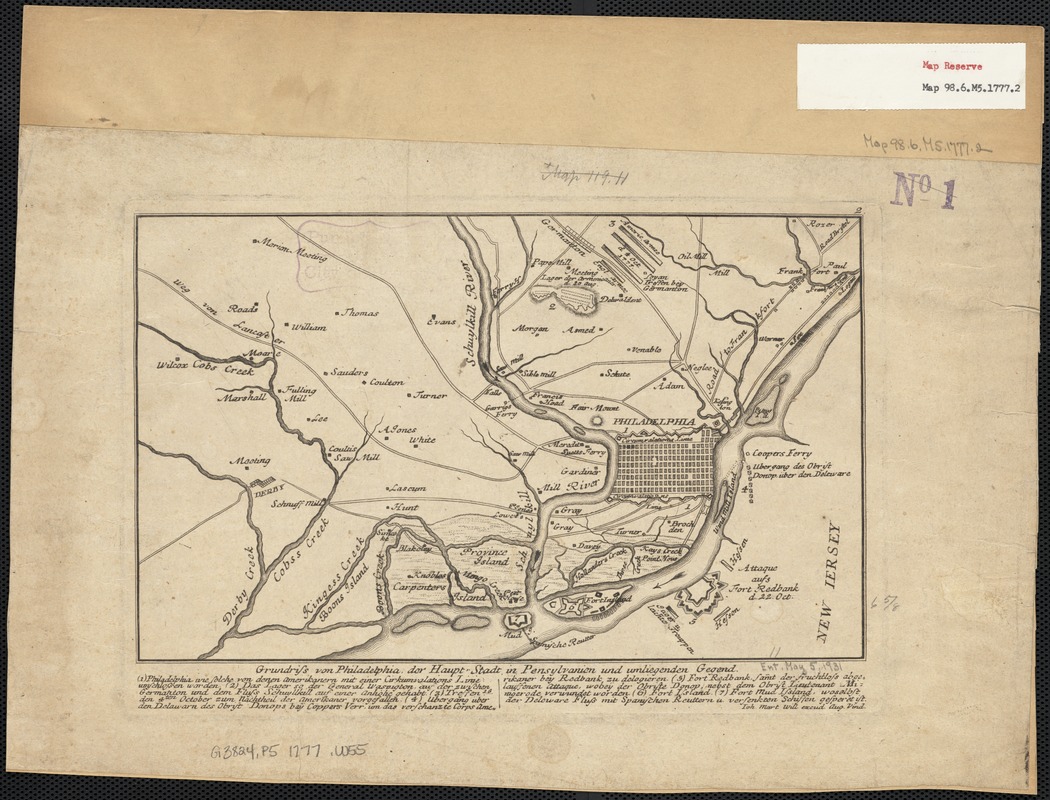
Grundriss von Philadelphia der hauptstadt in Pensylvanien und umliegenden Gegend
This map is also available in American Revolutionary Geographies Online (ARGO), a collections portal especially built for material relating to the American Revolutionary War Era. Visit ARGO to learn more about this item and explore the historical geography of North America in the late eighteenth century.
Item Information
- Title:
- Grundriss von Philadelphia der hauptstadt in Pensylvanien und umliegenden Gegend
- Creator:
- Will, Johann Martin, 1727-1806
- Name on Item:
-
Ioh. Mart. Will. excud.
- Date:
-
[1777]
- Format:
-
Maps/Atlases
- Location:
-
Boston Public Library
Norman B. Leventhal Map & Education Center - Collection (local):
-
Norman B. Leventhal Map & Education Center Collection
- Subjects:
-
Philadelphia (Pa.)--Maps--Early works to 1800
Pennsylvania--Maps
- Places:
-
PennsylvaniaPhiladelphia (county)Philadelphia
- Extent:
- 1 map ; 17 x 28 cm.
- Terms of Use:
-
No known copyright restrictions.
No known restrictions on use.
- Publisher:
-
Augsburg :
Will
- Scale:
-
Scale not given.
- Language:
-
German
- Notes:
-
Relief shown by hachures.
Includes index.
"2" in upper right corner.
Map of Phialdelphia, the capital of Pennsylvania, and vicinity.
- Notes (date):
-
This date is inferred.
- Identifier:
-
06_01_003755
- Call #:
-
G3824.P5 1777 .W55
- Barcode:
-
39999059001899
![[Environs of Philadelphia]](https://bpldcassets.blob.core.windows.net/derivatives/images/commonwealth:7h149x76d/image_thumbnail_300.jpg)


