Toggle navigation
LMEC Home
Exhibitions
Georeferencing
Tools for Teachers
Collections
My Favorites
Sign Up / Log In
Search
Search the map portal
Map Collection
Map Collection
Map Sets
Search
Search
Search for
Search In
All Fields
Creator
Title
Subject
Place
Search All Digital Collections
Advanced Search
8162 Results
My Search
Start Over
More Like
commonwealth:0r96fk76c
Remove constraint More Like: commonwealth:0r96fk76c
Filter your Search
Place
North and Central America
4,912
United States
3,744
Suffolk (county)
1,026
Boston
999
Europe
963
Canada
427
France
269
Massachusetts
258
more
Place
»
Topic
Boston (Mass.)--Maps
574
United States--Maps
270
Real property--Massachusetts--Boston--Maps
174
Massachusetts--Maps
160
Landowners--Massachusetts--Boston--Maps
132
North America--Maps--Early works to 1800
103
New England--Maps
99
Europe--Maps
78
more
Topic
»
Date
Date range begin
–
Date range end
Current results range from
1482
to
2023
View distribution
Creator
United States. Hydrographic Office
357
O.H. Bailey & Co
148
Des Barres, Joseph F. W. (Joseph Frederick Wallet), 1722-1824
123
United States. Post Office Dept
120
Ptolemy, 2nd cent
100
Walling, Henry Francis, 1825-1888
94
Jefferys, Thomas, -1771
84
Geological Survey (U.S.)
82
more
Creator
»
Format
Maps/Atlases
8,103
Manuscripts
215
Prints
51
Books
36
Objects/Artifacts
10
Drawings/Illustrations
8
Posters
4
Georeferenced
Yes
869
No
7,293
Collection
Norman B. Leventhal Map Center Collection
8,162
Boston and New England Maps
2,184
Urban Maps
1,925
Maritime Charts and Atlases
749
American Revolutionary War-Era Maps
616
Boston Redevelopment Authority Collection
86
Available to use
No known restrictions
8,021
Creative Commons license
46
Search Constraints
Sort by relevance
relevance
title
date (asc)
date (desc)
Number of results to display per page
100 per page
10
per page
20
per page
50
per page
100
per page
View results as:
grid view
map view
Search Results
1.
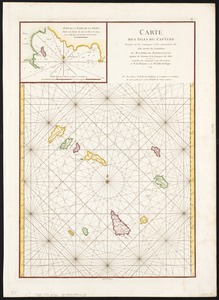
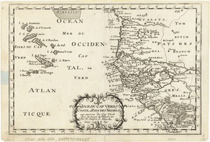
The Cape Verd Islands, laid down from the remarks and observations of experienced navigators
2.
The Cape Verd Islands : laid down from the remarks and observations of experienced navigators
3.
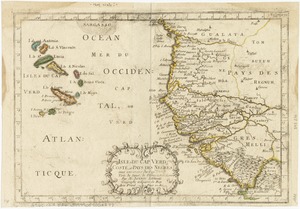
Carte des isles du Cap-Verd : dressée sur les remarques et les observations les plus exactes des navigateurs
4.
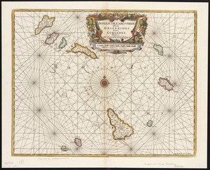
Insulae de Cabo Verde, Olim Hesperides, sive Gorgades : Belgice de zoute eylanden
5.
Archipelagus Atlanticus cum suis insulis Canariis, Hesperidibus et Azoribus
6.
Barbariae et Guineae maritimi à freto Gibraltar ad fluvium Gambiae cum Insulis Salfis Flandrisis et Canaricis
7.
Bocche del Fiume Negro et Isole di Cape Verde : possedute dà Portoghesi, scoperte da Antonio di Nola Genouese nell' anno 1440,...
8.
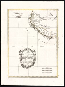
Carte de la Guinée : contenant les Isles du Cap Verd, le Senegal, la Côte de Guinée proprement dite, les Royaumes de Loango,...
9.
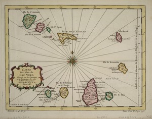
Carte des Isles du Cap Verd
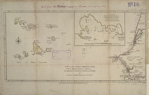
10.
Carte des Isles du Cap Verd = Kaart van de Eilanden van Kabo Verde, geschikt volgens de Daghregisters, en Aanmerkingen, der...
11.
Carte reduite des costes occidentales d'Afrique : seconde feuille depuis le Cap Bojador jusqu'a la Riviere de Sierra Léona
12.
A chart of the coast of Barbaria with the western, Canaria, & Cape de Verd, isles
13.
De cust van Barbaria, Gualata, Arguyn en Geneheo van Capo S Vincente tot Capo Verde
14.
Grundriss der stadt und der forts von St. Jago od. Jacob
15.
Grundriss von der bay der insel St. Vincent einer von den Eylanden des grünen Vorgebirges
16.
Insulae Capitis Viridis
17.
Insulae Capo Viridis
18.
Insulae Promontorii Viridis, Hispanis, Issas Cabo Verde, Belgis, De Soute Eylanden
19.
Isles de Cap Verd coste, et pays des Negres
20.
Isles de Cap Verd coste, et pays des Negres
21.
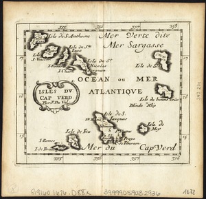
Isles du Cap Verd
22.
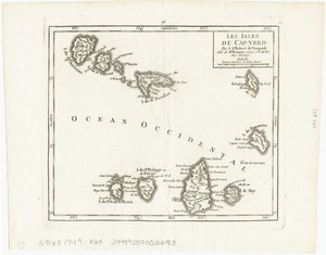
Les Isles du Cap-Verd
23.
Isles du Cap-Verd
24.
Isles Du Cap-Verd = Die Inseln von Capo Verde
25.
Le Isole di Capo Verde : delineate sulle ultime osservvazioni
26.
Karte von den Eylanden des Grünen Vorgebürges, nach den Tagebüchern und Anmerkungen der geschicktesten Seefahrer
27.
A map of the Cape de Verd Islands with the adjacent coast of Africa, the settlements of Senegal, Gambia and Goree, also a plan...
28.
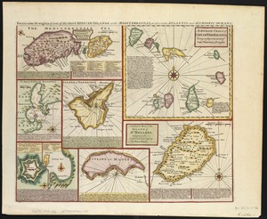
Particular draughts of some of the chief African Islands in the Mediterranean : as also in the Atlantic and Ethiopic Oceans
29.
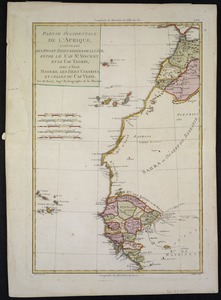
Partie occidentale de L'Afrique, contenant les pays et etats voisins de la côte, entre le Cap St. Vincent et le Cap Tagrin :...
30.
Pascaarte vande zee custen van Guinea, en Brasilia : van Cabo de Verde, tot C. de bona Esperanc̨a : van R. de Amazones tot Rio...
31.
Paskaart van de cust van Portugal, Barbaria en Genehoa : beginnende van d'Barlenges tot aan C. Verde met al zyn Diepte en...
32.
The 100th anniversary map of Abraham Lincoln's visit to Massachusetts, September 11-23, 1848
33.
1630 shoreline
34.
1879. Progress map of the U.S. Geographical Surveys west of the 100th Meridian : prepared under the direction of 1st Lieut....
35.
1903 Map of Salem and surrounding places
36.
19th annual convention of the National Association of Real Estate Boards : at Tulsa, June 7 to June 11 in 1926
37.
2005 significant U.S. hurricane strikes
38.
The 2100 project : an atlas for the Green New Deal
39.
227 Harzgerode
40.
305 Glatz
41.
38,000,000 escaped -- 10,000,000 died
42.
4 Kinten
43.
660 Wakulah St., Roxbury
44.
[A chart of Boston Bay and vicinity]
45.
[A chart of New York Island & North River : East River, passage through Hell Gate, Flushing Bay, Hampstead Bay, Oyster,...
46.
The A.A.A. key road map of continental Europe
47.
Aaron Bohrod's America, its history
48.
ABC pathfinder railway guide map : eastern division
49.
Abolition of Slavery, 1863
50.
Aboriginal map of North America, denoting the boundaries and the locations of various Indian tribes
51.
Acapulco, México
52.
Accurata delineatio Castrorum Suecicorum, ut et Haffniae, Regni Daniae Metropolis
53.
Accurata delineatio oppugnatae a faederatis, Caesareis, Polonicis, Danicis, et Brandeburgicis copijs sub-ductu Seren: Electoris...
54.
Accurata delineatio regionis circa Nieburgum Fioniæ cum prælio ibi commisso inter Danorum et fæderatorum exercitum ab una et...
55.
Accurata Scaniae, Blekingiae et Hallandiae descriptio
56.
An accurate map of Cuba, and the adjacent islands
57.
An accurate map of Dorset Shire divided into hundreds
58.
An accurate map of Dorset Shire, divided into its hundreds
59.
An accurate map of England and Wales with the principal roads from the best authorities
60.
An accurate map of England and Wales with the principal roads from the best authorities
61.
An accurate map of Europe from the best authorities
62.
An accurate map of Hindostan or India, from the best authorities
63.
An accurate map of His Majesty's province of New-Hampshire in New England : taken from actual surveys of all the inhabited...
64.
An Accurate map of New Hampshire in New England, from a late survey
65.
An Accurate map of New York in North America, from a late survey
66.
An accurate map of North America : describing and distinguishing the British and Spanish dominions on this great continent :...
67.
An accurate map of North America : describing and distinguishing the British and Spanish dominions of this great continent;...
68.
An accurate map of North America : describing and distinguishing the British, Spanish and French dominions on this great...
69.
An accurate map of North and South Carolina with their Indian frontiers, shewing in a distinct manner all the mountains,...
70.
An accurate map of Rhode Island, part of Connecticut and Massachusets, shewing Admiral Arbuthnot's station in blocking up...
71.
An accurate map of the coast of Cape de Verde
72.
An accurate map of the Commonwealth of Massachusetts exclusive of the district of Maine : compiled pursuant to an Act of the...
73.
An accurate map of the country round Boston in New England from the best authorities
74.
An accurate map of the county of Essex, divided into its hundreds
75.
An accurate map of the district of Maine being part of the Commonwealth of Massachusetts : compiled pursuant to an act of the...
76.
An accurate map of the United States of America, with part of the surrounding provinces agreeable to the Treaty of Peace of 1783
77.
Accuratissima Brasiliae tabula
78.
Accuratissima Circuli Saxoniae tabula quae est pars septentrionalis Germaniae
79.
Accuratissima Dominii Veneti in Italia, Ducatus Parmae, Placentiae, Modenae Regii Et Mantuae, Episcopatus Tridentini Tabula...
80.
Accuratissima et maxima totius Turcici Imperii tabula cum omnibus suis regionibus novissima delineatio
81.
Accuratissima principatus Cataloniae, et comitatuum Ruscinonis, et Cerretaniae descriptio
82.
An actual survey of the sea coast from New York to the I. Cape Briton : with tables of the direct and thwart courses &...
83.
Adams, Mass : 1882
84.
Adriatic
85.
The adventures of Mark Twain
86.
Aegyptus Antiqua
87.
Aerial photograph of South Boston
88.
Aerial photograph of South Boston
89.
An aerial view of New York City showing how easily the weary traveler may reach the Herald Square Hotel wherein he will find...
90.
Aero view of Canton, Mass. 1918
91.
Aero view of Lynn, Mass, 1916 : looking north
92.
Aeronautical view of the Panama Canal
93.
Aethiopia inferior, vel exterior : partes magis septentrionales, quae hic desiderantur, vide in tabula Ethiopiae superioris
94.
Aethiopia superior vel interior : vulgo Abissinorum, sive Presbiteri Ioannis imperium
95.
Ævi veteris usque ad annum salutis nonagesimum supra milles quadringentos cogniti tantum, typus geographica
96.
Affrice Tabule Quatuor : Prima Libie tabula continet ambas Mauritanias
97.
Africa
98.
Africa : corrected from the observations of the Royal Society of London and Paris
99.
Africa
100.
Africa
‹ Prev
Next ›
1
2
3
4
5
…
81
82


![[A chart of Boston Bay and vicinity]](https://bpldcassets.blob.core.windows.net/derivatives/images/commonwealth:cj82m2976/image_thumbnail_300.jpg)


