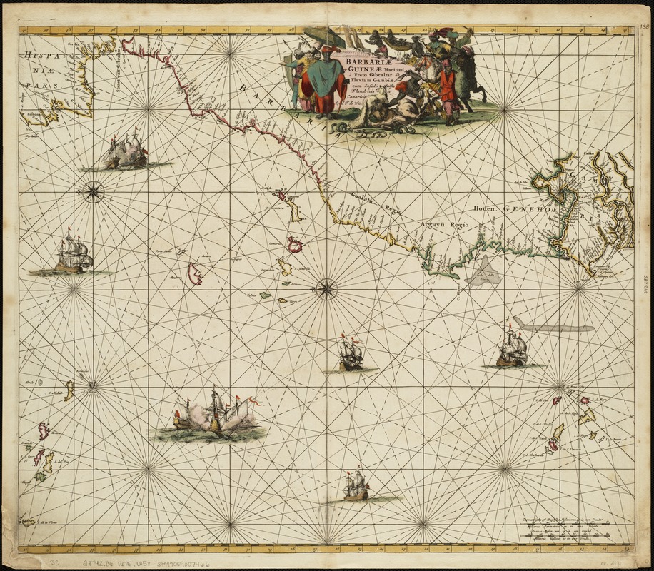
Barbariae et Guineae maritimi à freto Gibraltar ad fluvium Gambiae cum Insulis Salfis Flandrisis et Canaricis
Item Information
- Title:
- Barbariae et Guineae maritimi à freto Gibraltar ad fluvium Gambiae cum Insulis Salfis Flandrisis et Canaricis
- Creator:
- Wit, Frederik de.
- Name on Item:
-
apud F. de Wit.
- Date:
-
[1675]
- Format:
-
Maps/Atlases
- Location:
-
Boston Public Library
Norman B. Leventhal Map & Education Center - Collection (local):
-
Norman B. Leventhal Map & Education Center Collection
- Subjects:
-
Nautical charts--Early works to 1800
Africa, French-speaking West--Maps--Early works to 1800
Cape Verde--Maps--Early works to 1800
Canary Islands--Maps--Early works to 1800
- Places:
-
Cape Verde
SpainCanary Islands (island)
- Extent:
- 1 map : col. ; 48 x 57 cm.
- Terms of Use:
-
No known copyright restrictions.
No known restrictions on use.
- Publisher:
-
Amsterdam :
Frederick de Wit
- Scale:
-
Scale 1:5,5000,000.
- Language:
-
Latin
- Notes:
-
Oriented with north to the left.
From: Orbis maritimus ofte Zee-Atlas by de Wit, Amsterdam, [1675].
- Notes (date):
-
This date is inferred.
- Identifier:
-
06_01_004761
- Call #:
-
G8742.C6 1675 .W5x
- Barcode:
-
39999059007466


