Carte des Isles du Cap Verd
Item Information
- Title:
- Carte des Isles du Cap Verd
- Description:
-
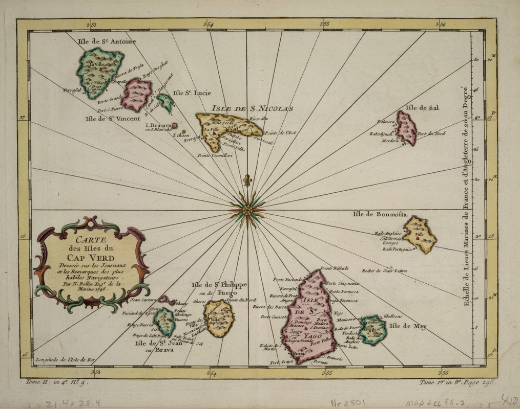
Although drawn and engraved in 1746 by Bellin, one of the most prolific mid-18th-century French cartographers, this map of the Cape Verde islands was published in the 1780 edition of Jean-Francois de la Harpe's "Abrege de l 'histoire generale des voyages". The map depicts the Cape Verde Islands, a small group of volcanic islands located in the tropical waters of the Atlantic, about 15º north of the Equator and 385 miles west of the African country of Senegal. These islands were discovered and settled by the Portuguese in the 1450s and 1460s. During the subsequent centuries, the French and British tried to gain control, but the islands remained under Portuguese domination until 1975 when they gained independence.
- Creator:
- Bellin, Jacques Nicolas, 1703-1772
- Name on Item:
-
dressée sur les journaux et les remaques des plus habiles navigateurs par N. Bellin ingr. de la Marine 1746.
- Date:
-
1746
- Format:
-
Maps/Atlases
- Location:
-
Boston Public Library
Norman B. Leventhal Map & Education Center - Collection (local):
-
Norman B. Leventhal Map & Education Center Collection
- Subjects:
-
Cape Verde--Maps--Early works to 1800
- Places:
-
Cape Verde
- Extent:
- 1 map : col. ; 29 x 22 cm.
- Terms of Use:
-
No known copyright restrictions.
No known restrictions on use.
- Publisher:
-
Paris :
[s.n.]
- Scale:
-
Scale not given.
- Language:
-
French
- Notes:
-
Relief shown pictorially.
"Tome 1er in 8?. Page 296."
"Tome II in 4?.n?.g."
Exhibited in “Faces and Places,” at the Boston Public Library, Boston, MA, October 2003 - September 2004. MB (BRL)
- Identifier:
-
05_04_000148
- Call #:
-
G9160 1746 .B4
- Barcode:
-
39999052509757


