Search Constraints
Search Results


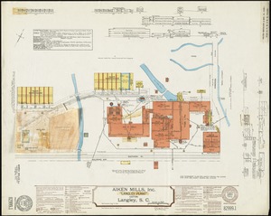
![Acushnet Mill Corp. (Cotton Mill), New Bedford, Mass. [insurance map]](https://bpldcassets.blob.core.windows.net/derivatives/images/commonwealth:ww72bz30x/image_thumbnail_300.jpg)

136. Adams, Mass : 1882

137. Adams Nervine Asylum


139. Adriatic


141. Aegyptus Antiqua


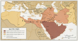
155. Africa


157. Africa

158. Africa

159. Africa

160. Africa

161. Africa

162. Africa

163. Africa


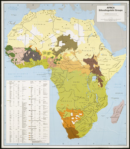


171. Africa vegetation


175. Africae nova tabula

176. Africae tabula nova


182. Afrika

183. Afrika

184. Afrika


186. L'Afrique

187. Afrique


189. Afrique

190. Afrique 1899