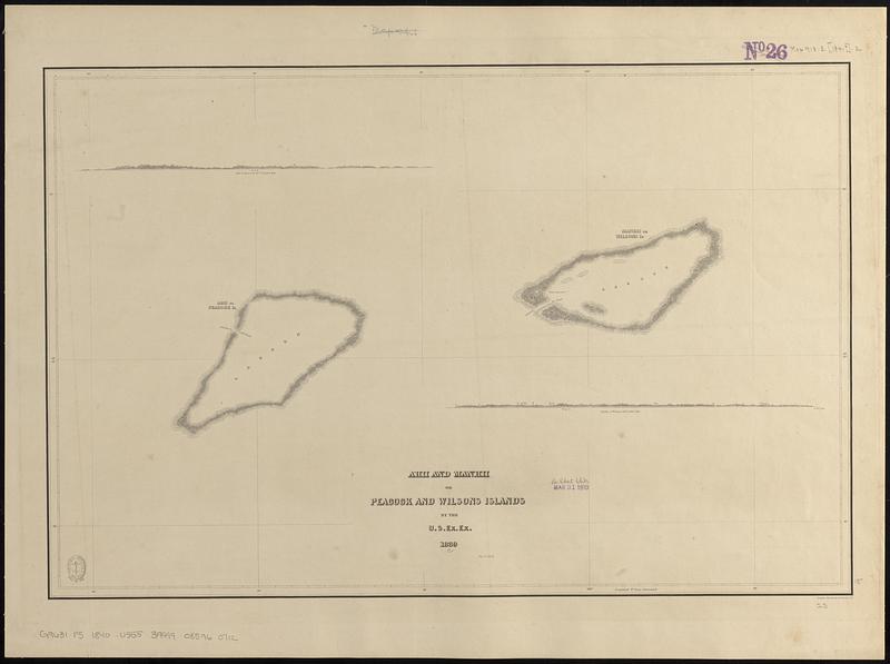
Ahii and Manhii or Peacock and Wilsons Islands
Item Information
- Title:
- Ahii and Manhii or Peacock and Wilsons Islands
- Surveyor:
- Wilkes, Charles, 1798-1877
- Cartographer:
- United States Exploring Expedition (1838-1842)
- Name on Item:
-
by the U.S. Ex. Ex. 1839 ; eng. by Sherman & Smith
- Date:
-
[1840–1849]
- Format:
-
Maps/Atlases
- Genre:
-
Nautical charts
- Location:
-
Boston Public Library
Norman B. Leventhal Map & Education Center - Collection (local):
-
Norman B. Leventhal Map & Education Center Collection
- Subjects:
-
Tuamotu Archipelago (French Polynesia)--Maps
Ahé (French Polynesia)--Maps
Manihi (French Polynesia)--Maps
Nautical charts--French Polynesia--Ahé
Nautical charts--French Polynesia--Manihi
United States Exploring Expedition (1838-1842)
- Places:
-
French Polynesia (territory)Îles Tuamotu-Gambier (area)
Ahé Atoll
Manihi Atoll
- Extent:
- 1 map ; 38 x 59 cm
- Terms of Use:
-
No known copyright restrictions.
No known restrictions on use.
- Scale:
-
Scale approximately 1:149,000
- Language:
-
English
- Notes:
-
Published in Narrative of the United States Exploring Expedition : during the years 1838, 1839, 1840, 1841, 1842.
Depths shown pictorially.
Includes 2 coastal views: Ahii or Peacock isld. 3 1/2 miles dist. -- Manhii or Wilsons isld. 3 miles dist.
- Notes (date):
-
This date is inferred.
- Identifier:
-
06_01_017628
- Call #:
-
G9631.P5 1840 .U555
- Barcode:
-
39999085960712


