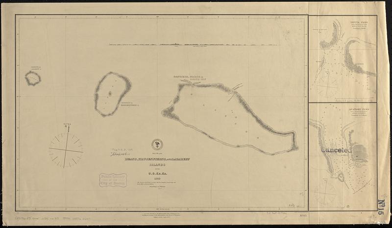
Deans, Krusensterns, and Lazareff Islands
Item Information
- Title:
- Deans, Krusensterns, and Lazareff Islands
- Issuing body:
- United States. Hydrographic Office
- Engraver:
- Sherman & Smith
- Cartographer:
- United States Exploring Expedition (1838-1842)
- Name on Item:
-
by the U.S. Ex. Ex. 1839 ; eng. by Sherman & Smith
- Date:
-
1887
- Format:
-
Maps/Atlases
- Genre:
-
Nautical charts
- Location:
-
Boston Public Library
Norman B. Leventhal Map & Education Center - Collection (local):
-
Norman B. Leventhal Map & Education Center Collection
- Subjects:
-
Tuamotu Archipelago (French Polynesia)--Maps
Mataiva (French Polynesia)--Maps
Tikehau (French Polynesia)--Maps
Rangiroa (French Polynesia)--Maps
Nautical charts--French Polynesia--Mataiva
Nautical charts--French Polynesia--Tikehau
Nautical charts--French Polynesia--Rangiroa
United States Exploring Expedition (1838-1842)
- Places:
-
French Polynesia (territory)Tuamotu Islands (area)Mataiva (atoll)
Tikehau
Rangiroa
- Extent:
- 1 map ; 39 x 58 cm on sheet 46 x 79 cm
- Terms of Use:
-
No known copyright restrictions.
No known restrictions on use.
- Publisher:
-
Washington, D.C. :
Hydrographic Office
- Edition:
- Edition of December 1887
- Scale:
-
Scale approximately 1:290,000
- Language:
-
English
- Notes:
-
Depths shown by soundings and pictorially.
Sheet with 2 ancillary maps joined to right side.
"Corrected July 1872 at the Hydrographic Office, Washington D.C."
Includes coastal view: Deans or Fly I. 5 miles distant.
Ancillary maps: Tiputa Pass from a French survey in 1877 -- Avatoru Pass from a French survey in 1877.
"Canceled" stamped on map of Avatoru Pass.
- Identifier:
-
06_01_017621
- Call #:
-
G9096.P5 svar .U55 no. 85
- Barcode:
-
39999085960647


