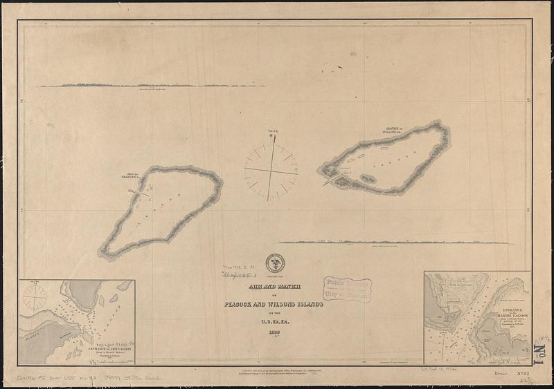
Ahii and Manhii or Peacock and Wilsons Islands
Item Information
- Title:
- Ahii and Manhii or Peacock and Wilsons Islands
- Issuing body:
- United States. Hydrographic Office
- Surveyor:
- United States Exploring Expedition (1838-1842)
- Name on Item:
-
by the U.S. Ex. Ex. 1839
- Date:
-
[1881]
- Format:
-
Maps/Atlases
- Genre:
-
Nautical charts
- Location:
-
Boston Public Library
Norman B. Leventhal Map & Education Center - Collection (local):
-
Norman B. Leventhal Map & Education Center Collection
- Subjects:
-
Ahé (French Polynesia)--Maps
Manihi (French Polynesia)--Maps
Nautical charts--French Polynesia--Ahé
Nautical charts--French Polynesia--Manihi
- Places:
-
French Polynesia (territory)
Ahé Atoll
Manihi Atoll
- Extent:
- 1 map ; 39 x 58 cm
- Terms of Use:
-
No known copyright restrictions.
No known restrictions on use.
- Publisher:
-
Washington, D.C. :
Hydrographic Office
- Scale:
-
Scale approximately 1:147,000
- Language:
-
English
- Notes:
-
Depth shown by soundings and pictorially.
Insets: Entrance to Ahii Lagoon from a French survey -- Entrance to Manhii Lagoon from a French survey.
Includes 2 coastal views: Ahii or Peacock isld. 3 1/2 miles dist. -- Manhii or Wilsons isld. 3 miles dist.
"Corrected July 1872 at the Hydrographic Office, Washington D.C. Additions 1881."
- Notes (date):
-
This date is inferred.
- Identifier:
-
06_01_017623
- Call #:
-
G9096.P5 svar .U55 no. 82
- Barcode:
-
39999085960662


