Africa
Item Information
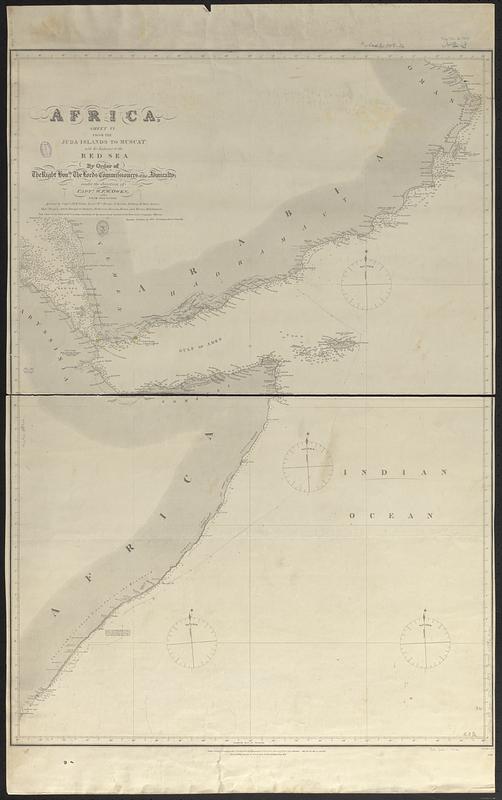
- Title:
- Africa
- Title (alt.):
-
Africa, sheet VI, from the Juba Islands to Muscat with the entrance to the Red Sea
- Issuing body:
- Great Britain. Hydrographic Office
- Surveyor:
- Owen, W. F. W., 1774-1857
- Surveyor:
- Vidal, A. T. E. (Alexander Thomas Emeric), 1792-1863
- Surveyor:
- Mudge, William, 1762-1820
- Engraver:
- J. & C. Walker (Firm)
- Name on Item:
-
by order of the Right Honble. the Lords Commissioners of the Admiralty ; under the direction of Captn. W.F.W. Owen, from 1822 to 1826 ; assisted by Captn. A.T.E. Vidal, Lieuts. Wm. Mudge [and 3 others] ; Messrs. Rogier [and 7 others], midshipmen ; J. & C. Walker sculpt.
- Date:
-
[1866]
- Format:
-
Maps/Atlases
- Genre:
-
Nautical charts
- Location:
-
Boston Public Library
Norman B. Leventhal Map & Education Center - Collection (local):
-
Norman B. Leventhal Map & Education Center Collection
- Subjects:
-
Aden, Gulf of--Maps
Red Sea--Maps
Mandab, Strait of--Maps
Indian Coast (Africa)--Maps
Nautical charts--Aden, Gulf of
Nautical charts--Red Sea
Nautical charts--Mandab, Strait of
Coasts--Africa, Eastern--Maps
- Places:
-
Aden, Gulf of
Red Sea
Mandeb, Bab el
- Extent:
- 1 map ; 87 x 60 cm
- Terms of Use:
-
No known copyright restrictions.
No known restrictions on use.
- Publisher:
-
London :
Hydrographical Office of the Admiralty
- Scale:
-
Scale approximately 1:3,700,000
- Language:
-
English
- Notes:
-
Relief shown by hachures and spot heights. Depths shown by soundings.
"Published according to Act of Parliament at the Hydrographical Office of the Admiralty 6th Octr. 1827. Corrections to 1859_61.64. May 65. Jany 66."
"598"--Lower right margin.
Manuscript annotation in pencil tracing a track along the African coast.
- Notes (date):
-
This date is inferred.
- Identifier:
-
06_01_017698
- Call #:
-
G9096.P5 svar .G74 no. 598
- Barcode:
-
39999085962106


