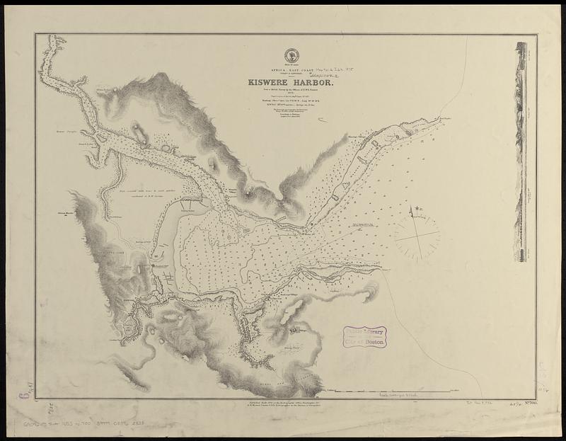
Africa--east coast, coast of Zanzibar, Kiswere Harbor : from a British survey by the officers of H.M.S. Nassau, 1874 : republication of British Admty. chart no. 687
Item Information
- Title:
- Africa--east coast, coast of Zanzibar, Kiswere Harbor : from a British survey by the officers of H.M.S. Nassau, 1874 : republication of British Admty. chart no. 687
- Issuing body:
- United States. Hydrographic Office
- Date:
-
1875
- Format:
-
Maps/Atlases
- Genre:
-
Nautical charts
- Location:
-
Boston Public Library
Norman B. Leventhal Map & Education Center - Collection (local):
-
Norman B. Leventhal Map & Education Center Collection
- Subjects:
-
Kiswere (Tanzania)--Maps
Harbors--Tanzania--Kiswere
Nautical charts--Tanzania--Kiswere
- Places:
-
TanzaniaLindi Region (region)Kiswere
- Extent:
- 1 map ; 47 x 65 cm
- Terms of Use:
-
No known copyright restrictions.
No known restrictions on use.
- Publisher:
-
Washington, D.C. :
Hydrographic Office
- Scale:
-
Scale approximately 1:24,800
- Language:
-
English
- Table of Contents:
-
Yura Harbor
Wadasima Harbor
Osaki Bay
Hachken R.
Yura no Uchi
Bay of Tanabè
- Notes:
-
Relief shown by hachures and spot heights. Depths shown by soundings and isolines.
Includes coastal view.
- Identifier:
-
06_01_017720
- Call #:
-
G9096.P5 svar .U55 no. 700
- Barcode:
-
39999085962338


