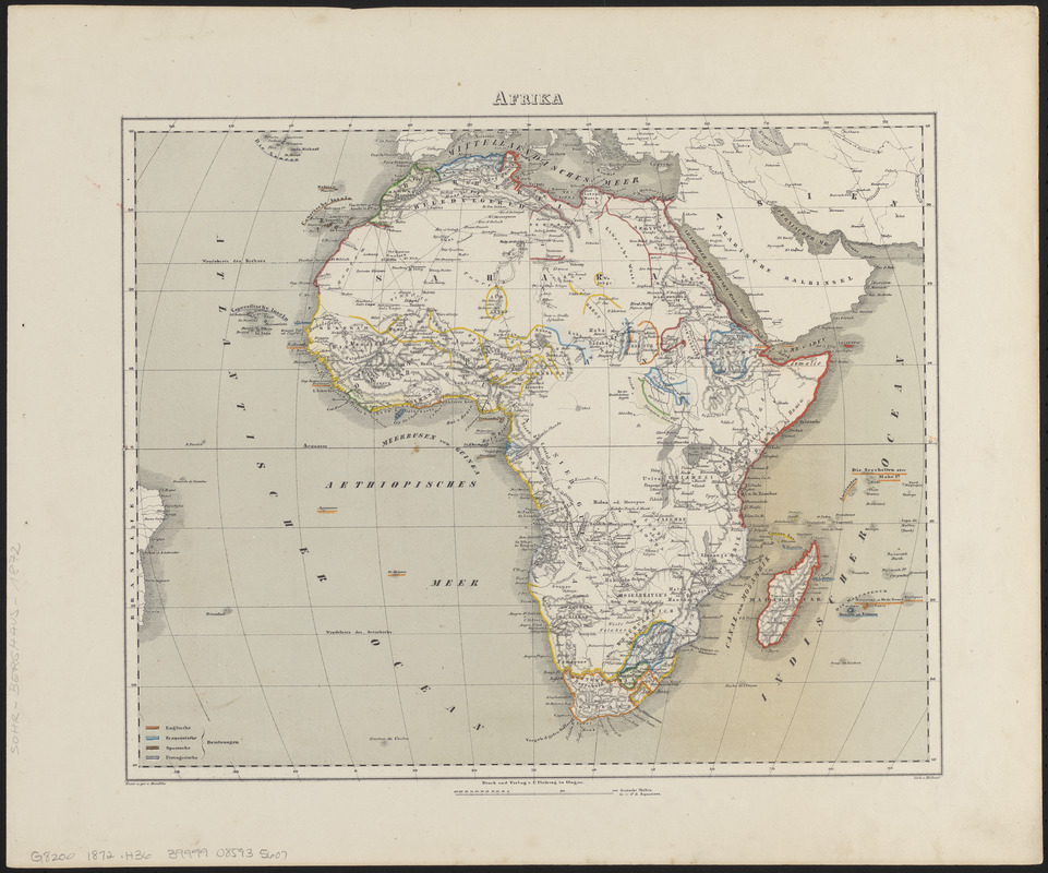
Afrika
Item Information
- Title:
- Afrika
- Cartographer:
- Handtke, F. (Friedrich), 1815-1879
- Engraver:
- Hübner, F. (Engraver)
- Publisher:
- Carl Flemming (Firm)
- Name on Item:
-
entw. u. gez. v. Handtke ; Hübner lith.
- Date:
-
[1872]
- Format:
-
Maps/Atlases
- Location:
-
Boston Public Library
Norman B. Leventhal Map & Education Center - Collection (local):
-
Norman B. Leventhal Map & Education Center Collection
- Subjects:
-
Africa--Maps
- Places:
-
Africa
Africa
- Extent:
- 1 map : hand colored ; 29 x 36 cm
- Terms of Use:
-
No known copyright restrictions.
No known restrictions on use.
- Publisher:
-
Glogau :
Druck und verlag v. C. Flem̄ing
- Scale:
-
Scale approximately 1:30,000,000
- Language:
-
German
- Notes:
-
Relief shown by hachures.
Prime meridian: [Canary Islands].
Colored to show possessions.
From Sohr-Berghaus hand-atlas über alle theile der erde. Glogau : Carl Flemming, 1872.
- Notes (date):
-
This date is inferred.
- Identifier:
-
06_01_015352
- Call #:
-
G8200 1872 .H36
- Barcode:
-
39999085935607


