Toggle navigation
LMEC Home
Exhibitions
Georeferencing
Tools for Teachers
Collections
My Favorites
Sign Up / Log In
Search
Search the map portal
Map Collection
Map Collection
Map Sets
Search
Search
Search for
Search In
All Fields
Creator
Title
Subject
Place
Search All Digital Collections
Advanced Search
13385 Results
Filter your Search
Place
North and Central America
9,353
United States
7,078
Suffolk (county)
1,664
Boston
1,621
Europe
1,035
Canada
949
Massachusetts
794
New York
532
more
Place
»
Topic
Boston (Mass.)--Maps
741
City planning--Massachusetts--Boston--Maps
418
United States--History--Revolution, 1775-1783--Maps
329
United States--Maps
315
Urban renewal--Massachusetts--Boston--Maps
254
Real property--Massachusetts--Boston--Maps
252
Massachusetts--Maps
219
Insurance surveys
197
more
Topic
»
Date
Date range begin
–
Date range end
Current results range from
1482
to
2023
View distribution
Creator
United States. Hydrographic Office
595
Boston Redevelopment Authority
403
Des Barres, Joseph F. W. (Joseph Frederick Wallet), 1722-1824
247
Royal United Services Institute for Defence and Security Studies
160
Jefferys, Thomas, -1771
154
George, III, King of Great Britain, 1738-1820
152
George, IV, King of Great Britain, 1762-1830
151
O.H. Bailey & Co
148
more
Creator
»
Format
Maps/Atlases
13,205
Manuscripts
985
Prints
102
Books
49
Drawings/Illustrations
44
Photographs
15
Objects/Artifacts
13
Documents
7
more
Format
»
Georeferenced
Yes
979
No
12,406
Collection
Norman B. Leventhal Map Center Collection
8,891
American Revolutionary War-Era Maps
3,305
Boston and New England Maps
2,804
Urban Maps
2,397
Maritime Charts and Atlases
1,150
William L. Clements Library Collection
910
Library of Congress Collection
618
Boston Redevelopment Authority Collection
475
more
Collection
»
Available to use
No known restrictions
9,952
Creative Commons license
1,677
Search Constraints
Sort by title
relevance
title
date (asc)
date (desc)
Number of results to display per page
100 per page
10
per page
20
per page
50
per page
100
per page
View results as:
grid view
map view
Search Results
9801.
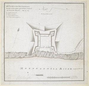
A PLAN of the Fort for 220 men built in December 1758 within 400 Yard's of Fort du Quesne
9802.
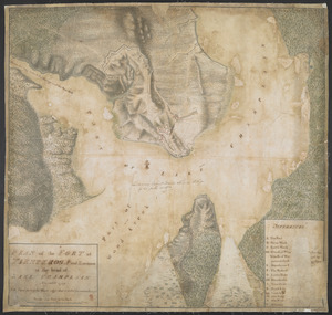
PLAN of the FORT in TIENDEROGA and Environs at the head of LAKE CHAMPLAIN November 1759
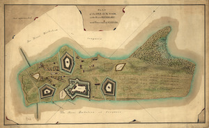
9803.
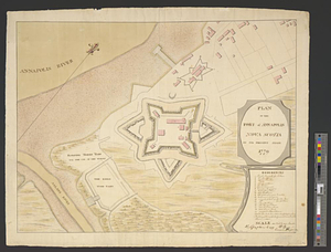
Plan of the fort of Annapolis Nova Scotia in its present state 1779
9804.
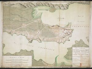
PLAN of the FORTRESS and dependant FORTS at CROWN POINT with their Environs and part of LAKE CHAMPLAIN. 1759
9805.
PLAN of the FORTS at the Onoida or Great Carrying Place in the Province of New York in America built by Major Charles Craven by...
9806.
Plan of the Forts at the Onoida or Great Carrying Place in the Province of New York in North America built by Major Charles...
9807.
A plan of the Forts Montgomery & Clinton : as taken by His Majesty's forces under the command of Genl. Sr. Henry Clinton the...
9808.
A PLAN of the FORTS MONTGOMERY & CLINTON as taken by his Majesty's Forces under the Command of Gen:l Sir Henry clinton the 6.th...
9809.
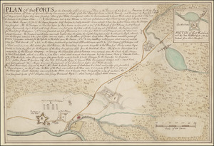
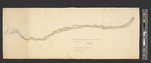
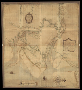
Plan of the French and rebells sieg[e] of Savannah in Georgia, in South [sic] America, deffend : t[h]rough the Br: Gen: August...
9810.
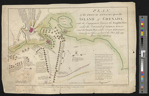
Plan of the French attacks upon the island of Grenada, with the engagement between the English fleet under the command of...
9811.
Plan of the general attack on Fort Mifflin
9812.
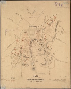
Plan of the Gettysburg battle ground
9813.
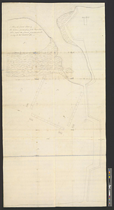
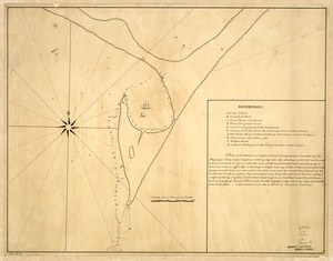
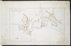
[Plan of the Gore Estate at the corner of Pitts and Green streets]
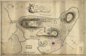
9814.
PLAN of the Great Falls on Hudsons River
9815.
A plan of the ground allotted by his excellence Governor Grant for the troops No: 1 2. 3 with a proposed plan of barracks for...
9816.
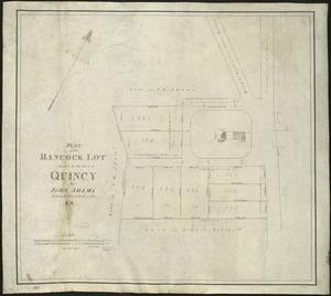
Plan of the Hancock lot given to the town of Quincy by John Adams, formerly President of the U.S
9817.
Plan of the harbor of Halifax in Nova Scotia
9818.
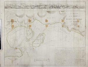
A plan of the harbors of Port Antonio in the island of Jamaica : survey'd 1770
9819.
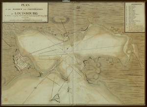
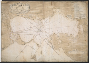
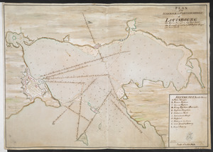
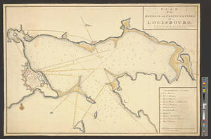
A PLAN OF THE HARBOUR AND FORTIFICATIONS OF LOUISBOURG
9820.
A PLAN OF THE HARBOUR AND FORTIFICATIONS OF LOUISBOURG
9821.
Plan of the HARBOUR and FORTIFICATIONS OF LOUISBOURG
9822.
A PLAN OF THE HARBOUR AND FORTIFICATIONS OF LOUISBOURG : The Harbour Survey'd by Cap.t Phi; Durrell The Fortifications by Cap.t...
9823.
PLAN of the HARBOUR and FORTIFICATIONS of LOUISBOURG : The Harbour Survey'd by Capt Phill Durell the Town & Fortifications by...
9824.
Plan of the harbour and fortifications of Louisbourg : the harbour survey'd by Capt. Phillip Durell: the town and...
9825.
PLAN of the HARBOUR and Part of the RIVER S.T JOHNS in the BAY of FUNDY
9826.
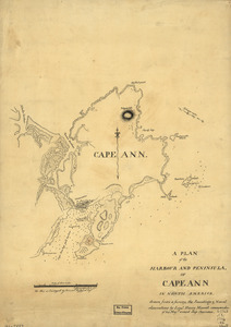
A plan of the harbour and peninsula of Cape Ann in North America
9827.
PLAN of the HARBOUR and Rivers of PORT LE JOYE in the Island of S.t Iohn
9828.
Plan of the harbour of Boston, from surveys made under the direction of commissioners appointed by a resolve of the...
9829.
A plan of the harbour of Cape Lookout surveyed and sounded by His Majesty's sloop Viper
9830.
Plan of the harbour of Charles Town, South Carolina
9831.
Plan of the harbour of Halifax
9832.
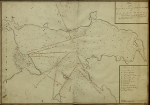
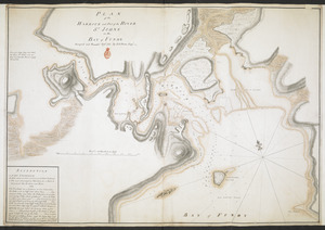
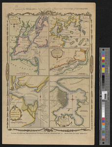
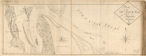
A plan of the harbour of Louisbourg with the adjacent country survey'd by Samuel Holland esqr. surveyer [sic] general for the...
9833.
Plan of the harbour of New-York and parts adjacent
9834.
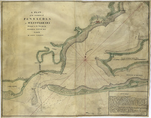
Plan of the harbour of Pensacola in West Florida with the different stations of the Spanish fleet during the siege from the 9...
9835.
A plan of the harbour of Pensacola in West-Florida
9836.
Plan of the harbour of San Fernando de Omoa ; A map of the Isthmus of Panama, drawn from Spanish surveys
9837.
Plan of the Harbour of St John's in the Bay of Fundy= Plan & Section of the Fort as it is Near Finish'd= Plan & Section's of...
9838.
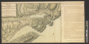
Plan of the harbour town and fort of St. Iohns in Newfoundland with part of the country adjacent, shewing the operations...
9839.
A plan of the harbour's and town's, of Kingston and Port-Royal in the island of Jamaica, and of their environs : carefully laid...
9840.
Plan of the Havana with part of the country adjacent
9841.
Plan of the heights of Charles Town, &c
9842.
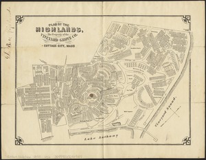
Plan of the Highlands, the property of the Vineyard Grove Co : Cottage City, Mass
9843.
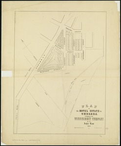
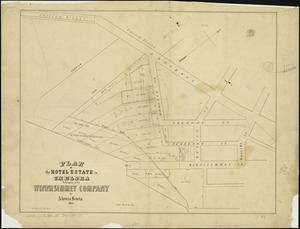
Plan of the Hotel Estate in Chelsea belonging to the Winnisimmet Company
9844.
Plan of the hotel estate in Chelsea belonging to the Winnisimmet Company
9845.
Plan of the Hutchinson Estate on the corner of Hanover & Clark Streets : to be sold by public auction on Monday Feby. 20th 1871...
9846.
A plan of the Ibberville from the Missisippi to Anatamaha
9847.
Plan of the Incampement at Fort Edward
9848.
A plan of the Indian boundary line [torn] : from Atchtickpi to the Buckatanne; and from the line at [torn] Buckatanne to the...
9849.
Plan of the Indian countrys through which the troops marchd in 1764 under the command of Col. Henry Bouquet
9850.
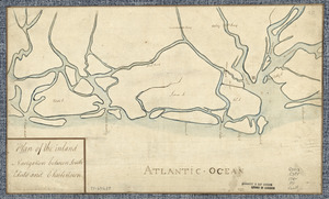
Plan of the inland navigation between South Edisto and Charlestown
9851.
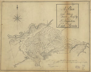
Plan of the inlet, strait, & town of St. Augustine
9852.
A plan of the inlets & rivers of Savannah & Warsaw in the Province of Georgia
9853.
Plan of the Inner Harbor of Boston
9854.
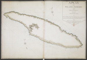
A PLAN of the ISLAND of ANTICOSTI in the Gulph of S.T Lawrence Surveyed under the Directions of Samuel Holland Esq.r His...
9855.
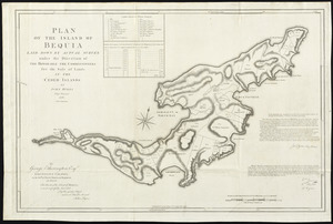
Plan of the island of Bequia laid down by actual survey under the direction of the honorable the Commissioners for the Sale of...
9856.
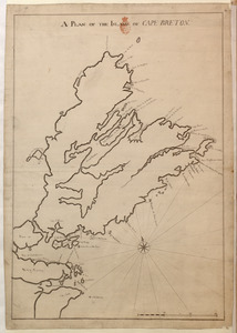
A PLAN OF THE ISLAND OF CAPE BRETON
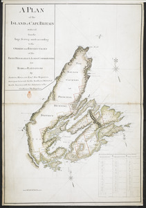
9857.
A PLAN of the ISLAND of CAPE BRITAIN reduced from the large Survey made according to the ORDERS and INSTRUCTIONS of the RIGHT...
9858.
A plan of the island of Cape Britain reduced from the large survey made by the orders and instructions of the right honorable...
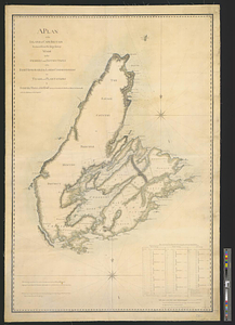
9859.
Plan of the island of Dominica laid down by actual survey under the direction of the honorable the Commissioners for the Sale...
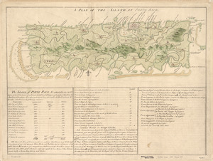
9860.
A Plan of the island of Porto Rico
9861.
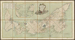
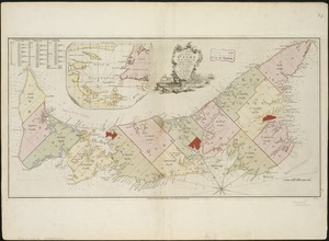
A plan of the island of St. John with the divisions of the counties, parishes, & the lots as granted by government, likewise...
9862.
A plan of the island of St. John with the divisions of the counties, parishes, & the lots as granted by government, likewise...
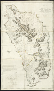
9863.
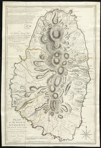
Plan of the island of St. Vincent laid down by actual survey under the direction of the honorable the Commissioners for the...
9864.
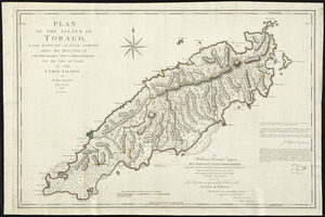
Plan of the island of Tobago laid down by actual survey under the direction of the honorable the Commissioners for the Sale of...
9865.
Plan of the Isle aux Noix, in the River Richelieu, and Province of Canada
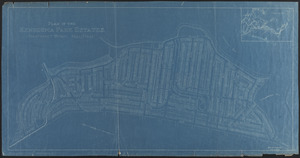
9866.
Plan of the Kenberma Park Estates : Nantasket Beach, Hull, Mass.
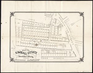
9867.
Plan of the Kimball Estate in Brookline Village : June 2nd 1873
9868.
[Plan of the land at Prince Street and Snowhill Street, Boston]
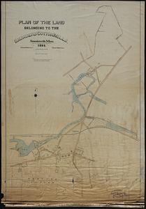
9869.
Plan of the land belonging to the Saunders Cotton Mills, Saundersville, Mass.
9870.
A plan of the land between Fort Mossy and St. Augustine in the province of East Florida
9871.
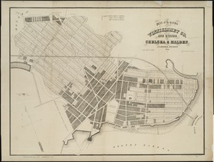
Plan of the lands of the Winnisimmet Co. and others in Chelsea & Malden
9872.
A Plan of the late Province of Main as far as Kennebeck River
9873.
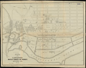
Plan of the Lewiston Water Power Co.'s works, Lewiston, Me
9874.
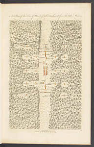
A plan of the line of march of the detachment from the Little Meadows
9875.
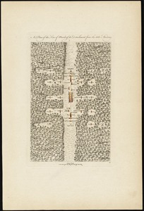
A plan of the line of march of the detachment from the little Meadows
9876.
A plan of the line of march of the detachment from the little Meadows
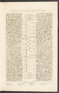
9877.
A plan of the line of march with the whole baggage
9878.
A plan of the line of march with the whole baggage
9879.
A plan of the line of march with the whole baggage
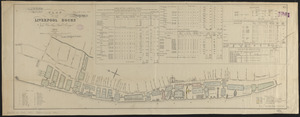
9880.
Plan of the Liverpool Docks
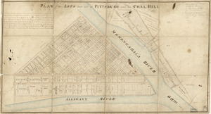
9881.
Plan of the lots laid out at Pittsburg and the Coal Hill
9882.
A plan of the Magdelain, Brion, Bird and Entry islands reduced from the large survey made agreable to the orders and...
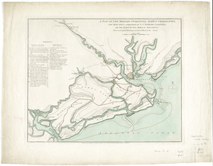
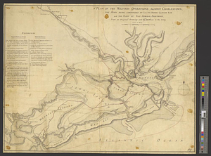
9883.
A plan of the military operations against Charlestown, the army being commanded by L.G. Sir Henry Clinton K.B. and the fleet by...
9884.
A plan of the military operations against Charlestown, the army being commanded by L.G. Sir Henry Clinton K.B. and the fleet by...
9885.
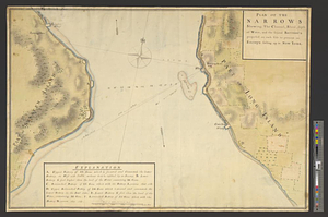
Plan of the narrows : shewing, the channel, shoal, depth of water, and the several battery's proposed on each side to prevent...
9886.
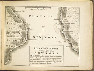
Plan of the narrows about 10 miles from New York
9887.
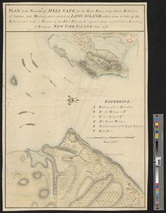
Plan of the narrows of Hell Gate, on the East River near which batteries of cannon, and morters, were erected on Long Island :...
9888.
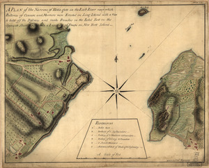
A plan of the Narrows of Hells-gate in the East River : near which batteries of cannon and mortars were erected on Long Island...
9889.
Plan of The Narrows, shewing the channel, shoal, depth of water, and the several battery's proposed on each side to prevent an...
9890.
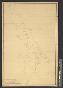
[Plan of the Neck and environs]
9891.
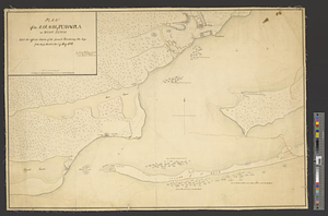
[Plan of the "Neck" and fortifications] : Delivd. to H.E. Gl. Gage, June 30th. 1775.--J.M
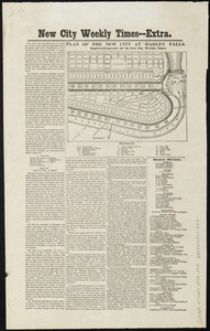
9892.
Plan of the new city at Hadley Falls
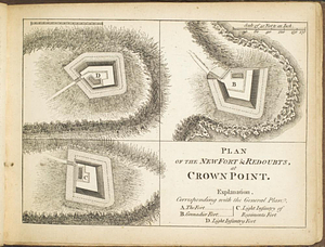
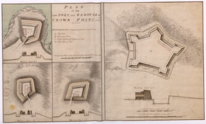
9893.
Plan of the new fort & redoubts, at Crown Point
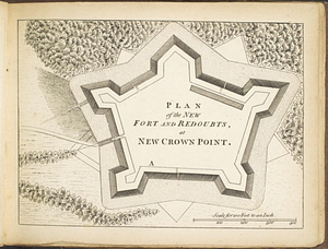
9894.
Plan of the new fort and redoubts, at New Crown Point
9895.
PLAN of the new FORT, and REDOUTS at CROWN POINT, called as below
9896.
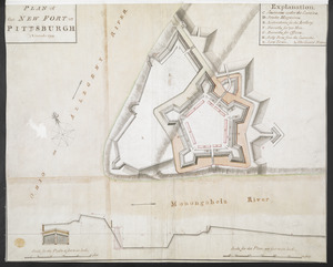
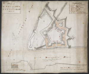
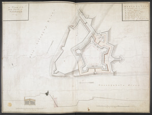
PLAN of the NEW FORT at PITSBURGH November 1759
9897.
PLAN of the NEW FORT at PITTSBURGH November 1759
9898.
A plan of the New Fort at Pittsburgh Novr 1759
9899.
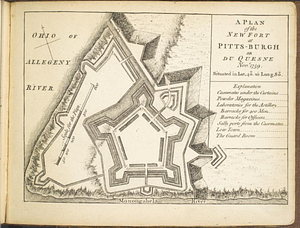
A plan of the new fort at Pitts-Burgh or Du Quesne Novr. 1759 : situated in lat. 40 20' long. 80
9900.
A plan of the northern part of New Jersey : shewing the positions of the American and British armies after crossing the North...
‹ Prev
Next ›
1
2
…
95
96
97
98
99
100
101
102
103
…
133
134
![Plan of the French and rebells sieg[e] of Savannah in Georgia, in South [sic] America, deffend](https://bpldcassets.blob.core.windows.net/derivatives/images/commonwealth:q524nc699/image_thumbnail_300.jpg)
![[Plan of the Gore Estate at the corner of Pitts and Green streets]](https://bpldcassets.blob.core.windows.net/derivatives/images/commonwealth:9s161h402/image_thumbnail_300.jpg)


![A plan of the harbour of Louisbourg with the adjacent country survey'd by Samuel Holland esqr. surveyer [sic] general for the northern district of North America](https://bpldcassets.blob.core.windows.net/derivatives/metadata/commonwealth-oai:fx71fk83p/image_thumbnail_300.jpg)


![A plan of the Indian boundary line [torn]](https://bpldcassets.blob.core.windows.net/derivatives/metadata/commonwealth-oai:gh93mw53c/image_thumbnail_300.jpg)


![[Plan of the land at Prince Street and Snowhill Street, Boston]](https://bpldcassets.blob.core.windows.net/derivatives/images/commonwealth:4m90f3650/image_thumbnail_300.jpg)


![[Plan of the Neck and environs]](https://bpldcassets.blob.core.windows.net/derivatives/images/commonwealth:z603vj436/image_thumbnail_300.jpg)
![[Plan of the "Neck" and fortifications]](https://bpldcassets.blob.core.windows.net/derivatives/images/commonwealth:z603vj23q/image_thumbnail_300.jpg)