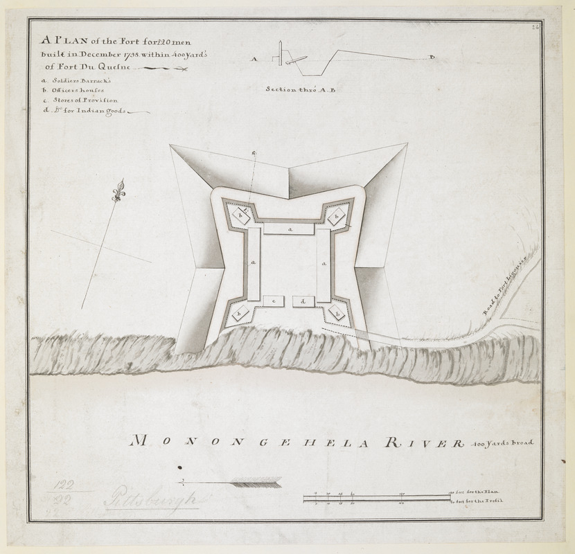
A PLAN of the Fort for 220 men built in December 1758 within 400 Yard's of Fort du Quesne
This map is also available in American Revolutionary Geographies Online (ARGO), a collections portal especially built for material relating to the American Revolutionary War Era. Visit ARGO to learn more about this item and explore the historical geography of North America in the late eighteenth century.
Item Information
- Title:
- A PLAN of the Fort for 220 men built in December 1758 within 400 Yard's of Fort du Quesne
- Former owner:
- George, III, King of Great Britain, 1738-1820
- Donor:
- George, IV, King of Great Britain, 1762-1830
- Date:
-
1758
- Format:
-
Maps/Atlases
Manuscripts
- Location:
- British Library
- Collection (local):
-
British Library Collection
- Subjects:
-
Military art and science--Pennsylvania--Fort Pitt--Maps, Manuscript--Early works to 1800
Pittsburgh (Pa.)--Maps, Manuscript--Early works to 1800
United States--History--French and Indian War, 1754-1763--Maps, Manuscript--Early works to 1800
- Places:
-
Allegheny (county)Pittsburgh
- Extent:
- 1 map : pen and ink with watercolour ; 26 x 26 cm
- Terms of Use:
-
No known copyright restrictions.
This work is licensed for use under a Creative Commons Attribution Non-Commercial Share Alike License (CC BY-NC-SA).

- Scale:
-
Scale approximately 1:720
- Language:
-
English
- Catalog Record:
-
http://explore.bl.uk/BLVU1:LSCOP-ALL:BLL01004987648
- Notes:
-
Relief shown by shading.
Scales at lower right - 60 feet to an inch for the plan and 20 feet to an inch for the "Profil".
Title at upper left followed by a short lettered key (a-d) identifying locations within the fort.
Inset with a sectional profile through the fort wall at the top of the map (scale approximately 1:240).
Shows "MONONGEHELA RIVER 400 Yards Broad" with an arrow indicating the direction of flow.
North is oriented to the top of the map and is indicated by a compass arrow.
Titled "A drawn Plan of the Fort for 220 Men, built in Dec. 1758, within 400 yards of Fort du Quesne" in the Catalogue of Maps, Prints, Drawings, etc., forming the geographical and topographical collection attached to the Library of his late Majesty King George the third, etc., London, 1829.
Titled 'A "plan of the fort for 220 men, built in December, 1758, within 400 yards of Fort du Quesne," and on the Mononaghela River; drawn on a scale of 60 feet to an inch, with profil on a scale of 30 feet to an inch: 10 1/2 in. x 10 in.' in the Catalogue of the manuscript maps, charts, and plans, and of the topographical drawings in the British Museum.
Known today as "Mercer's Fort" this temporary fort in present-day Pittsburgh, Pennsylvania was unnamed at the time of its construction and use. It was built between December 1758 and July 1759 - Stotz. The fort housed British troops for a short period after the destruction of the French Fort Duquesne and before the construction of the British Fort Pitt.

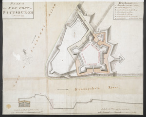
![[Fort Pitt]](https://bpldcassets.blob.core.windows.net/derivatives/images/commonwealth:hx11xz65w/image_thumbnail_300.jpg)
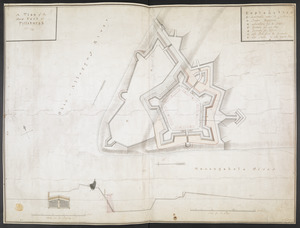
![[Map of Fort Pitt]](https://bpldcassets.blob.core.windows.net/derivatives/images/commonwealth:hx11z224f/image_thumbnail_300.jpg)
