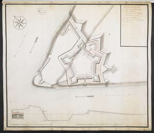
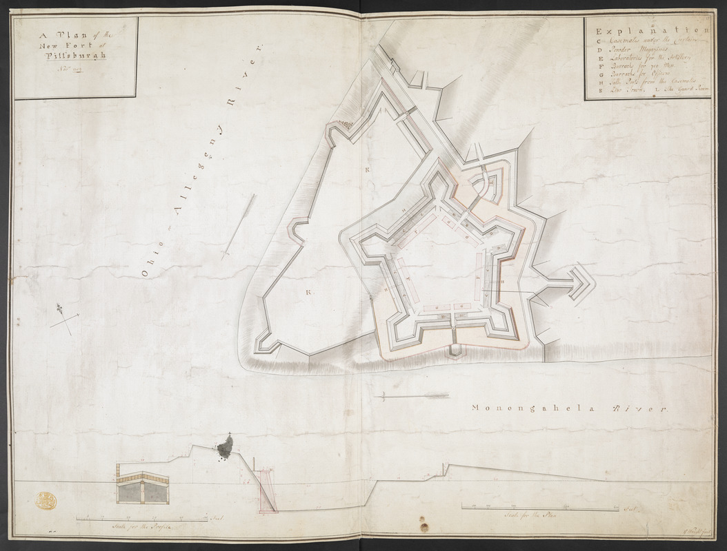
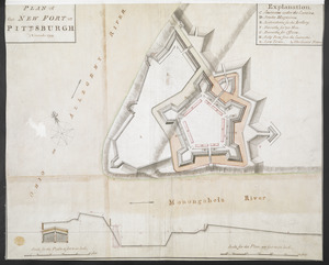
A plan of the New Fort at Pittsburgh Novr 1759
This map is also available in American Revolutionary Geographies Online (ARGO), a collections portal especially built for material relating to the American Revolutionary War Era. Visit ARGO to learn more about this item and explore the historical geography of North America in the late eighteenth century.
Item Information
- Title:
- A plan of the New Fort at Pittsburgh Novr 1759
- Cartographer:
- Wright, George
- Former owner:
- George, III, King of Great Britain, 1738-1820
- Donor:
- George, IV, King of Great Britain, 1762-1830
- Name on Item:
-
G. Wright fecit.
- Date:
-
1759
- Format:
-
Maps/Atlases
Manuscripts
- Location:
- British Library
- Collection (local):
-
British Library Collection
- Subjects:
-
Military art and science--Pennsylvania--Fort Pitt--Maps, Manuscript--Early works to 1800
Fort Pitt (Pa.)--Maps, Manuscript--Early works to 1800
United States--History--French and Indian War, 1754-1763--Maps, Manuscript--Early works to 1800
- Places:
-
Allegheny (county)Pittsburgh
- Extent:
- 1 map : manuscript pen and ink with watercolour ; 50 x 67 cm
- Terms of Use:
-
No known copyright restrictions.
This work is licensed for use under a Creative Commons Attribution Non-Commercial Share Alike License (CC BY-NC-SA).

- Scale:
-
Scale approximately 1:1,200
- Language:
-
English
- Catalog Record:
-
http://explore.bl.uk/BLVU1:LSCOP-ALL:BLL01004987647
- Notes:
-
Relief shown by shading.
"Scale for the Plan" at lower right (100 feet to an inch).
Title at upper left.
Lettered key (C-L) at upper right identifying locations with the fort.
Inset with a sectional profile through the fort wall at lower left with its own scale (10 feet to an inch, 1:120).
Signed lower right.
Compare with Maps K.Top.122.20. - a similar map by a different hand.
This manuscript map could be the source for a printed map of Fort Pitt which appeared in "A SET of PLANS and FORTS IN AMERICA, Reduced from Actual Surveys", first published in 1763. A copy of the second edition of the work published by Mary Ann Rocque (1765) may be found in the King's Topographical Collection (118.a.22.). Letters from Mary Ann Rocque to Lord Bute, who advised George III's early collecting, are known to exist in the Mount Stuart archives (Peter Barber - Head of Cartographic and Topographic Materials at the British Library).
Titled "A drawn Plan of the New Fort at Pittsburgh by G. Wright, Nov. 1759" in the Catalogue of Maps, Prints, Drawings, etc., forming the geographical and topographical collection attached to the Library of his late Majesty King George the third, etc., London, 1829.
Titled 'A colored "plan of the new fort at Pittsburgh, Nov., 1759;" drawn by G. Wright, on a scale of 100 feet to an inch: with profil on a scale of 10 feet to an inch:2 f. 3 in. x 1 f. 7 1/2 in. (Two copies.)' in the Catalogue of the manuscript maps, charts, and plans, and of the topographical drawings in the British Museum.

![[Map of Fort Pitt]](https://bpldcassets.blob.core.windows.net/derivatives/images/commonwealth:hx11z224f/image_thumbnail_300.jpg)
![[Map showing Fort Pitt, Fort Duquesne and Fort Mercer]](https://bpldcassets.blob.core.windows.net/derivatives/images/commonwealth:hx11z222w/image_thumbnail_300.jpg)