Toggle navigation
LMEC Home
Exhibitions
Georeferencing
Tools for Teachers
Collections
My Favorites
Sign Up / Log In
Search
Search the map portal
Map Collection
Map Collection
Map Sets
Search
Search
Search for
Search In
All Fields
Creator
Title
Subject
Place
Search All Digital Collections
Advanced Search
13385 Results
Filter your Search
Place
North and Central America
9,353
United States
7,078
Suffolk (county)
1,664
Boston
1,621
Europe
1,035
Canada
949
Massachusetts
794
New York
532
more
Place
»
Topic
Boston (Mass.)--Maps
741
City planning--Massachusetts--Boston--Maps
418
United States--History--Revolution, 1775-1783--Maps
329
United States--Maps
315
Urban renewal--Massachusetts--Boston--Maps
254
Real property--Massachusetts--Boston--Maps
252
Massachusetts--Maps
219
Insurance surveys
197
more
Topic
»
Date
Date range begin
–
Date range end
Current results range from
1482
to
2023
View distribution
Creator
United States. Hydrographic Office
595
Boston Redevelopment Authority
403
Des Barres, Joseph F. W. (Joseph Frederick Wallet), 1722-1824
247
Royal United Services Institute for Defence and Security Studies
160
Jefferys, Thomas, -1771
154
George, III, King of Great Britain, 1738-1820
152
George, IV, King of Great Britain, 1762-1830
151
O.H. Bailey & Co
148
more
Creator
»
Format
Maps/Atlases
13,205
Manuscripts
985
Prints
102
Books
49
Drawings/Illustrations
44
Photographs
15
Objects/Artifacts
13
Documents
7
more
Format
»
Georeferenced
Yes
979
No
12,406
Collection
Norman B. Leventhal Map Center Collection
8,891
American Revolutionary War-Era Maps
3,305
Boston and New England Maps
2,804
Urban Maps
2,397
Maritime Charts and Atlases
1,150
William L. Clements Library Collection
910
Library of Congress Collection
618
Boston Redevelopment Authority Collection
475
more
Collection
»
Available to use
No known restrictions
9,952
Creative Commons license
1,677
Search Constraints
Sort by relevance
relevance
title
date (asc)
date (desc)
Number of results to display per page
100 per page
10
per page
20
per page
50
per page
100
per page
View results as:
grid view
map view
Search Results
10001.
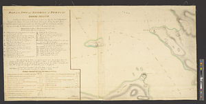
PLAN of the TOWER at POINT PLEASANT for the protection of the Sea Batteries at that place and for the defence of the Harbour of...
10002.
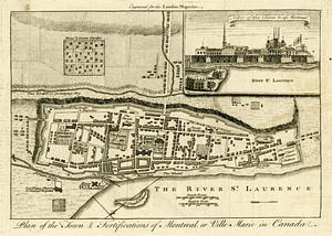
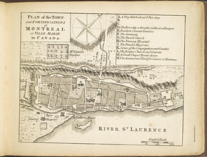
Plan of the town & fortifications of Montreal, or Ville Marie in Canada
10003.
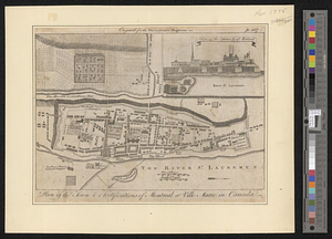
Plan of the town & fortifications of Montreal or Ville Marie in Canada
10004.
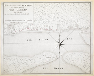
PLAN of the Town & Port of BEAUFORT in Carteret County NORTH CAROLINA
10005.
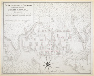
PLAN of the Town & Port of EDENTON in Chowan County NORTH CAROLINA
10006.
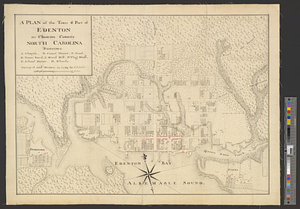
A plan of the town & port of Edenton in Chowan County, North Carolina : survey'd and drawn in 1769
10007.
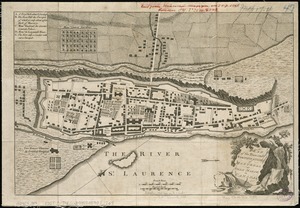
A plan of the town and chart of the harbour of Boston exhibiting a view of the islands, castle forts, and entrances into the...
10008.
A plan of the town and chart of the harbour of Boston exhibiting a view of the islands castle forts and entrances into the said...
10009.
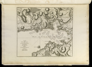
Plan of the town and citadel of Fort Royal, the capital of Martinico : with the Bay of Cul de Sac Royal
10010.
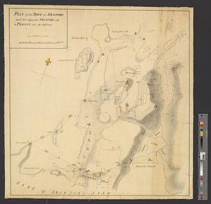
Plan of the town and environs of Newport, Rhode Island : exhibiting its defenses formed before the 8th of August 1778 when the...
10011.
Plan of the town and environs of Newport, Rhode Island : exhibiting its defenses formed before the 8th of August 1778 when the...
10012.
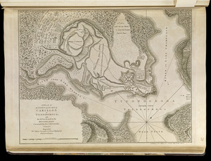
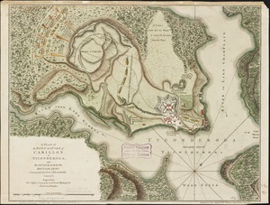
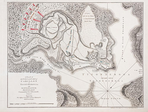
A plan of the town and Fort of Carillon at Ticonderoga : with the attack made by the British army commanded by Genl....
10013.
A plan of the town and Fort of Carillon at Ticonderoga : with the attack made by the British army commanded by Genl....
10014.
A plan of the town and fort of Carillon at Ticonderoga : with the attack made by the British army commanded by Genl....
10015.
Plan of the town and fort of Grenada
10016.
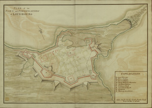
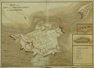
PLAN of the TOWN and FORTIFICATIONS of LOUISBOURG
10017.
PLAN of the TOWN and FORTIFICATIONS of LOUISBOURG
10018.
Plan of the town and fortifications of Montreal or Ville Marie in Canada
10019.
Plan of the town and fortifications of Montreal or Ville Marie in Canada
10020.
Plan of the town and fortifications of Montreal or Ville Marie in Canada
10021.
Plan of the town and fortifications of Montréal or Ville Marie in Canada
10022.
PLAN of the TOWN and FORTRESS of LOUISBOURG on the ISLAND CAPE BRETON : Surrender'd ye 16th June 1745 after a Seige of 12 days...
10023.
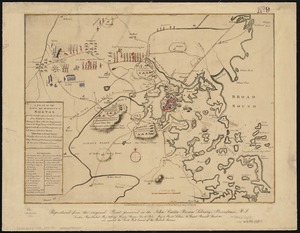
A plan of the town and harbour of Boston. : And the country adjacent with the road from Boston to Concord shewing the place of...
10024.
A plan of the town and harbour of Boston : and the country adjacent with the road from Boston to Concord, shewing the place of...
10025.
A plan of the town and harbour of Boston, and the country adjacent with the road from Boston to Concord shewing the place of...
10026.
A plan of the town and harbour of Boston and the country adjacent with the road from Boston to Concord shewing the place of the...
10027.
Plan of the Town and Harbour of Louisbourg
10028.
Plan of the town and harbour of San Juan de Puerto Rico ; Plan of the Aguada Nueva de Puerto Rico
10029.
PLAN of the TOWN and HARBOUR of S.T AUGUSTIN
10030.
Plan of the town and harbour of St. Augustin, in East Florida
10031.
PLAN of the Town and Port of BATH in Beaufort County NORTH CAROLINA
10032.
PLAN of the Town and Port of BRUNSWICK in Brunswick County. NORTH CAROLINA
10033.
A plan of the town, bar, harbour and environs, of Charlestown in South Carolina : with all the channels, soundings,...
10034.
A plan of the town, bar, harbour, and environs of Charlestown in South Carolina : with all the channels, soundings,...
10035.
A plan of the town dock, formerly called Bendalls Dock, in Boston, with the buildings round & flats before it
10036.
Plan of the town of Basse Terre the capital of Guadaloupe from an authentic survey
10037.
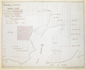
PLAN of the TOWN of BELLE VIEU situated on the East side Beaver Harbour in the District of Passamaquoddy
10038.
Plan of the town of Boston
10039.
Plan of the town of Boston
10040.
Plan of the town of Boston and circumjacent country shewing the present situation of the Kings troops & the Rebels...
10041.
A plan of the town of Boston and its environs, with the lines, batteries, and incampments of the British and American armies
10042.
A Plan of the town of Boston, in New-England, : distinguishing that part which was burnt in 1760
10043.
A plan of the town of Boston, in New-England, distinguishing that part which was burnt in 1760
10044.
Plan of the town of Boston with the attack on Bunkers-Hill in the peninsula of Charlestown the 17th of June 1775
10045.
Plan of the town of Boston, with the attack on Bunkers-Hill, in the peninsula of Charlestown, the 17th of June, 1775
10046.
Plan of the town of Boston with the attack on Bunkers-Hill in the peninsula of Charlestown the 17th of June 1775
10047.
A plan of the town of Boston with the intrenchments & ca. of His Majesty's forces in 1775 : from the observations of Lieut....
10048.
A plan of the town of Boston, with the intrenchments &c. of His Majestys forces in 1775 : from the observations of Lieut. Page...
10049.
A plan of the town of Boston, with the intrenchments &c. of His Majestys forces in 1775 : from the observations of Lieut. Page...
10050.
A plan of the town of Boston with the intrenchments &ca. of His Majesty's forces in 1775 : from the observations of Lieut. Page...
10051.
Plan of the town of Brighton
10052.
Plan of the town of Cayenne and Fort St. Michael
10053.
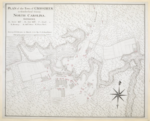
PLAN of the Town of CROSS CREEK in Cumberland County. NORTH CAROLINA
10054.
Plan of the town of Dorchester
10055.
A plan of the town of Dracut protracted by a scale of 200 rods to an inch : taken in Octobr. 1791
10056.
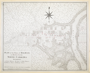
PLAN of the Town of HALIFAX in Halifax County. NORTH CAROLINA
10057.
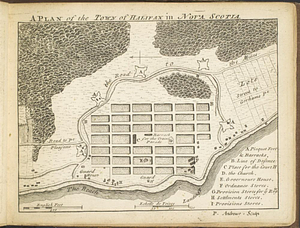
A plan of the town of Halifax in Nova Scotia
10058.
A plan of the town of Halifax in Nova Scotia August 1749
10059.
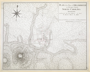
PLAN of the Town of HILLSBOROUGH in Orange County NORTH CAROLINA
10060.
Plan of the town of Lowell and Belvidere Village
10061.
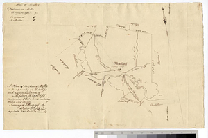
A plan of the town of Medford in the county of Middlesex and commonwealth of Massachusetts containing 5631 acres including...
10062.
Plan of the town of Meriden, New Haven County, Connecticut
10063.
Plan of the town of Millbury : Worcester Co. Mass. : from recent and actual surveys
10064.
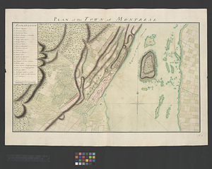
Plan of the town of Montreal
10065.
A plan of the town of New Bern
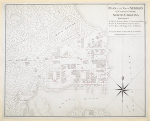
10066.
A plan of the town of New Haven : with all the buildings in 1748 taken by the Hon. Gen. Wadsworth of Durham to which are added...
10067.
PLAN of the Town of NEWBERN in Craven County NORTH CAROLINA
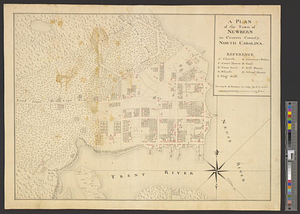
10068.
A plan of the town of Newbern in Craven County, North Carolina : survey'd and drawn in 1769
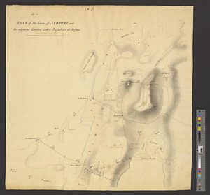
10069.
Plan of the town of Newport, and the adjacent country; with a project for its defence : (no. 7)
10070.
Plan of the town of Newport and the adjacent country, with a project for its defence
10071.
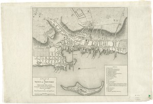
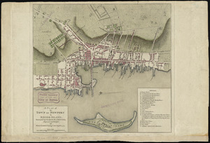
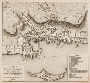
A plan of the town of Newport in Rhode Island
10072.
A plan of the town of Newport in Rhode Island
10073.
A plan of the town of Newport in Rhode Island
10074.
A plan of the town of Newport in the province of Rhode Island
10075.
A plan of the town of Newport in the province of Rhode Island
10076.
A Plan of the town of Pensacola, 1767
10077.
Plan of the town of Quebec the capital of Canada in North America : with the bason and a part of the adjacent country shewing...
10078.
Plan of the town of Quebec the capital of Canada in North America : with the bason and a part of the adjacent country shewing...
10079.
Plan of the town of Quebec the capital of Canada in North America : with the bason and a part of the adjacent country shewing...
10080.
Plan of the town of Quebec the capital of Canada in North America : with the bason and a part of the adjacent country shewing...
10081.
Plan of the town of Quebec, the capital of Canada in North America, with the Bason and a part of the adjacent country shewing...
10082.
Plan of the town of Quebeck in Canada enlarged from Bellin’s plan with additions
10083.
Plan of the town of Quebeck in Canada enlarged from Bellin's plan, with additions
10084.
A plan of the Town of Reading in the County of Middlesex and the Town of Lynnfield in the County of Essex
10085.
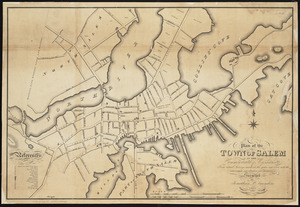
Plan of the town of Salem in the commonwealth of Massachusetts : from actual surveys, made in the years 1796 & 1804; with the...
10086.
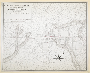
PLAN of the Town of SALISBURY in Rowan County. NORTH CAROLINA
10087.
PLAN Of the Town of SAVANNAH, Showing the Works Constructed for its Defence; also, The Approaches and Batteries of the Enemy:...
10088.
Plan of the town of Savannah, with the works constructed for its defence, together with the approaches & batteries of the...
10089.
PLAN of The TOWN of SHELBURNE projected and laid out By Order of his Excell,y IOHN PARR Esqr Capt,n Gen,l Governor & Commander...
10090.
A PLAN of the TOWN of St ANDREWS Situated at the Head of Passamaquoddy Bay-laid out for the Accomodation of Loyal Emigrants &...
10091.
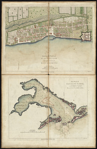
Plan of the town of St. Augustine, the capital of East Florida ; The bay of Espiritu Santo, on the western coast of East Florida
10092.
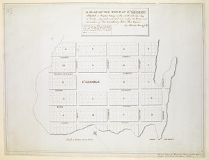
A PLAN OF THE TOWN OF ST. GEORGE Situated in Harbor Etang on the North side the Bay of Fundy, projected and laid out under the...
10093.
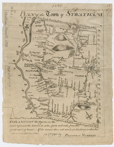
Plan of the town of Stratham
10094.
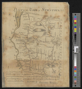
Plan of the town of Stratham... : July 17th, 1793
10095.
Plan of the town of Three Rivers
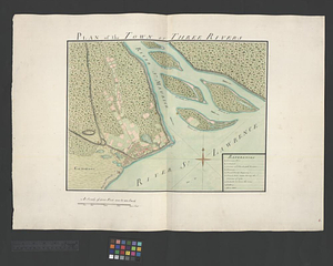
10096.
Plan of the Town of Turner, formerly Silvester Plantation : out side lines and part of the lotts ran out
10097.
A plan of the town of Walpole taken by an actual survey in the month of October 1794 and layed down from a scale of 200 rods to...
10098.
Plan of the town of West Roxbury : compiled from various plans and surveys, by order of the selectmen
10099.
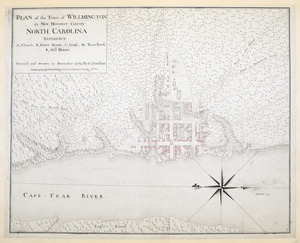
PLAN of the Town of WILLMINGTON in New Hanover County NORTH CAROLINA
10100.
Plan of the town, road, and harbour of Chagre ; Plan of Porto Belo
‹ Prev
Next ›
1
2
…
97
98
99
100
101
102
103
104
105
…
133
134