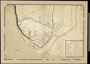
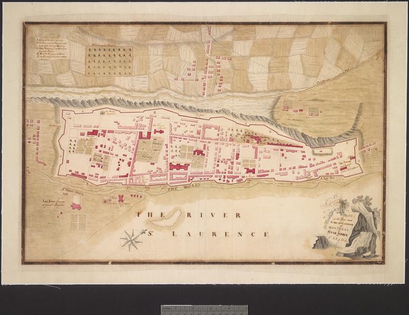
Plan of the town and fortifications of Montreal or Ville Marie in Canada
This map is also available in American Revolutionary Geographies Online (ARGO), a collections portal especially built for material relating to the American Revolutionary War Era. Visit ARGO to learn more about this item and explore the historical geography of North America in the late eighteenth century.
Item Information
- Title:
- Plan of the town and fortifications of Montreal or Ville Marie in Canada
- Cartographer:
- MacKay, H.
- Name on Item:
-
H. MacKay
- Date:
-
[1760]
- Format:
-
Maps/Atlases
- Genre:
-
Manuscript maps
- Location:
- Library and Archives Canada
- Collection (local):
-
Library and Archives Canada Collection
- Subjects:
-
Seven Years' War, 1756-1763--Campaigns--Canada--Maps
Montréal (Québec)--Maps
Fortification--Québec (Province)
New France--Maps
- Places:
-
CanadaMontreal
New France
- Extent:
- 1 manuscript map : hand color ; 34.5 x 51.5 cm
- Terms of Use:
-
Copyright expired. Contact host institution to download image.
Contact host institution for more information.
- Language:
-
English
- Catalog Record:
-
Catalog record
- Notes (date):
-
This date is inferred.
- Identifier:
-
e008310486
- Barcode:
-
3704392