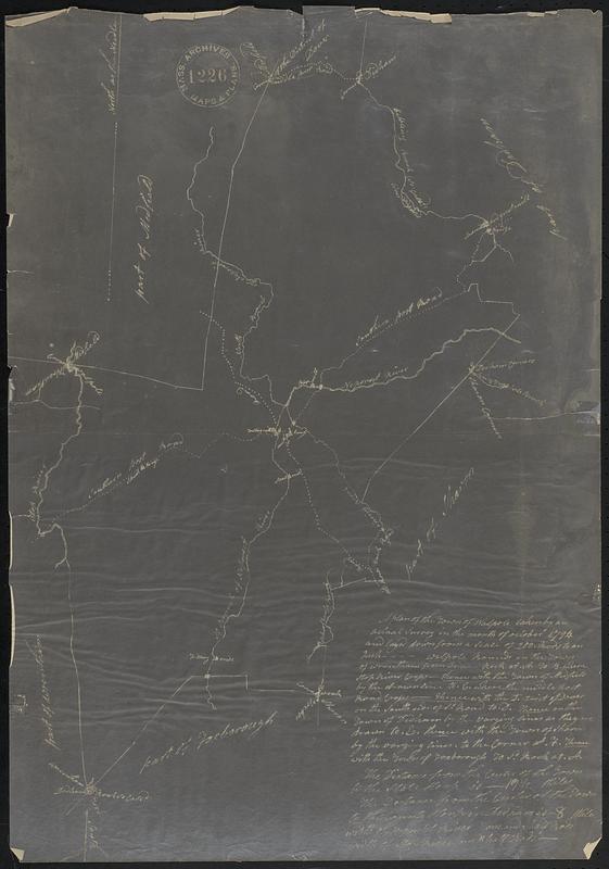
A plan of the town of Walpole taken by an actual survey in the month of October 1794 and layed down from a scale of 200 rods to an inch
Item Information
- Title:
- A plan of the town of Walpole taken by an actual survey in the month of October 1794 and layed down from a scale of 200 rods to an inch
- Date:
-
[ca. 1927]
- Format:
-
Maps/Atlases
- Location:
-
Boston Public Library
Norman B. Leventhal Map & Education Center - Collection (local):
-
Norman B. Leventhal Map & Education Center Collection
- Subjects:
-
Walpole (Mass. : Town)--Maps, Manuscript--Facsimiles
- Places:
-
MassachusettsNorfolk (county)Walpole
- Extent:
- 1 map : photostat ; on sheet 75 x 52 cm.
- Terms of Use:
-
No known copyright restrictions.
No known restrictions on use.
- Scale:
-
Scale 1:39,600
- Language:
-
English
- Notes:
-
Photostat copy of 1794 original.
- Identifier:
-
06_01_018588
- Call #:
-
G3764.W19 1794 .P5 1927x
- Barcode:
-
39999059018471


