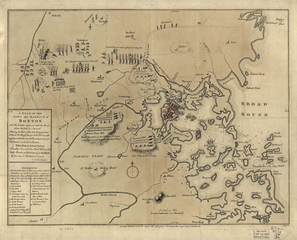
A plan of the town and harbour of Boston : and the country adjacent with the road from Boston to Concord, shewing the place of the late engagement between the King's troops & the provincials, together with the several encampments of both armies in & about Boston. Taken from an actual survey
This map is also available in American Revolutionary Geographies Online (ARGO), a collections portal especially built for material relating to the American Revolutionary War Era. Visit ARGO to learn more about this item and explore the historical geography of North America in the late eighteenth century.
Item Information
- Title:
- A plan of the town and harbour of Boston : and the country adjacent with the road from Boston to Concord, shewing the place of the late engagement between the King's troops & the provincials, together with the several encampments of both armies in & about Boston. Taken from an actual survey
- Creator:
- De Costa, J.
- Contributor:
- Hall, Charles, 1720?-1783
- Name on Item:
-
Humbly inscribed to Richd. Whitworth by J. De Costa; C. Hall, sc.
- Date:
-
1775
- Format:
-
Maps/Atlases
- Location:
- Library of Congress Geography and Map Division
- Collection (local):
-
Library of Congress Geography and Map Division
- Subjects:
-
Boston--History--Revolution, 1775-1783--Maps--Early works to 1800
Concord, Battle of, Concord, Mass., 1775--Maps--Early works to 1800
Boston Harbor (Mass.)--Maps--Early works to 1800
Boston Bay (Mass.)--Maps--Early works to 1800
- Places:
-
Boston Harbor
Suffolk (county)Boston
- Extent:
- col. map 37 x 49 cm.
- Terms of Use:
-
No known copyright restrictions.
This work is licensed for use under a Creative Commons Attribution Non-Commercial Share Alike License (CC BY-NC-SA).

- Scale:
-
Scale ca. 1:120,000
- Language:
-
English
- Catalog Record:
-
https://lccn.loc.gov/gm71002447
- Notes:
-
Hand colored.
Relief shown by hachures.
Includes index to points of military interest.
- LCCN:
-
gm 71002447


