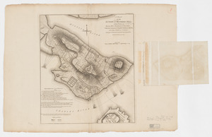
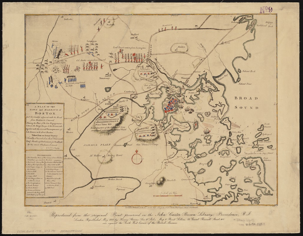
A plan of the town and harbour of Boston, and the country adjacent with the road from Boston to Concord shewing the place of the late engagement between the King's troops & the provincials, together with the several encampments of both armies in & about Boston : taken from an actual survey
Item Information
- Title:
- A plan of the town and harbour of Boston, and the country adjacent with the road from Boston to Concord shewing the place of the late engagement between the King's troops & the provincials, together with the several encampments of both armies in & about Boston : taken from an actual survey
- Creator:
- De Costa, J.
- Name on Item:
-
J. De Costa ; C. Hall, sc.
- Date:
-
1911
- Format:
-
Maps/Atlases
- Location:
-
Boston Public Library
Norman B. Leventhal Map & Education Center - Collection (local):
-
Norman B. Leventhal Map & Education Center Collection
- Subjects:
-
Concord, Battle of, Concord, Mass., 1775--Maps--Early works to 1800--Facsimiles
Boston (Mass.)--History--Revolution, 1775-1783--Maps--Early works to 1800--Facsimiles
Boston Harbor (Mass.)--Maps--Early works to 1800--Facsimiles
- Places:
-
MassachusettsBoston Harbor
MassachusettsMiddlesex (county)Concord
MassachusettsSuffolk (county)Boston
- Extent:
- 1 map : col. ; 37 x 49 cm.
- Terms of Use:
-
No known copyright restrictions.
No known restrictions on use.
- Publisher:
-
London :
Henry Stevens, Son & Stiles
- Scale:
-
Scale ca. 1:120,000.
- Language:
-
English
- Notes:
-
Facsimile.
Relief shown by hachures.
Depth shown by soundings.
Includes index to points of military interest.
"Reproduced from the original print preserved in the John Carter Brown Library, Province, R.I."
Original version: London : J. De Costa, Red Cross Street, 1775 July 29.
- Identifier:
-
06_01_003095
- Call #:
-
G3764.B6S3 1775 .D43 1911
- Barcode:
-
39999058998335
- LCCN:
-
gm 71005461