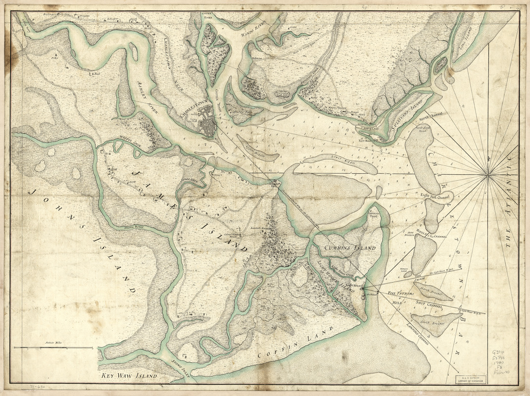
A plan of the town, bar, harbour, and environs of Charlestown in South Carolina : with all the channels, soundings, sailing-marks &c. from the surveys made in the colony
This map is also available in American Revolutionary Geographies Online (ARGO), a collections portal especially built for material relating to the American Revolutionary War Era. Visit ARGO to learn more about this item and explore the historical geography of North America in the late eighteenth century.
Item Information
- Title:
- A plan of the town, bar, harbour, and environs of Charlestown in South Carolina : with all the channels, soundings, sailing-marks &c. from the surveys made in the colony
- Creator:
- Faden, William, 1749-1836
- Date:
-
[1780?]
- Format:
-
Maps/Atlases
Manuscripts
- Location:
- Library of Congress Geography and Map Division
- Collection (local):
-
Library of Congress Collection
- Subjects:
-
Harbors--South Carolina--Charleston--Maps, Manuscript--Early works to 1800
Charleston (S.C.)--Maps, Manuscript--Early works to 1800
- Places:
-
Charleston (county)Charleston Harbor (bay)
Charleston (county)Charleston
- Extent:
- 1 manuscript map : hand color 52 x 71 cm.
- Terms of Use:
-
No known copyright restrictions.
This work is licensed for use under a Creative Commons Attribution Non-Commercial Share Alike License (CC BY-NC-SA).

- Scale:
-
Scale ca. 1:45,000
- Language:
-
English
- Catalog Record:
-
https://lccn.loc.gov/gm71000630
- Notes:
-
Title from engraved copy issued by William Faden in 1780.
Manuscript, pen-and-ink and watercolor.
Has watermark.
Relief shown by hachures. Depths shown by soundings.
- Notes (citation):
-
LC Maps of North America, 1750-1789, 1542
- Identifier:
-
ar154200

![[Charles Town Neck Exhibiting the Plan of the Town and all the Fortifications in December 1781]](https://bpldcassets.blob.core.windows.net/derivatives/images/commonwealth:hx11z273c/image_thumbnail_300.jpg)


