Toggle navigation
LMEC Home
Exhibitions
Georeferencing
Tools for Teachers
Collections
My Favorites
Sign Up / Log In
Search
Search the map portal
Map Collection
Map Collection
Map Sets
Search
Search
Search for
Search In
All Fields
Creator
Title
Subject
Place
Search All Digital Collections
Advanced Search
186 Results
My Search
Start Over
More Like
commonwealth:z603vh26b
Remove constraint More Like: commonwealth:z603vh26b
Filter your Search
Place
North and Central America
117
United States
53
West Indies
51
Canada
22
North America
20
Caribbean Sea
13
Boston
10
Mesoamerica
10
more
Place
»
Topic
West Indies--Maps
52
United States--Maps
27
North America--Maps
20
Canada--Maps
14
Caribbean Area--Maps
13
Mexico, Gulf of--Maps
13
Central America--Maps
11
Boston (Mass.)--Maps
9
more
Topic
»
Date
Date range begin
–
Date range end
Current results range from
1700
to
1993
View distribution
Creator
Reid, John, 1764?-1828
11
Bellin, Jacques Nicolas, 1703-1772
9
Farwell, John Whittemore, 1843-1929
9
Kitchin, Thomas, 1718-1784
9
Carleton, Osgood, 1742-1816
6
Tanner, Benjamin, 1775-1848
6
Anderson, Alexander, 1775-1870
5
Gibson, J. (John), active 1750-1792
5
more
Creator
»
Format
Maps/Atlases
186
Manuscripts
12
Georeferenced
Yes
22
No
164
Collection
American Revolutionary War-Era Maps
147
American Antiquarian Society Collection
138
Norman B. Leventhal Map Center Collection
39
Maritime Charts and Atlases
9
William L. Clements Library Collection
9
Boston and New England Maps
1
Available to use
No known restrictions
39
Creative Commons license
1
Search Constraints
Sort by relevance
relevance
title
date (asc)
date (desc)
Number of results to display per page
50 per page
10
per page
20
per page
50
per page
100
per page
View results as:
grid view
map view
Search Results
1.
A new and correct map of the American islands, now called the West Indies, : with the whole coast of the neighbouring continent
2.
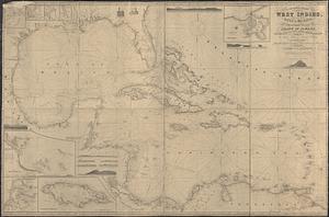
West Indies
3.
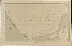
Gulf of Mexico, West Indies and Caribbean Sea : from the most recent U.S. Coast Survey, Spanish and British Admiralty charts
4.
An accurate map of the West Indies, : containing the Bahama & Carribe islands, the Great & Little Antilles, with the Leward and...
5.
An Accurate map of the West Indies, with the adjacent coast
6.
The West Indies, and Gulf of Mexico, : from the latest discoveries and best observations
7.
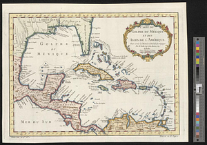
Carte du Golphe du Méxique et des isles de l'Amérique : pour servir à l'Histoire générale des voyages
8.
A general chart of the West Indies, including the Gulf of Mexico, with an enlarged plan of the island of Jamaica, also...
9.
A new and correct general chart of the West Indies including the Gulf of Mexico & Bay of Honduras &c : collected from the...
10.
The countries of the Caribbean : including Mexico, Central America, the West Indies and the Panama Canal
11.
The Evening Post map of the West Indies
12.
Map of Central America, Cuba, Porto Rico, and the islands of the Caribbean Sea
13.
Map of the United States of America, the British Provinces, Mexico, the West Indies and Central America, with part of New...
14.
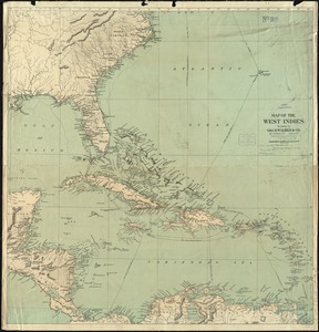
Map of the West Indies
15.
The West India Islands and adjacent territory showing British possessions south of the United States
16.
The British governments in Nth. America : laid down agreeable to the proclamation of Octr. 7, 1763
17.
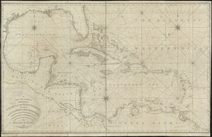
An accurate map of the West Indies
18.
An accurate map of the West Indies with the adjacent coast of America
19.
An Accurate map of the West Indies with the adjacent coast of America. 1796
20.
Carolinae Floridae nec non insularum Bahamensium : cum partibus adjacendibus delineatio ad Exemplar Londinense in lucem edita a...
21.
A Correct chart of the West India islands : engraved for Malham's naval gazetteer
22.
Map of the European settlements in the West Indies
23.
A new map of the West Indian islands; : as they are possessed by the European powers; drawn from the most recent authorities
24.
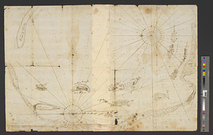
Plan of the bay of Tortuga
25.
The West Indies, : exhibiting the English French Spanish Dutch & Danish settlements with the adjacent parts of North & South...
26.
West Indies, : with the harbour & fort of Omoa. From the best authorities
27.
The Windward Passage, with the several passages from the east end of Cuba : & from the north part of St. Domingo
28.
Heathers, improved chart of the Bermudas, drawn from the best surveys
29.
A map of the Bermuda Islands : ya des demonios, isles of the devils
30.
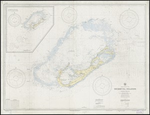
North Atlantic Ocean, Bermuda Islands : from British surveys to 1926, with additions and corrections to 1936
31.
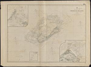
North Atlantic Ocean, Bermuda Islands : from the most recent Brit. Admty. surveys, 1877
32.
Breton Sound
33.
Chart of the east coast of the Yucatan
34.
The Gulf coast from the Mississippi Delta to the Bay of St. Joseph
35.
North America, east coast, Gulf of Mexico, the Gulf coast of Mexico, sheet 1 : from the Rio Grande to Cape Roxo
36.
North America, east coast, Gulf of Mexico, the Gulf coast of Mexico, sheet 2 : from Tampico to Campeche Bank
37.
The north coast of the Gulf of Mexico, from St. Marks to Galveston
38.
Plano de la costa de la Luciana decide el cabo de Loso hasta el cabo de San Blas sacado por los Yngs. el ano de 1769 con sur...
39.
Dagbladets kart over krigsskuepladsen
40.
An accurate map of the West Indies : exhibiting not only all the islands possess'd by the English, French, Spaniards & Dutch...
41.
An accurate map of the West Indies, containing the Bahama & Caribbe islands the Great & Little Antilles; with the Leward and...
42.
Antilles ou Indes Occidentales
43.
Carte geo-hydrographique du Golfe du Mexique et de ces isles : construit d'après les mémoires les plus recens, et assujeties...
44.
Case's map of the United States, the British provinces, Mexico, and part of the West Indies : compiled from the latest...
45.
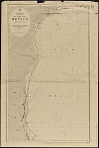
Chart of the West Indies and Spanish Dominions in North America
46.
A chart of the West Indies, from the latest marine journals and surveys
47.
Colton's map of the United States of America, the British provinces, Mexico and the West Indies : showing the country from the...
48.
Indie Occidentali
49.
Map of North America from 20 to 80 degrees north latitude : exhibiting the recent discoveries, geographical and nautical; drawn...
50.
Map of the seat of war : showing the only practical method by which the movements of the warships of both nations can be...
‹ Prev
Next ›
1
2
3
4