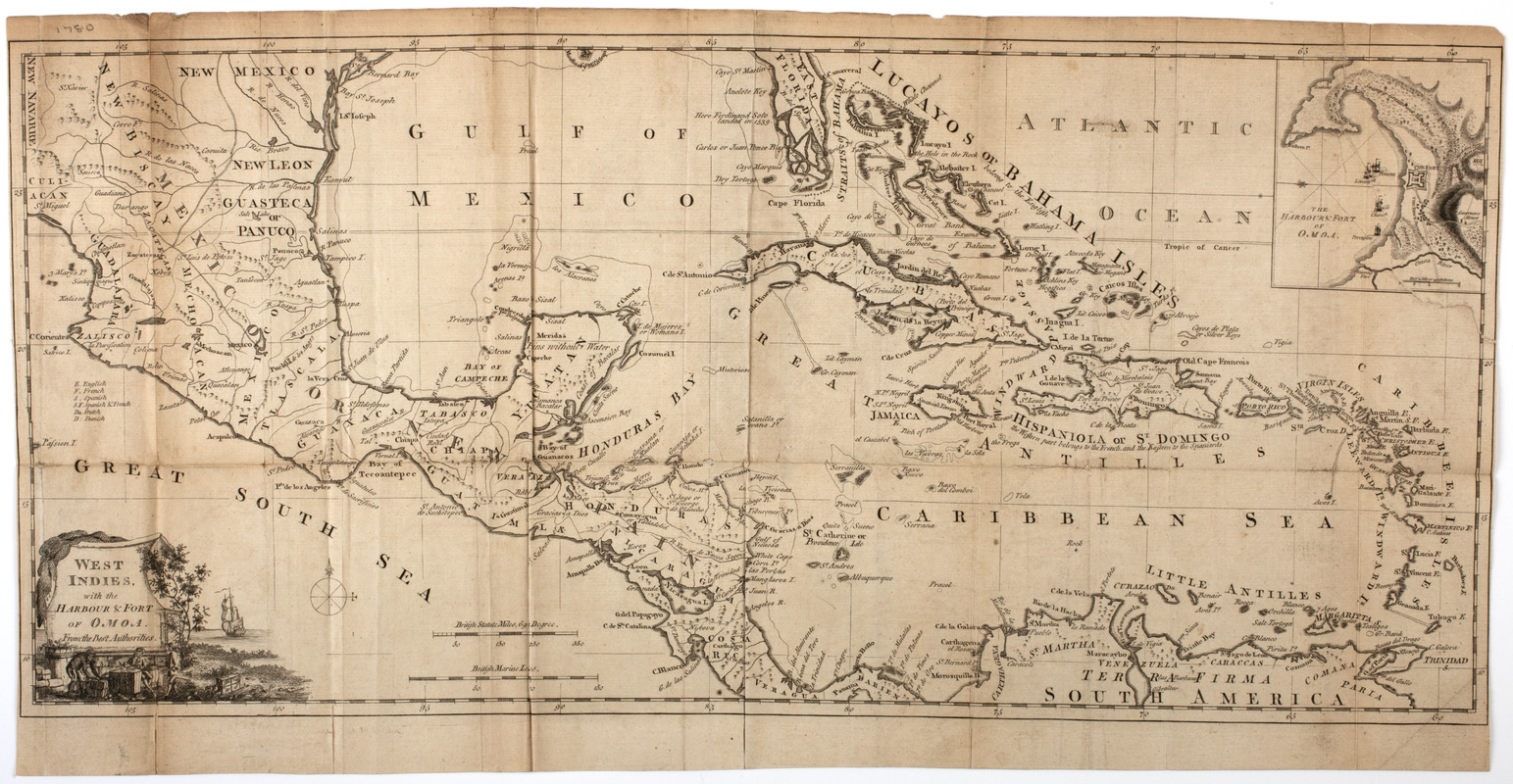
West Indies, : with the harbour & fort of Omoa. From the best authorities
This map is also available in American Revolutionary Geographies Online (ARGO), a collections portal especially built for material relating to the American Revolutionary War Era. Visit ARGO to learn more about this item and explore the historical geography of North America in the late eighteenth century.
Item Information
- Title:
- West Indies, : with the harbour & fort of Omoa. From the best authorities
- Title (uniform):
-
Political magazine (London, England)
- Description:
-
Subject: Map of the West Indies, including Florida, Mexico and Central America. Includes inset of the harbor of Omoa, Honduras. Cartouche at lower left shows a European man writing at a makeshift desk as a West Indian moves cargo and a ship is seen off shore.
- Date:
-
[1780]
- Format:
-
Maps/Atlases
- Location:
- American Antiquarian Society
- Collection (local):
-
American Antiquarian Society Collection
- Subjects:
-
Indians of the West Indies--Pictorial works
West Indies--Maps
Omoa (Honduras)--Maps
- Places:
-
HondurasCortésOmoa
West Indies
- Extent:
- 1 map : engraving ; 30 x 64 cm., on sheet 33 x 64 cm.
- Terms of Use:
-
Public Domain/No known restrictions on use. Contact host institution to download image.
Contact host institution for more information.
- Publisher:
-
London :
[s.n.]
- Scale:
-
Scale [ca. 1:8,500,000]
- Language:
-
English
- Catalog Record:
-
http://catalog.mwa.org/vwebv/holdingsInfo?bibId=483195
- Notes:
-
Relief shown pictorially.
From the Political magazine, London, March, 1780.
Inset: The harbour & fort of Omoa.
- Notes (date):
-
This date is inferred.


