West Indies
This map is also available in American Revolutionary Geographies Online (ARGO), a collections portal especially built for material relating to the American Revolutionary War Era. Visit ARGO to learn more about this item and explore the historical geography of North America in the late eighteenth century.
Item Information
- Title:
- West Indies
- Description:
-
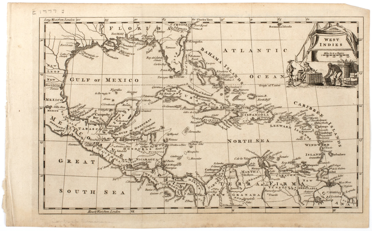
Subject: Map of the West Indies, Florida, part of Mexico and part of South America. Cartouche shows two European men watching as a native person moves cargo.
- Date:
-
[1777]
- Format:
-
Maps/Atlases
- Location:
- American Antiquarian Society
- Collection (local):
-
American Antiquarian Society Collection
- Subjects:
-
Indians of the West Indies--Pictorial works
West Indies--Maps
Mexico, Gulf of--Maps
Caribbean Area--Maps
- Places:
-
West Indies
Mexico, Gulf of
Caribbean Sea
- Extent:
- 1 map : engraving ; 18 x 30 cm., on sheet 20 x 33 cm.
- Terms of Use:
-
Public Domain/No known restrictions on use. Contact host institution to download image.
Contact host institution for more information.
- Publisher:
-
London :
[s.n.]
- Scale:
-
Scale [ca. 1:15,200,000]
- Language:
-
English
- Catalog Record:
-
http://catalog.mwa.org/vwebv/holdingsInfo?bibId=483122
- Notes:
-
Relief shown pictorially.
From Guthrie, W. New geographical, historical, and commercial grammar.
- Notes (date):
-
This date is inferred.


