Colton's map of the United States of America, the British provinces, Mexico and the West Indies : showing the country from the Atlantic to the Pacific Ocean
Item Information
- Title:
- Colton's map of the United States of America, the British provinces, Mexico and the West Indies : showing the country from the Atlantic to the Pacific Ocean
- Description:
-
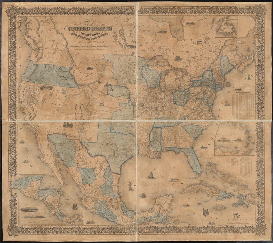
America Transformed: During the 1840s and early 1850s, the political geography of the West changed dramatically. The nation annexed Texas, established the 49th parallel as its northwestern boundary, claimed the Oregon Territory, and won land from Mexico following the Mexican-American War. By the time this map was published in 1854, the United States included 31 states and seven territories. Commercially published maps like this one celebrated the nation’s expansion with small vignettes dispersed throughout these newly acquired territories depicting Native people, wildlife, and a wagon train. It also suggests a unified nation, but a statistical table enumerating free and enslaved population alludes to conflicts over whether to extend slavery into the western territories and foreshadows the impending Civil War.
- Creator:
- Colton, J. H. (Joseph Hutchins), 1800-1893
- Date:
-
1854
- Format:
-
Maps/Atlases
- Location:
-
Boston Public Library
Norman B. Leventhal Map & Education Center - Collection (local):
-
Norman B. Leventhal Map & Education Center Collection
- Subjects:
-
United States--Maps
North America--Maps
Mexico--Maps
West Indies--Maps
- Places:
-
North America (area)
United States
Mexico
- Extent:
- 1 map : col., mounted on muslin ; 118x 139 cm.
- Terms of Use:
-
No known copyright restrictions.
No known restrictions on use.
- Publisher:
-
New York :
J.H. Colton
- Scale:
-
Scale [ca. 1:3,500,000]
- Language:
-
English
- Notes:
-
Relief shown by hachures.
Prime meridians: Greenwich and Washington D.C.
Insets: Map of Central America -- The south eastern part of the West Indies -- Map of Newfoundland.
Includes statistics of the United States, table of distances, illustrations, and decorative border.
"Entered according to Act of Congress, February in the year 1853 by Joseph H. Coulton..."
- Notes (exhibitions):
-
Exhibited: "America transformed. Part 1: the United States expands westward," organized by the Norman B. Leventhal Map & Education Center at the Boston Public Library, 2019.
- Identifier:
-
06_01_008412
- Call #:
-
G3700 1854 .C65x
- Barcode:
-
39999065653618


