Toggle navigation
LMEC Home
Exhibitions
Georeferencing
Tools for Teachers
Collections
My Favorites
Sign Up / Log In
Search
Search the map portal
Map Collection
Map Collection
Map Sets
Search
Search
Search for
Search In
All Fields
Creator
Title
Subject
Place
Search All Digital Collections
Advanced Search
484 Results
My Search
Start Over
More Like
commonwealth:q524nj64z
Remove constraint More Like: commonwealth:q524nj64z
Filter your Search
Place
North and Central America
420
United States
297
New York
42
Florida
19
Canada
17
Alabama
15
Chatham (county)
15
Savannah
13
more
Place
»
Topic
Manuscript maps--Early works to 1800
92
Manuscript maps
21
Gulf Coast (U.S.)--Maps, Manuscript--Early works to 1800
12
Fortification--New York (State)--New York--Maps--Early works to 1800
11
New York (N.Y.)--Maps, Manuscript--Early works to 1800
11
New York (N.Y.)--Buildings, structures, etc--Maps, Manuscript--Early works to 1800
9
Saratoga Campaign, N.Y., 1777--Maps, Manuscript--Early works to 1800
8
Coasts--Florida--Maps--Early works to 1800
7
more
Topic
»
Date
Date range begin
–
Date range end
Current results range from
1664
to
1899
View distribution
Creator
Hills, John, (Surveyor)
18
Montrésor, John, 1736-1799
16
Bingham, William, 1752-1804
12
Adlum, John, 1759-1836
10
Washington, George, 1732-1799
9
Faden, William, 1749-1836
7
Morgan, Benjamin, (Draftsman)
7
Wangenheim, Friedrich Adam Julius von
7
more
Creator
»
Format
Maps/Atlases
482
Manuscripts
478
Objects/Artifacts
2
Georeferenced
Yes
5
No
479
Collection
American Revolutionary War-Era Maps
483
Library of Congress Collection
480
Maritime Charts and Atlases
31
Urban Maps
16
British Library Collection
3
Norman B. Leventhal Map Center Collection
1
Available to use
Creative Commons license
483
No known restrictions
1
Search Constraints
Sort by relevance
relevance
title
date (asc)
date (desc)
Number of results to display per page
100 per page
10
per page
20
per page
50
per page
100
per page
View results as:
grid view
map view
Search Results
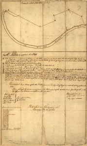
301.
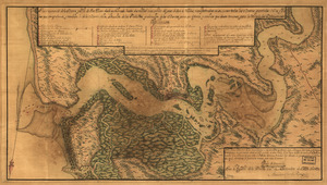
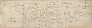
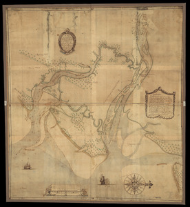
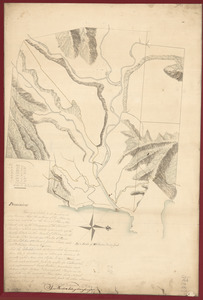
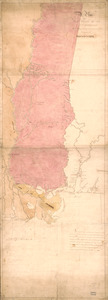
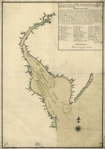
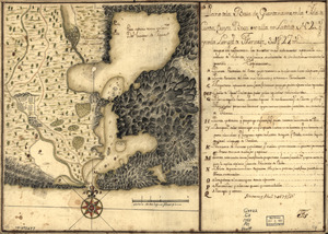
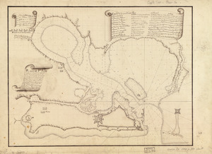
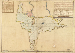
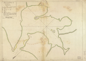
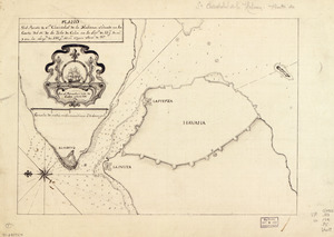
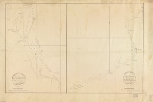
A Plan of the entrance of Chesapeak [sic] Bay, with James and York Rivers : wherein are shewn the respective positions (in the...
302.
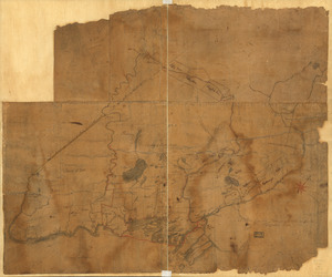
Plan of the fort and fortress at Crown Point with their environs : With the disposition of the English Army under the command...
303.
A plan of the Forts Montgomery & Clinton : as taken by His Majesty's forces under the command of Genl. Sr. Henry Clinton the...
304.
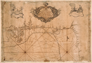
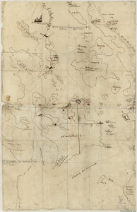
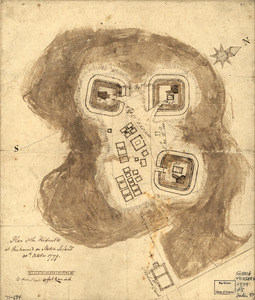
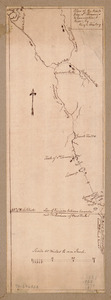
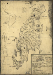
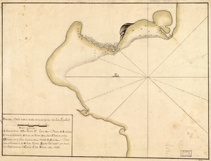
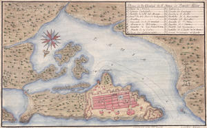
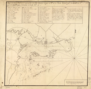
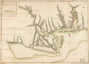
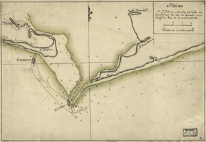
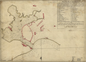
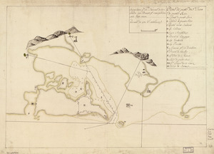
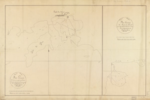
Plan of the French and rebells sieg[e] of Savannah in Georgia, in South [sic] America, deffend : t[h]rough the Br: Gen: August...
305.
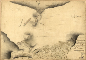
A plan of the harbour of Cape Lookout surveyed and sounded by His Majesty's sloop Viper
306.
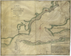
A plan of the harbour of Pensacola in West-Florida
307.
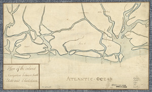
Plan of the inland navigation between South Edisto and Charlestown
308.
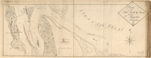
Plan of the inlet, strait, & town of St. Augustine
309.
A plan of the inlets & rivers of Savannah & Warsaw in the Province of Georgia
310.
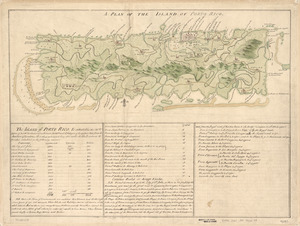
A Plan of the island of Porto Rico
311.
Plan of the Isle aux Noix, in the River Richelieu, and Province of Canada
312.
A plan of the land between Fort Mossy and St. Augustine in the province of East Florida
313.
A Plan of the late Province of Main as far as Kennebeck River
314.
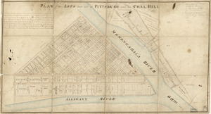
Plan of the lots laid out at Pittsburg and the Coal Hill
315.
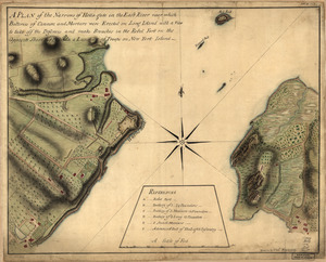
A plan of the Narrows of Hells-gate in the East River : near which batteries of cannon and mortars were erected on Long Island...
316.
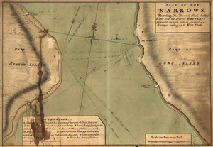
Plan of The Narrows, shewing the channel, shoal, depth of water, and the several battery's proposed on each side to prevent an...
317.
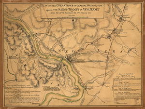
Plan of the operations of General Washington against the King's troops in New Jersey : from the 26th of December 1776 to the 3d...
318.
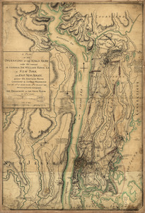
A plan of the operations of the King's army : under the command of General Sir William Howe, K.B. in New York and east New...
319.
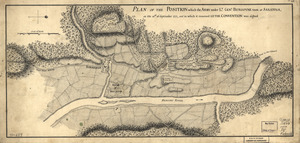
Plan of the position which the army under Lt. Genl. Burgoyne took at Saratoga : on the 10th of September 1777, and in which it...
320.
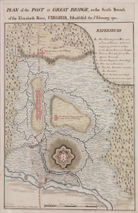
Plan of the post at Great Bridge, on the south branch of the Elizabeth River, Virginia : establish'd the 5th February 1781
321.
Plan of the redoubts at Richmond on Staten Island, 30th October 1779
322.
Plan of the river of Annapolis Royal in Nova Scotia
323.
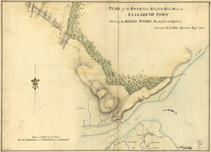
Plan of the road from Elizabeth Town Point to Elizabeth Town : shewing the rebel works raised for its defence
324.
A Plan of the Rosalij Compy. Estates : the property of His Excelly. Charles O'Harra, the Honble. Leiut. Gov. Will. Stuart,...
325.
A plan of the Rosalij Compy. Estates showing the impracticable lands
326.
Plan of the route from St. Francis to Connecticut River
327.
Plan of the siege of Charles Town in South Carolina : under command of His Excellence Sir Henry Clinton and under direction of...
328.
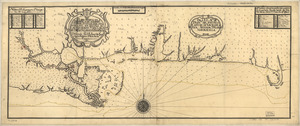
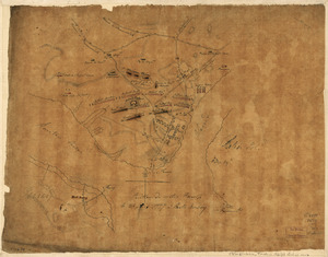
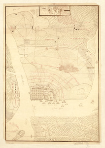
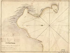
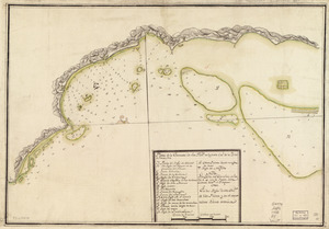
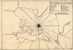
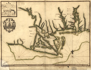
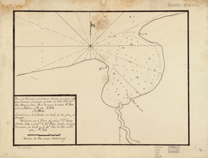
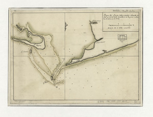
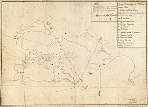
Plan of the siege of the Havana surrenderid [sic] Aug. 12, 1762 to the English commanded by the Earl of Albemarle General and...
329.
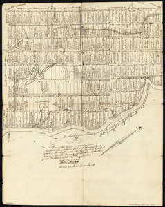
A plan of the town, bar, harbour, and environs of Charlestown in South Carolina : with all the channels, soundings,...
330.
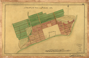
A Plan of the town of Pensacola, 1767
331.
Plan of the Town of Turner, formerly Silvester Plantation : out side lines and part of the lotts ran out
332.
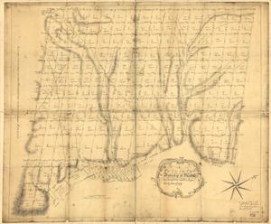
A plan of the township of Blenheim, as surveyed and divided in the year 1772
333.
A Plan of the works on Spikendevil Hill with the ground in front, protracted from a scale of 200 feet to an inch
334.
A Plan of West Florida, the Isle of Orleans, and some parts of the Spanish dominions to the westward of the Mississipi
335.
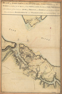
Plan of York Town and Gloucester in Virginia : shewing the works constructed for the defence of those posts by the Rt. Honble:...
336.
Plan von Rhode Island : und deren dem comando des Herrn General Majors Presgott inf dies-malig befundlichen campements
337.
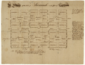
A plann of the town of Savannah in the state of Georgia
338.
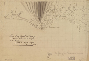
Plano d. las aguadas d. Sn. Juan y Sn. Franco. d. Añasco en la ysla de Pto. Rico, año d. 1787
339.
Plano d. las aguads. d. Sn. Juan y Sn. Franco. d. Añasco en la ysla d. Pto. Rico
340.
Plano de la Bahía de Fort Real cituado a la parte del oeste de la Ysla Martinica
341.
Plano de la bahía de Guantánamo en la ysla de Cuva, cuya boca se halla en latd. N. de 20 gros. y longd. de Tenerife 30l. gs....
342.
Plano de la Bahia de la Ware y entrada de Filadelfie
343.
Plano de la Bahía de Ocoa situado en la banda del sur de la Ysla Española
344.
Plano de la Bahía de Ocoa situado en la banda del sur de la Ysla Española
345.
Plano de la bahia de Pansacola
346.
Plano de la Baía de Guantánamo, en la ysla de Cuva, cuya boca se alla en latitud N. 20 gs. y en la longitd. de Thenerife 301...
347.
Plano de la ciudad de S. Juan de Puerto Rico
348.
Plano de la enzenada de San Franco. en la parte occl. de la ysla de Puerto Rico
349.
Plano de la hermosa Bahía de Naranjos situada en la costa del norte de la ysla de Sn. Tiago de Cuva
350.
Plano de la Ysla de Santo Domingo, parte de las Cuba, Jamaica y otras contiguas a ellas, del seno mexicano
351.
Plano de la Ysla Trinidad de Barlovento situado entre las latitudes septentrionales de 10⁰51ʹ y la de 9⁰44ʹ y entre las...
352.
Plano de las aguadas de S. Juan y S. Franco. & Anasco en la ysla de Puerto Rico
353.
Plano de Philadelphia
354.
Plano de Pto. Rico en la ysla de este nombre situado en 18⁰37ʹ de latitd. N. y en 59⁰42ʹ de longd. O. de Cádiz
355.
Plano de Puerto Real en la costa del S. de la Ysla Jamaica, 12 leguas al ote. de la Punta Oriental y por la latitud de...
356.
Plano de Puerto Rico, situado en la parte septemtrional de la ysla de este nombre, una de las de Barlovento en la lattd. de...
357.
Plano del desembarcadero del Río Misipipi en el Seno Megicano con parte del Territorio de la Mobila, el qual yncluien los...
358.
Plano del desembocadero del Río de Misipi en el Seno Mexino con parte del Territorio de la Mobila, el qual incluyen los...
359.
Plano del desembocadero del Río Misipipi en el seno Mexicano con parte del territorio de la Movila, el qual incluien los...
360.
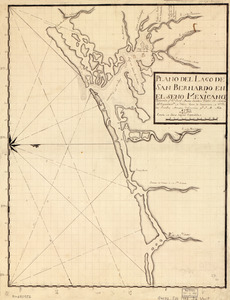
Plano del Lago de San Bernardo en el Seno Mexicano
361.
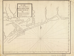
Plano del Lago de Sn. Bernardo en el Seno Mexica no
362.
Plano del pto. de Fuerte Delfin en la Ys. Española de Sto. Domingo situado en la latd. de 19⁰40ʹ N. y en longd. de 66⁰20ʹ al...
363.
Plano del Pto. de la Movila situado en la latd. N. de 30⁰ 10ʹ tomado á los Ings., el día 14 de marzo de 1780
364.
Plano del puertecito de la Chorrera cituado una legua al O. de la Havana
365.
Plano del puertecito de la Chorrera situado una legua al O. de la Havana
366.
Plano del Puerto de Cabañas situado en la costa del norte de la ysla de Cuba, 12 leguas al ote. de la Havana
367.
Plano del Puerto de la Havana
368.
Plano del puerto de la Havana, situado en la parte del N. de la ysla de Cuba en la lattd. de 23⁰10ʹ y en longd. astronómica de...
369.
Plano del Puerto de la Mobila : Situado en latd. No. de 30⁰ 10ʹ m. tomado á los Ingleses el dia 14 de Marzo de 1780
370.
Plano del Puerto de Samá, situado en la costa del N. de la ysla de Sntiágo. de Cuba
371.
Plano del Puerto de Sn. Christobal de la Habana situado en la costa del N. de la ysla de Cuba en la latd. de 23 gs. 10 ms. y en...
372.
Plano del puerto de Sn. Juan de Puerto Rico
373.
Plano del puerto de Sn. Juan de Puerto Rico
374.
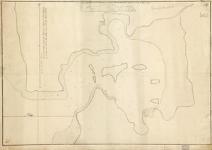
Plano del puerto del Guárico, cuyo conocimto. y entrada es del modo siguiente
375.
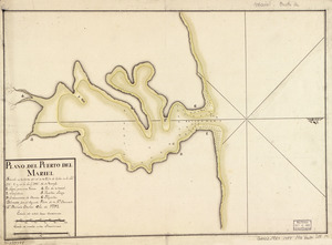
Plano del Puerto del Mariel situado en la costa del N. de la ysla de Cuba en la latd. 23⁰5ʹ y en la longd. 293⁰16ʹ de Tenerife
376.
Plano del Puerto Naranjos cituado 4 leguas al oeste de Punta de Mulas en la costa del N. de la ysla de Cuba
377.
Plano geométrico de la boca de monos y puertos de Charguaramas y Carenero en la Ya. de Trinidad
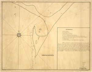
378.
Plano geométrico de la rada y carenero de San Jorge en la costa occidl. de la ysla de la Granada
379.
Plano geométrico de las ensenadas de Añasco y Mayagües en la costa occidental de la ysla de Puerto Rico
380.
Plano geométrico del puerto principal de San Tomas en la costa meridional de la ya. del mismo nombre ; Plano geométrico del...
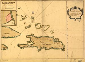
381.
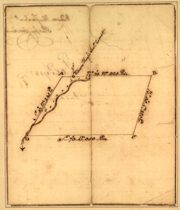
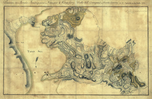
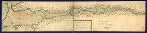
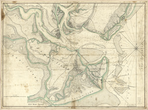
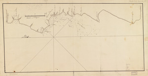
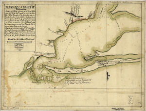
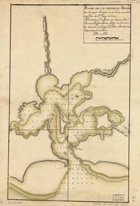
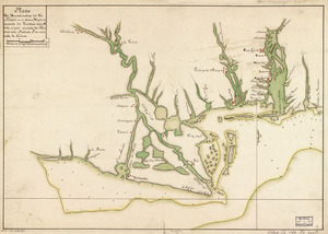
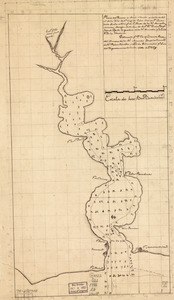
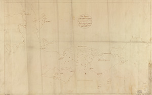
Plano. I descripcion de la costa, desde el Cavo Cañaveral, hasta cerca de la boca de la Vir[g]inia : contando, costa de...
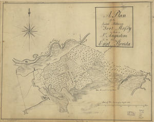
382.
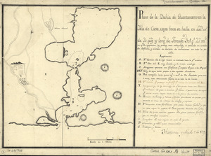
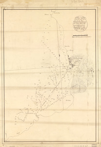
Plano numero 1. de la barra, y Rio de San Juan desde su entrada hasta dos millas mas arriba del paso de San Nicolas,...
383.
Plano que comprehende parte del Seno Mexicano desde la Bahia de la Asencion hasta la Bahia de Tampa : con las sondas y...
384.
Plano y costa de la Palisada o de Misipipi zituada, su entrada o Cabo de Lodo en 29 gs. 17 ms. de lattud. norte y en longd. de...
385.
Plat of a survey for William Hughes, Jr. of 460 acres in Frederick County, Va. on the Cacapon River
386.
Plat of a survey of 2,314 acres of land, being the first large bottom on the east side of the Ohio River : 3 or 4 miles below...
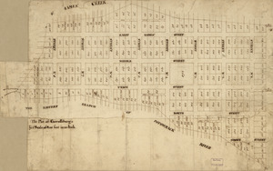
387.
Plat of Carrollsburg
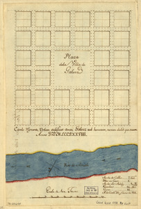
388.
Plaza de la villa de Galvez
389.
The plot of Carroll'sburgh : [part of Washington D.C.]
390.
Portion of a map of Feliciana District, Spanish Louisiana, from the Lac de la Croix to Thompson's Creek
391.
Portsmouth, New Hampshire
392.
Position de notre camp le 24 juin 1777 à Perth Amboy
393.
Position des Armées amériquaine et françoise à Kings-ferry, Peaks-hill, Crompond et Hunts-taverne : du 17. septembre au 20...
394.
Position du camp de l'armée combinée a Philipsburg du 6 juillet au 19 aoust
395.
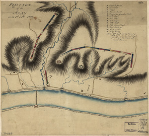
Position of the army on the 8th Octbr. 1777
396.
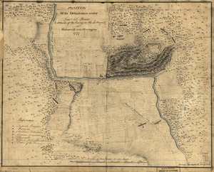
Position of the detachment under Lieut't Col. Baum & attacks of the enemy on the 16th August at Walmscock near Benington, 1777
397.
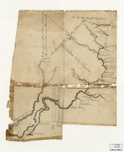
Potomack
398.
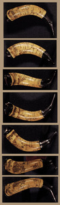
Powder horn with hand-drawn map of the Hudson River (above Albany), Mohawk River, Niagara region, and Lake Ontario in New York...
399.
Progress of the army from their landing till taking possession of Philadelphia
400.
Project for the attack of Ticonderoga : proposed to be put in execution as near as the circumstances and ground will admit of....
‹ Prev
Next ›
1
2
3
4
5
![A Plan of the entrance of Chesapeak [sic] Bay, with James and York Rivers](https://bpldcassets.blob.core.windows.net/derivatives/images/commonwealth:q524nf233/image_thumbnail_300.jpg)
![Plan of the French and rebells sieg[e] of Savannah in Georgia, in South [sic] America, deffend](https://bpldcassets.blob.core.windows.net/derivatives/images/commonwealth:q524nc699/image_thumbnail_300.jpg)
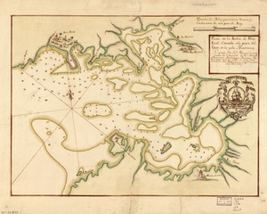
![Plan of the siege of the Havana surrenderid [sic] Aug. 12, 1762 to the English commanded by the Earl of Albemarle General and Sir George Pococke K.B. Admiral](https://bpldcassets.blob.core.windows.net/derivatives/images/commonwealth:q524nf87n/image_thumbnail_300.jpg)

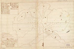
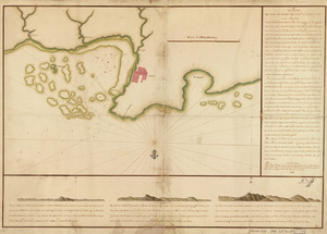
![Plano. I descripcion de la costa, desde el Cavo Cañaveral, hasta cerca de la boca de la Vir[g]inia](https://bpldcassets.blob.core.windows.net/derivatives/images/commonwealth:q524nf34m/image_thumbnail_300.jpg)