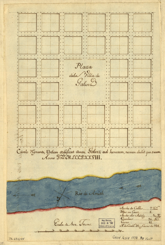
Plaza de la villa de Galvez
This map is also available in American Revolutionary Geographies Online (ARGO), a collections portal especially built for material relating to the American Revolutionary War Era. Visit ARGO to learn more about this item and explore the historical geography of North America in the late eighteenth century.
Item Information
- Title:
- Plaza de la villa de Galvez
- Date:
-
[1778]
- Format:
-
Maps/Atlases
Manuscripts
- Location:
- Library of Congress Geography and Map Division
- Collection (local):
-
Library of Congress Collection
- Subjects:
-
Galvez (La.)--Maps, Manuscript--Early works to 1800
- Places:
-
Ascension (county)Galvez
- Extent:
- 1 manuscript map : hand color on sheet 38 x 25 cm.
- Terms of Use:
-
No known copyright restrictions.
This work is licensed for use under a Creative Commons Attribution Non-Commercial Share Alike License (CC BY-NC-SA).

- Scale:
-
Scale ca. 1:1,000
- Language:
-
Spanish
Latin
- Catalog Record:
-
https://lccn.loc.gov/73691644
- Notes:
-
Title from verso.
Manuscript, pen-and-ink and watercolor.
Oriented with north toward the bottom.
"Carolo ignante, urbem adisicat amor, Galvez ad honorem, nomen dedit que suum. Anno dñi. ML.C.C.D.XX.VIII."
Includes table of statistics.
- Notes (date):
-
This date is inferred.
- Notes (citation):
-
LC Luso-Hispanic World, 957
- Identifier:
-
ct000274


