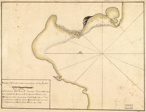
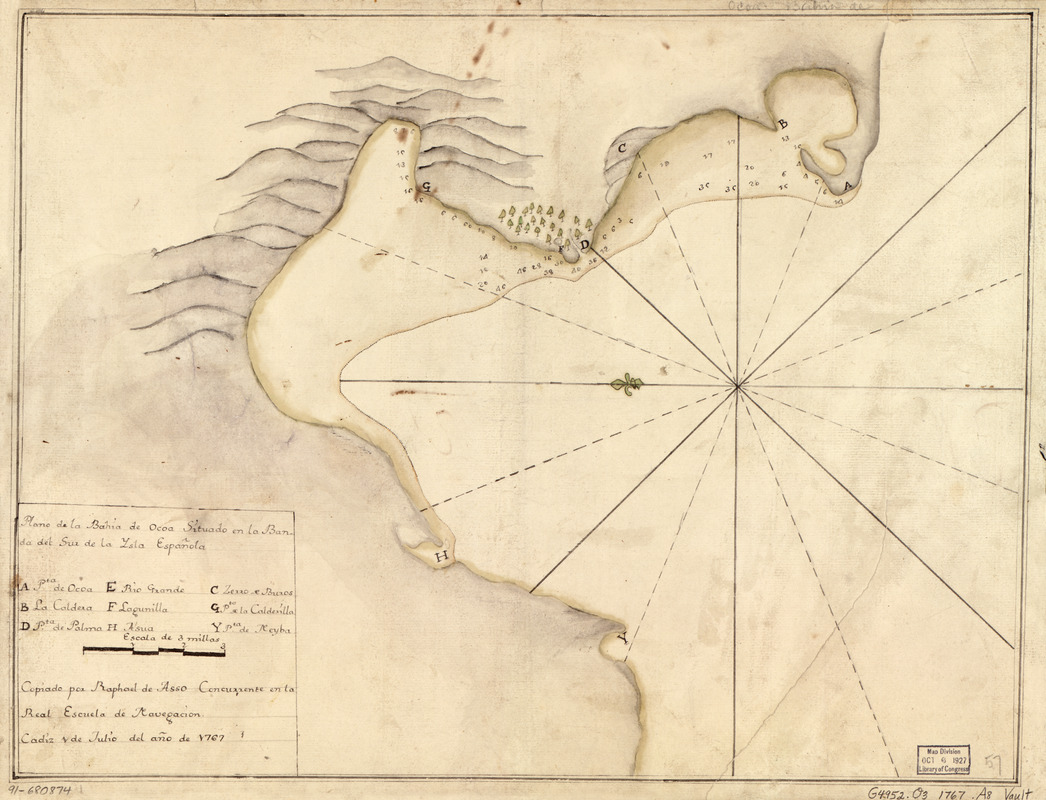
Plano de la Bahía de Ocoa situado en la banda del sur de la Ysla Española
This map is also available in American Revolutionary Geographies Online (ARGO), a collections portal especially built for material relating to the American Revolutionary War Era. Visit ARGO to learn more about this item and explore the historical geography of North America in the late eighteenth century.
Item Information
- Title:
- Plano de la Bahía de Ocoa situado en la banda del sur de la Ysla Española
- Creator:
- Asso, Raphael de
- Contributor:
- Real Escuela de Navegación (Cádiz, Spain)
- Name on Item:
-
copiado por Raphael de Asso, concurrente en la Real Escuela de Navegación, Cádiz, 1 de jul. del año de 1767
- Date:
-
[1767]
- Format:
-
Maps/Atlases
Manuscripts
- Location:
- Library of Congress Geography and Map Division
- Collection (local):
-
Library of Congress Collection
- Subjects:
-
Ocoa Bay (Dominican Republic)--Maps, Manuscript--Early works to 1800
Coasts--Dominican Republic--Ocoa Bay--Maps--Early works to 1800
Manuscript maps--Early works to 1800
- Places:
-
Azua (province)Ocoa, Bahía de (bay)
- Extent:
- 1 map : ms., col. ; 37 x 48 cm.
- Terms of Use:
-
No known copyright restrictions.
This work is licensed for use under a Creative Commons Attribution Non-Commercial Share Alike License (CC BY-NC-SA).

- Scale:
-
Scale [ca. 1:67,500]
- Language:
-
Spanish
- Catalog Record:
-
https://lccn.loc.gov/91680874
- Notes:
-
Relief shown pictorially. Depths shown by soundings.
Oriented with north to the left.
Watermarks: IV; and, fleur-de-lis over the characters VDL.
Pen-and-ink and watercolor.
Mounted on cloth backing.
Indexed.
Maggs number annotated in pencil in lower right corner: 57.
- Notes (date):
-
This date is inferred.
- Notes (citation):
-
LC Luso-Hispanic World, 391
- Identifier:
-
lh000391