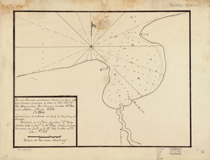
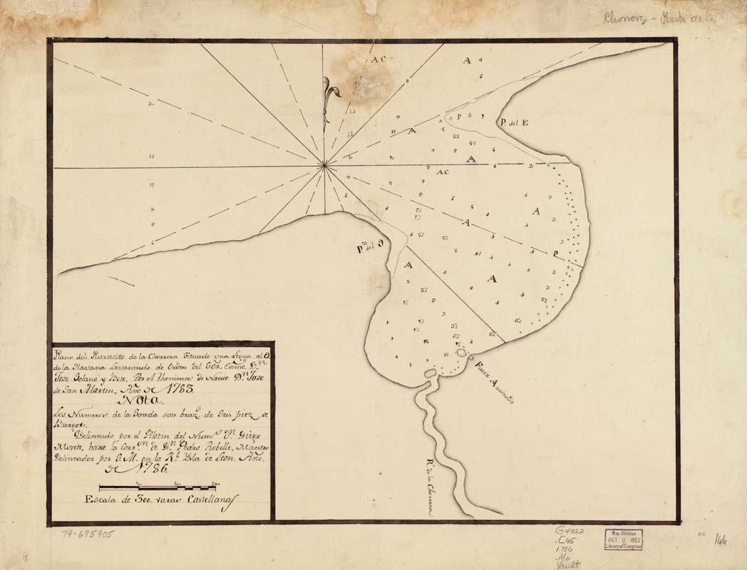
Plano del puertecito de la Chorrera cituado una legua al O. de la Havana
This map is also available in American Revolutionary Geographies Online (ARGO), a collections portal especially built for material relating to the American Revolutionary War Era. Visit ARGO to learn more about this item and explore the historical geography of North America in the late eighteenth century.
Item Information
- Title:
- Plano del puertecito de la Chorrera cituado una legua al O. de la Havana
- Creator:
- San Martín Suárez, José de
- Name on Item:
-
Levantado de orden del Exmo. Sor. Dn. Josef Solano y Bote por el teniente de Navio Dn. Josef de San Martín, año de 1783
- Date:
-
[1783]
- Format:
-
Maps/Atlases
Manuscripts
- Location:
- Library of Congress Geography and Map Division
- Collection (local):
-
Library of Congress Collection
- Subjects:
-
Chorrera Bay (Cuba)--Maps, Manuscript--Early works to 1800
Coasts--Cuba--Chorrera Bay--Maps--Early works to 1800
- Places:
-
Boca de la Chorrera
- Extent:
- 1 manuscript map 25 x 38 cm.
- Terms of Use:
-
No known copyright restrictions.
This work is licensed for use under a Creative Commons Attribution Non-Commercial Share Alike License (CC BY-NC-SA).

- Scale:
-
Scale ca. 1:3,300
- Language:
-
Spanish
- Catalog Record:
-
https://lccn.loc.gov/74695904
- Notes:
-
Depths shown by soundings.
Manuscript, pen-and-ink.
Watermark: Adriaan Roger; and Strasburg fleur-de-lis.
Oriented with north to the bottom.
Mounted on cloth backing.
Maggs number annotated in pencil in lower right margin: 147.
- Notes (date):
-
This date is inferred.
- Notes (citation):
-
LC Luso-Hispanic World, 320
LC Maps of North America, 1750-1789, 1822
- Identifier:
-
lh000320