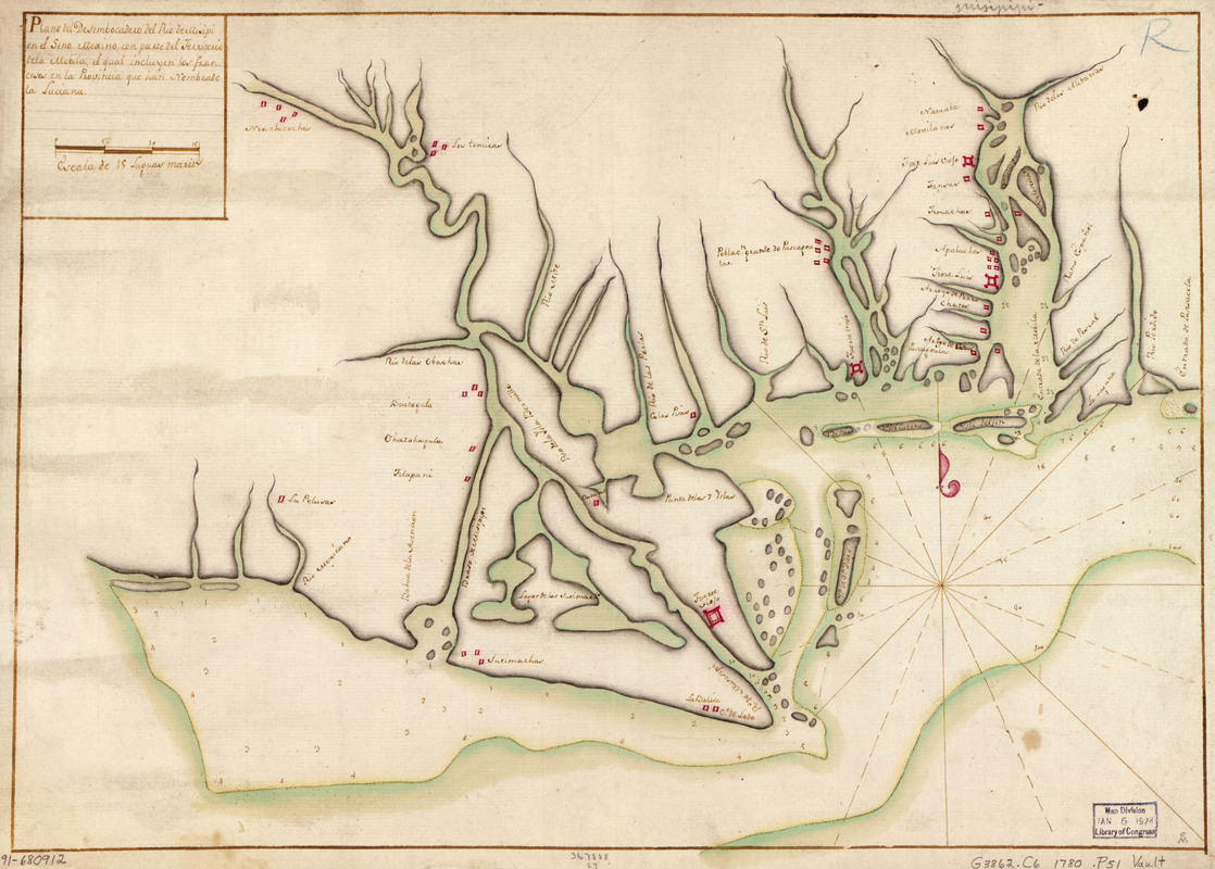
Plano del desembocadero del Río de Misipi en el Seno Mexino con parte del Territorio de la Mobila, el qual incluyen los Franceses en la provincia que han nombrado la Luciana
This map is also available in American Revolutionary Geographies Online (ARGO), a collections portal especially built for material relating to the American Revolutionary War Era. Visit ARGO to learn more about this item and explore the historical geography of North America in the late eighteenth century.
Item Information
- Title:
- Plano del desembocadero del Río de Misipi en el Seno Mexino con parte del Territorio de la Mobila, el qual incluyen los Franceses en la provincia que han nombrado la Luciana
- Date:
-
[ca. 1780]
- Format:
-
Maps/Atlases
Manuscripts
- Location:
- Library of Congress Geography and Map Division
- Collection (local):
-
Library of Congress Collection
- Subjects:
-
Gulf Coast (U.S.)--Maps, Manuscript--Early works to 1800
- Places:
-
Florida
Alabama
Louisiana
Mississippi
- Extent:
- 1 map : ms., col. ; 33 x 47 cm.
- Terms of Use:
-
No known copyright restrictions.
This work is licensed for use under a Creative Commons Attribution Non-Commercial Share Alike License (CC BY-NC-SA).

- Scale:
-
Scale [ca. 1:1,425,000]
- Language:
-
Spanish
- Catalog Record:
-
https://lccn.loc.gov/91680912
- Notes:
-
Also shows forts and settlements.
Depths shown by soundings.
Watermark: J. Honig & Zoonen.
Pen-and-ink and green, red, and yellow watercolors.
Mounted on cloth backing.
Printed label describing the map mounted on verso.
Maggs number annotated in pencil in lower right corner: 2.
Order number annotated in lower margin: 367888/27.
- Notes (citation):
-
LC Luso-Hispanic World, 845
- Identifier:
-
lh000845