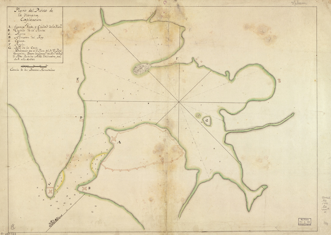
Plano del Puerto de la Havana
This map is also available in American Revolutionary Geographies Online (ARGO), a collections portal especially built for material relating to the American Revolutionary War Era. Visit ARGO to learn more about this item and explore the historical geography of North America in the late eighteenth century.
Item Information
- Title:
- Plano del Puerto de la Havana
- Creator:
- González, Pedro, (Pilot)
- Name on Item:
-
delineado por el 2o piloto del No. D. Pedro González, baxo la correcón. del tente. de fraga. D. Pedro Rebelles, mtro. delineador por S.M., año de 1791
- Date:
-
[1791]
- Format:
-
Maps/Atlases
Manuscripts
- Location:
- Library of Congress Geography and Map Division
- Collection (local):
-
Library of Congress Collection
- Subjects:
-
Havana Bay (Cuba)--Maps, Manuscript--Early works to 1800
Coasts--Cuba--Havana Bay--Maps--Early works to 1800
Manuscript maps--Early works to 1800
- Places:
-
Havana (province)Havana
- Extent:
- 1 map : ms., col. ; 46 x 62 cm.
- Terms of Use:
-
No known copyright restrictions.
This work is licensed for use under a Creative Commons Attribution Non-Commercial Share Alike License (CC BY-NC-SA).

- Scale:
-
Scale [ca. 1:6,000]
- Language:
-
Spanish
- Catalog Record:
-
https://lccn.loc.gov/91680723
- Notes:
-
Depths shown by soundings.
Oriented with north toward the lower left.
Watermarks: D. & C. Blauw; and, Strasburg fleur-de-lis.
Pen-and-ink and watercolor.
Mounted on cloth backing.
Indexed.
Maggs number annotated in pencil in lower right margin: 104.
- Notes (date):
-
This date is inferred.
- Notes (citation):
-
LC Luso-Hispanic World, 351
- Identifier:
-
lh000351