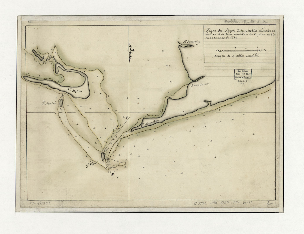
Plano del Puerto de la Mobila : Situado en latd. No. de 30⁰ 10ʹ m. tomado á los Ingleses el dia 14 de Marzo de 1780
This map is also available in American Revolutionary Geographies Online (ARGO), a collections portal especially built for material relating to the American Revolutionary War Era. Visit ARGO to learn more about this item and explore the historical geography of North America in the late eighteenth century.
Item Information
- Title:
- Plano del Puerto de la Mobila : Situado en latd. No. de 30⁰ 10ʹ m. tomado á los Ingleses el dia 14 de Marzo de 1780
- Date:
-
[1780]
- Format:
-
Maps/Atlases
Manuscripts
- Location:
- Library of Congress Geography and Map Division
- Collection (local):
-
Library of Congress Collection
- Subjects:
-
Mobile Bay (Ala)--Maps, Manuscript--Early works to 1800
Nautical charts--Alabama--Mobile Bay--Early works to 1800
Dauphin Island--Maps, Manuscript--Early works to 1800
Mobile Point, Ala--Maps, Manuscript--Early works to 1800
- Places:
-
AlabamaMobile Bay
AlabamaDauphin Island
AlabamaBaldwin (county)Mobile Point (cape)
- Extent:
- 1 manuscript map : hand color 26 x 37 cm.
- Terms of Use:
-
No known copyright restrictions.
This work is licensed for use under a Creative Commons Attribution Non-Commercial Share Alike License (CC BY-NC-SA).

- Scale:
-
Scale ca. 1:100,000
- Language:
-
Spanish
- Catalog Record:
-
https://lccn.loc.gov/73691551
- Notes:
-
Manuscript, pen-and-ink and watercolor.
Soundings shown in fathoms.
Shows the entrance to Mobile Bay, with the peninsula of "Pta. de la Mobilla" and the "Ya. Delfina."
On verso: No. 188.
- Notes (date):
-
This date is inferred.
- Notes (citation):
-
LC Maps of North America, 1750-1789, 1670
- Identifier:
-
ar167000


