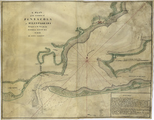
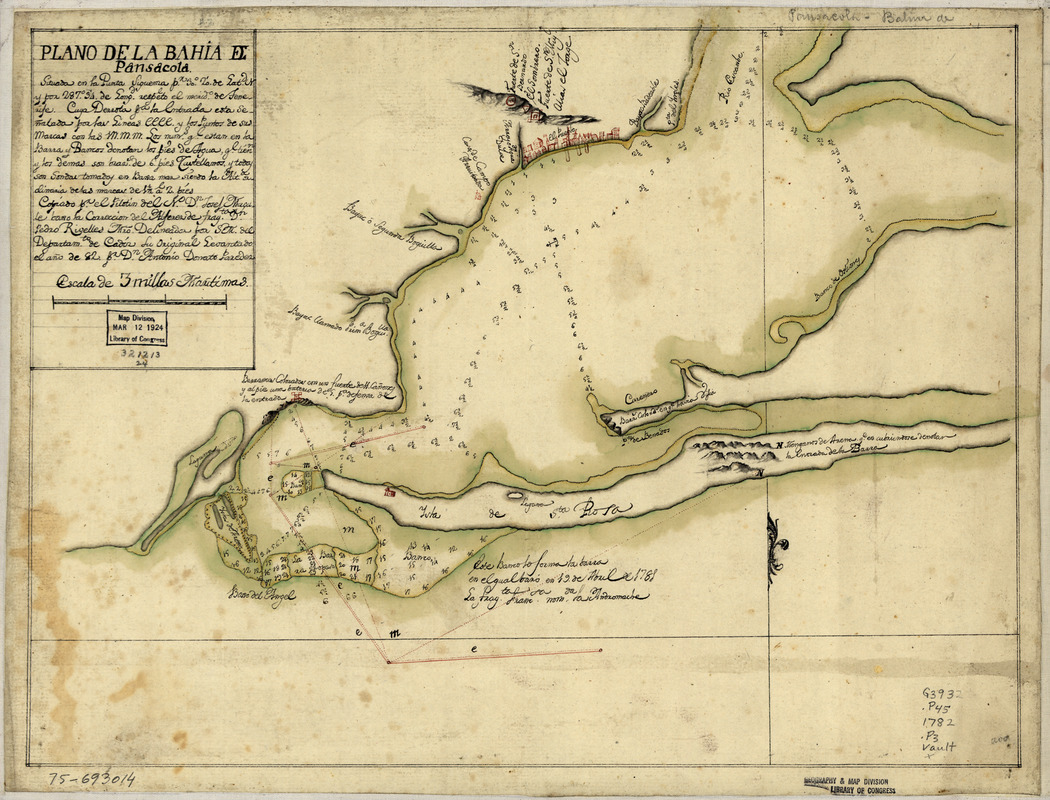
Plano de la bahia de Pansacola
This map is also available in American Revolutionary Geographies Online (ARGO), a collections portal especially built for material relating to the American Revolutionary War Era. Visit ARGO to learn more about this item and explore the historical geography of North America in the late eighteenth century.
Item Information
- Title:
- Plano de la bahia de Pansacola
- Creator:
- Paredes, Antonio Donato
- Contributor:
- Rivelles, Pedro
- Contributor:
- Magule, Josef
- Name on Item:
-
Copiado pr. el pilotin del No. Dn. Josef Magule bajo la correccion del Alférez de frag[a]ta Dn. Pedro Rivelles, mro. delineador por S. M. del Departam[en]to de Cadiz su original levantado el año de 82, por Dn. Antonio Donato Paredes
- Date:
-
[1782]
- Format:
-
Maps/Atlases
Manuscripts
- Location:
- Library of Congress Geography and Map Division
- Collection (local):
-
Library of Congress Collection
- Subjects:
-
Pensacola Bay (Fla.)--Maps, Manuscript--Early works to 1800
Nautical charts--Florida--Pensacola Bay--Early works to 1800
Manuscript maps--Early works to 1800
- Places:
-
Pensacola Bay
- Extent:
- 1 manuscript map : hand color 33 x 44 cm.
- Terms of Use:
-
No known copyright restrictions.
This work is licensed for use under a Creative Commons Attribution Non-Commercial Share Alike License (CC BY-NC-SA).

- Scale:
-
Scale ca. 1:60,000
- Language:
-
Spanish
- Catalog Record:
-
https://lccn.loc.gov/75693014
- Notes:
-
Manuscript, pen-and-ink and watercolor.
Watermark: Zoonen.
Relief shown pictorially. Depths shown by soundings.
Shows forts, churches, and Campbelltown pictorially.
Includes sailing directions for entering the bay.
- Notes (date):
-
This date is inferred.
- Notes (citation):
-
LC Maps of North America, 1750-1789, 1667
- Identifier:
-
ar166700