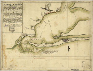
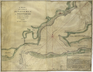
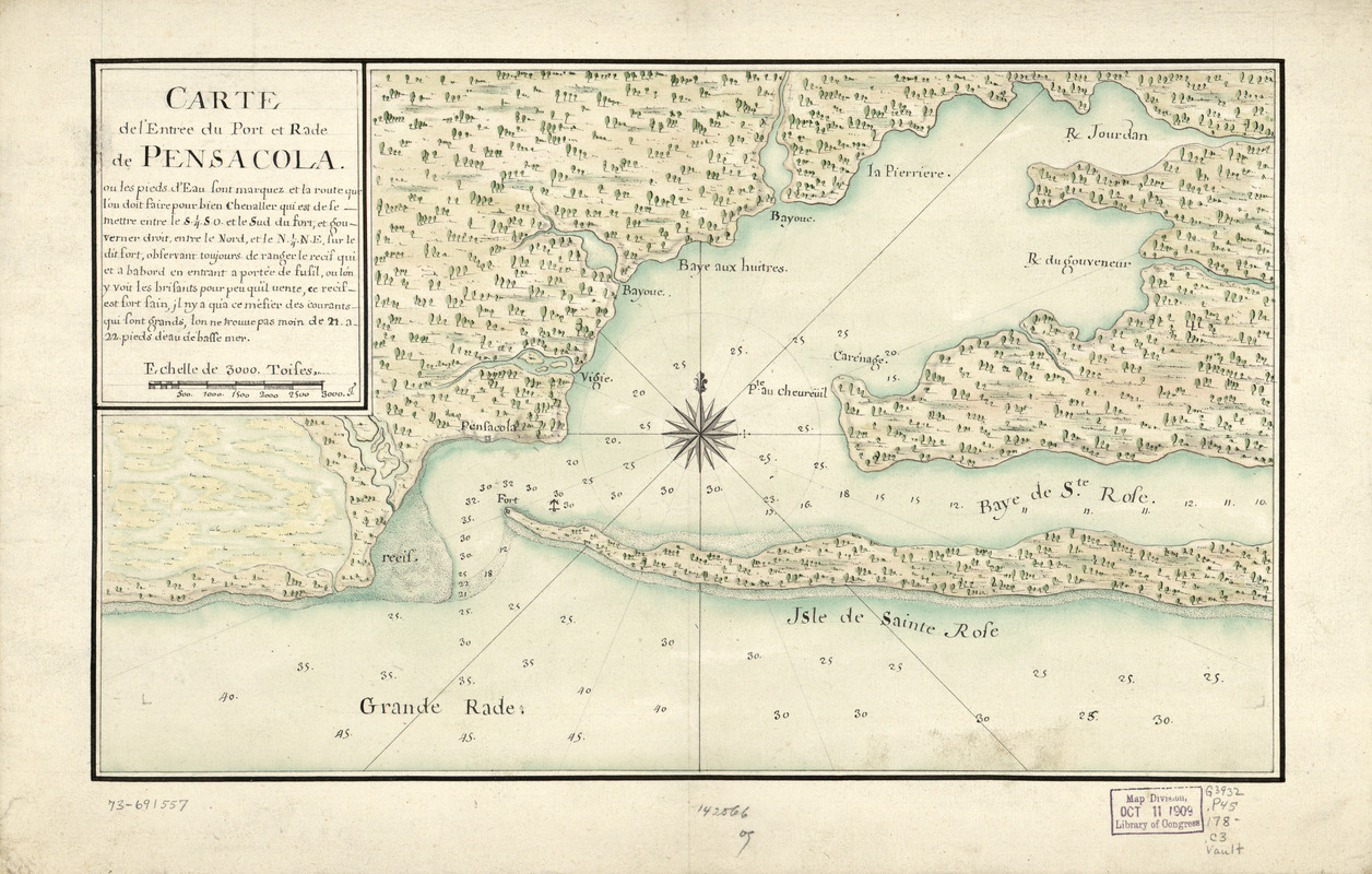
Carte de l'entrée du port et rade de Pensacola
This map is also available in American Revolutionary Geographies Online (ARGO), a collections portal especially built for material relating to the American Revolutionary War Era. Visit ARGO to learn more about this item and explore the historical geography of North America in the late eighteenth century.
Item Information
- Title:
- Carte de l'entrée du port et rade de Pensacola
- Date:
-
[1780?–1789?]
- Format:
-
Maps/Atlases
Manuscripts
- Location:
- Library of Congress Geography and Map Division
- Collection (local):
-
Library of Congress Collection
- Subjects:
-
Pensacola Bay (Fla.)--Maps, Manuscript--Early works to 1800
Manuscript maps--Early works to 1800
- Places:
-
Pensacola Bay
- Extent:
- 1 manuscript map : hand color 21 x 36 cm.
- Terms of Use:
-
No known copyright restrictions.
This work is licensed for use under a Creative Commons Attribution Non-Commercial Share Alike License (CC BY-NC-SA).

- Scale:
-
Scale ca. 1:115,000
- Language:
-
French
- Catalog Record:
-
https://lccn.loc.gov/73691557
- Notes:
-
Manuscript, pen-and-ink and watercolor.
Watermark: Queen Laid.
Soundings shown in feet.
Includes text.
- Notes (citation):
-
LC Maps of North America, 1750-1789, 1662
- Identifier:
-
ar166200