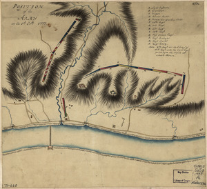
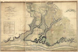
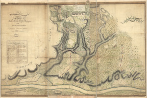
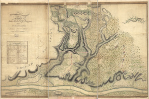
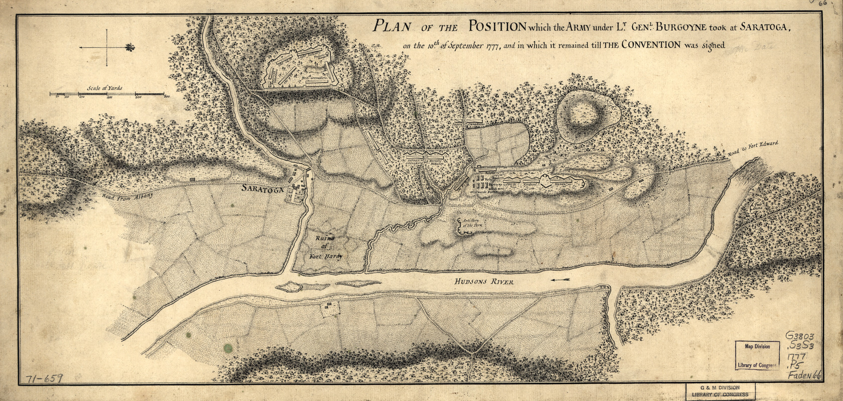
Plan of the position which the army under Lt. Genl. Burgoyne took at Saratoga : on the 10th of September 1777, and in which it remained till the convention was signed
This map is also available in American Revolutionary Geographies Online (ARGO), a collections portal especially built for material relating to the American Revolutionary War Era. Visit ARGO to learn more about this item and explore the historical geography of North America in the late eighteenth century.
Item Information
- Title:
- Plan of the position which the army under Lt. Genl. Burgoyne took at Saratoga : on the 10th of September 1777, and in which it remained till the convention was signed
- Date:
-
[1777?]
- Format:
-
Maps/Atlases
Manuscripts
- Location:
- Library of Congress Geography and Map Division
- Collection (local):
-
Library of Congress Collection
- Subjects:
-
Saratoga Campaign, N.Y., 1777--Maps, Manuscript--Early works to 1800
Saratoga County (N.Y.)--History--Revolution, 1775-1783--Maps
- Places:
-
Saratoga (county)
- Extent:
- 1 manuscript map 23 x 49 cm.
- Terms of Use:
-
No known copyright restrictions.
This work is licensed for use under a Creative Commons Attribution Non-Commercial Share Alike License (CC BY-NC-SA).

- Scale:
-
Scale ca. 1:108,000
- Language:
-
English
- Catalog Record:
-
https://lccn.loc.gov/gm71000659
- Notes:
-
Manuscript, pen-and-ink.
Has watermarks.
Oriented with north to the left.
Relief shown by hachures.
- Notes (citation):
-
LC Maps of North America, 1750-1789, 1178
- Identifier:
-
ar117800