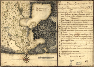
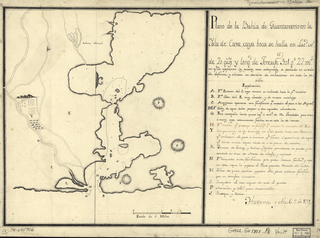
Plano de la bahía de Guantánamo en la ysla de Cuva, cuya boca se halla en latd. N. de 20 gros. y longd. de Tenerife 30l. gs. 27 ms
This map is also available in American Revolutionary Geographies Online (ARGO), a collections portal especially built for material relating to the American Revolutionary War Era. Visit ARGO to learn more about this item and explore the historical geography of North America in the late eighteenth century.
Item Information
- Title:
- Plano de la bahía de Guantánamo en la ysla de Cuva, cuya boca se halla en latd. N. de 20 gros. y longd. de Tenerife 30l. gs. 27 ms
- Name on Item:
-
Havana y abril 7 de 1751
- Date:
-
[1751]
- Format:
-
Maps/Atlases
Manuscripts
- Location:
- Library of Congress Geography and Map Division
- Collection (local):
-
Library of Congress Collection
- Subjects:
-
Guantánamo Bay (Cuba)--Maps, Manuscript--Early works to 1800
Coasts--Cuba--Guantánamo Bay--Maps--Early works to 1800
- Places:
-
Guantánamo (province)Guantánamo, Bahía de (bay)
- Extent:
- 1 manuscript map, 32 x 45 cm.
- Terms of Use:
-
No known copyright restrictions.
This work is licensed for use under a Creative Commons Attribution Non-Commercial Share Alike License (CC BY-NC-SA).

- Scale:
-
Scale ca. 1:120,000
- Language:
-
Spanish
- Catalog Record:
-
https://lccn.loc.gov/74695906
- Notes:
-
Manuscript, pen-and-ink.
Relief shown pictorially and by hachures. Depths shown by soundings.
Watermark: J. Kool.
Prime meridian: Tenerife.
Mounted on cloth backing.
Indexed.
Maggs number annotated in pencil in lower right margin: 125.
- Notes (date):
-
This date is inferred.
- Notes (citation):
-
LC Luso-Hispanic World, 312
- Identifier:
-
lh000312