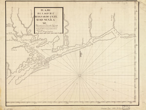
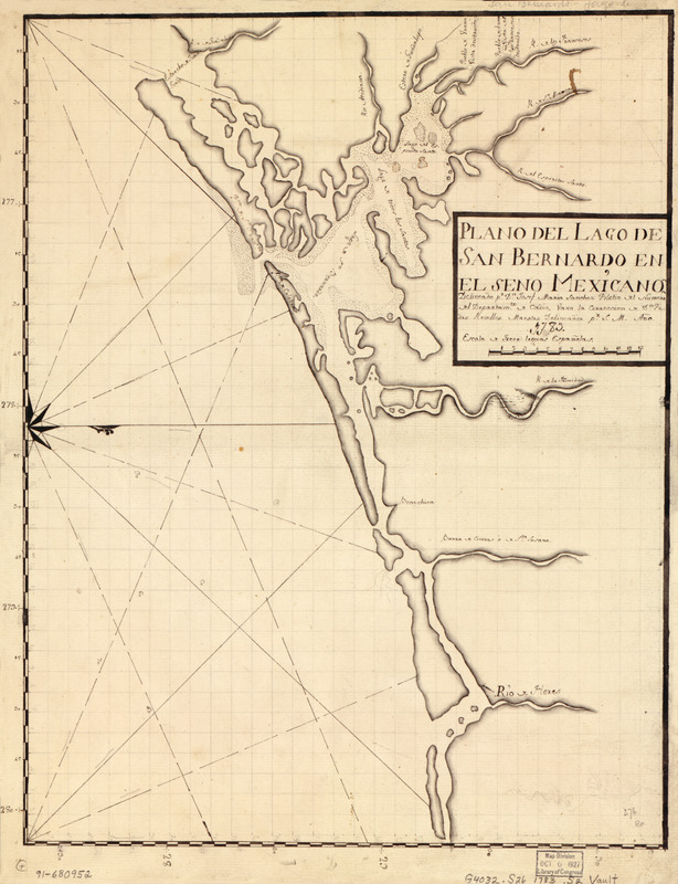
Plano del Lago de San Bernardo en el Seno Mexicano
This map is also available in American Revolutionary Geographies Online (ARGO), a collections portal especially built for material relating to the American Revolutionary War Era. Visit ARGO to learn more about this item and explore the historical geography of North America in the late eighteenth century.
Item Information
- Title:
- Plano del Lago de San Bernardo en el Seno Mexicano
- Creator:
- Sánchez, Josef María
- Name on Item:
-
delineado pr. Dn. Josef María Sánchez, pilotin del numero del Departamto. de Cádiz, vaxo la corrección de Dn. Pedro Revelles, maestro delineador pr. S.M., año 1783
- Date:
-
[1783]
- Format:
-
Maps/Atlases
Manuscripts
- Location:
- Library of Congress Geography and Map Division
- Collection (local):
-
Library of Congress Collection
- Subjects:
-
San Antonio Bay Region (Tex.)--Maps, Manuscript--Early works to 1800
Coasts--Texas--San Antonio Bay Region--Maps--Early works to 1800
Manuscript maps--Early works to 1800
- Places:
-
Calhoun (county)San Antonio Bay
- Extent:
- 1 map : ms. ; 45 x 35 cm.
- Terms of Use:
-
No known copyright restrictions.
This work is licensed for use under a Creative Commons Attribution Non-Commercial Share Alike License (CC BY-NC-SA).

- Scale:
-
Scale [ca. 1:950,000]
- Language:
-
Spanish
- Catalog Record:
-
https://lccn.loc.gov/91680952
- Notes:
-
Oriented with north to the right.
Pen-and-ink and pencil.
Mounted on cloth backing.
Maggs number annotated in pencil in lower right corner: 276.
- Notes (date):
-
This date is inferred.
- Notes (citation):
-
LC Luso-Hispanic World, 975
- Identifier:
-
lh000975